Kuishiyama Recreation Forest
286.88ha
Elevation Lowest : 600m / Mainly 900–1,177m
Magnificent views of the mountains and the Pacific Ocean await you at the end of the flower-lined path
Magnificent views of the mountains and the Pacific Ocean await you at the end of the flower-lined path
- Newest information
- Area
- Activities
- Overview
- Latest Information
- Usage Guide
- Facility
- Map
- Address
- Access
(Distances and times are
provided as a guide only) - Management office
contact details - Information on Other Local
Tourist Attractions - Official Tourist Information
- Recreation Forest
Management Committee - Supporters
- Other
- Newest information
- Gathering information in advance is important to safely enjoy forest recreation that brings you closer to nature.
・CHECK
・When you go out, please check local tourist and related information and gather information on road closures, weather conditions, etc.
- Area
- Shikoku
- Activities
- Flower-viewing Autumn leaf viewing Birdwatching Picnics Mountain climbing (Includes surrounding area)
- Overview
-
- Geographical/topographical features
- Mount Kuishi is a 1,176 m high mountain located in Kochi City and Tosa Town, Tosa District, Kochi Prefecture. The forest separates the upper reaches of the Kagami River from the Jizoji River (a tributary of the Yoshino River) valley. In Motoyama Town, Nagaoka District, Kochi Prefecture (near the border with Ehime Prefecture), there is another mountain called Mount Kuishi; that one is called “Oku Kuishi-yama” or “Tajigawa Kuishi-yama” to distinguish it from this one.
- Historical/cultural features
- Mount Kuishi is a limestone mountain and dolomite ― a mineral ore used as a basic ingredient in cement ― was once quarried here. There are many strangely shaped rocks, which were so familiar to people in days gone by that they gave many of the rocks names. These include Myotai Rock, Hinoki-byobu Rock (Cypress Screen Rock), and Shirowashi Rock (White Eagle Rock).
Kuishiyama Recreation Forest was the first forest in Kochi Prefecture to be selected as a recreation forest. - Climate, flora and fauna
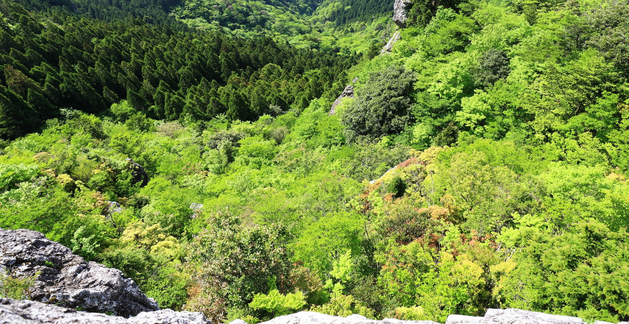
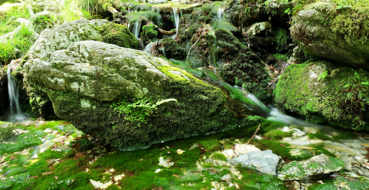
- The recreation forest is a veritable treasure trove of wildlife. The natural forest zone consists of trees that are more than 200 years old: conifers such as momi, fir (Abies firma), tsuga, Japanese hemlock (Tsuga sieboldii), and hinoki, Japanese cypress (Chamaecyparis obtusa); evergreen broad-leaved trees such as sakaki (Cleyera japonica) and akagashi, Japanese evergreen oak (Quercus acuta); and deciduous broad-leaved trees such as himeshara (Stewartia monadelpha) and mizume, Japanese cherry birch (Betula grossa). Among the 500 or so varieties of subcanopy trees and shrubs in the forest's substratum are shakunage (Rhododendron subg. Hymenanthes) and asebi, Japanese andromeda (Pieris japonica). There are around 100 species of wild bird, including kiji, green pheasant (Phasianus versicolor) and yamadori, copper pheasant (Syrmaticus soemmerringii). In addition, salamanders (Cryptobranchoidea) and amego, red-spotted masu salmon (Oncorhynchus masou macrostomus) inhabit the mountain streams.
- Attractions
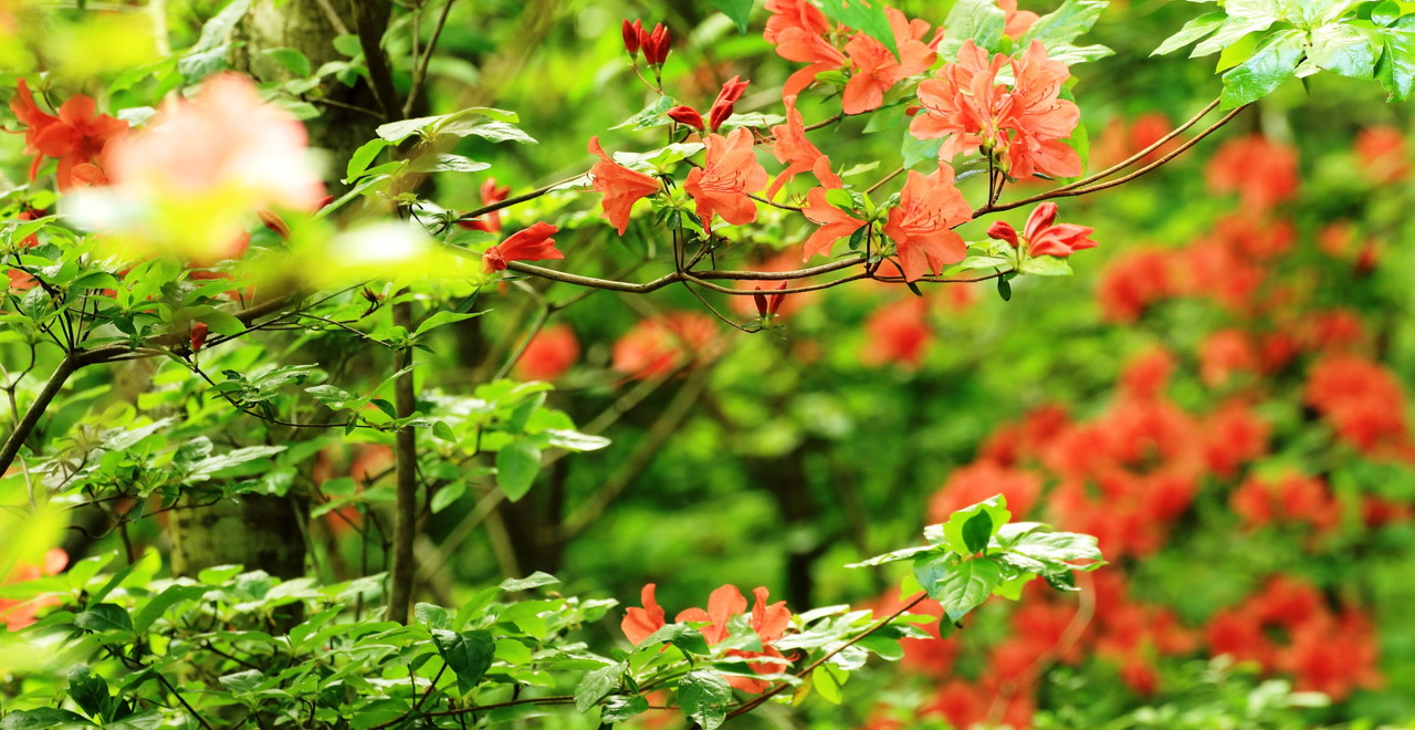
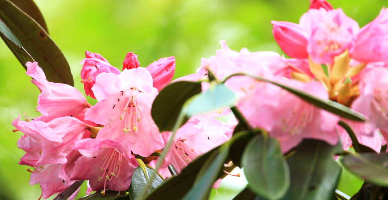
- The trailhead of Mount Kuishi is located about 30 km (an hour by car) from central Kochi City in a suburban forest that has become popular with residents of Kochi City and the rest of Kochi Prefecture as an accessible “citizens’ forest” where people can enjoy nature. Trails in the recreational forest have been laid out with a gentle slope, offering an easy trek for everyone from small children to elderly people. Along the way, walkers can enjoy the beauty of nature in all four seasons, including akebono-tsutsuji (Rhododendron pentaphyllum var. shikokianum) and mitsuba-tsutsuji (Rhododendron dilatatum) in mid-April, shakunage (Rhododendron subg. Hymenanthes) in mid-May, and autumn leaf colour in autumn. Particularly worthy of note is the view from the summit, which offers stunning panoramas of Mount Ishizuchi (1,982 m) ― western Japan's highest peak ― to the northwest, Mount Tsurugi (1,955 m) to the northeast, Kochi City and the Yokonami Peninsula to the south, Cape Muroto to the southeast, and Cape Ashizuri to the southwest.
- Other
- The Northern Trail takes in Shirowashi Rock, named for its resemblance to an eagle's beak, and Todo Rock (Sea Lion Rock), which looks like a sea lion's head. From these rocks, visitors can look out over the Ishizuchi Mountains, the Tsurugi Mountains, and the terraced rice paddies of the Reihoku region.
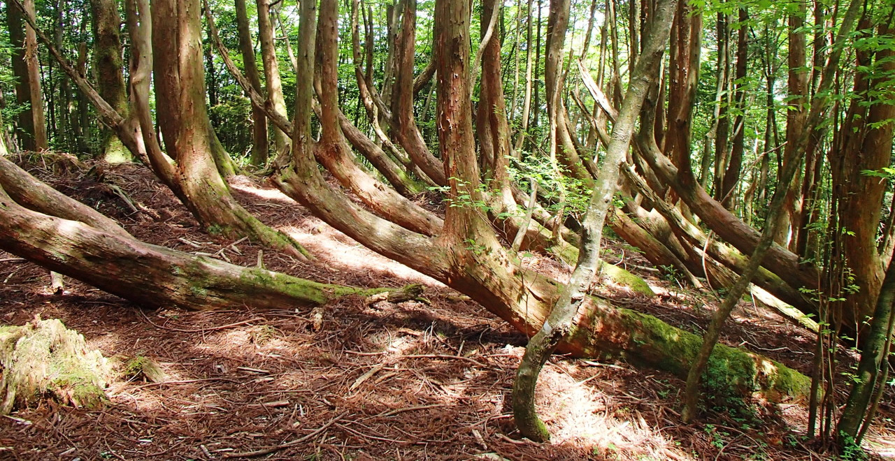
Other attractions include the Nemagari-sugi (Bent-root Cedar), a Japanese cedar that was blown over at the roots in 1963, but continued to grow; and the Uprooted Japanese cypress tree, a Japanese cypress uprooted by a severe gale.
Highlights on the Southern Trail include the Hinoki-byobu Rock vantage point, which looks out over the Kagami River below, and Sainokawara, one of the headwaters of the Kagami River. The Rhododendron Path takes in stands of akebono-tsutsuji (Rhododendron pentaphyllum var. shikokianum) and shakunage (Rhododendron subg. Hymenanthes), which are a particular delight of Mount Kuishi in the Spring, enabling visitors to enjoy the flowers and scenery as they climb.
The Myotai Trail takes its name from the Myotai Rock, a huge rock that stands on a precipice overlooking the Pacific Ocean. There is a legend that the famous local lord Yamauchi Kazutoyo used this rock as a landmark when he entered the domain of Tosa.
- Latest Information
-
- Information on temporarily unavailable facilities
- None
- Events
- Events organized throughout the year by Kochi City Kuishiyama Seishonen-no-ie Hostel include nature hikes on Mount Kuishi, firefly-spotting, charcoal-making classes, and outdoor camping (in a tent village).
- Warnings
- 1) Please note that ticks are present in this area between April and September, so particular caution is required. Wear long sleeves and long trousers.
2) Below Shirowashi Rock, Hinoki-byobu Rock, and Todo Rock are steep cliffs, so take care not to fall when enjoying the view from these vantage points.
- Usage Guide
-
- Entrance fee
- Free of charge
- Opening seasons and hours
- Open all year.
- Accommodation options
- Accommodation is available at Kochi City Kuishiyama Seishonen-no-ie Hostel, which is located close to the trailhead, but Kuishiyama Recreation Forest is only one hour from central Kochi City, so visitors can also stay at a hotel in the city.
- Facility
- Toilets and drinking fountains Walking trail Parking lot(Outside the forest) Observation platform Vending machine(Outside the forest) Restaurant(Outside the forest) Campsite and/or cabins(Outside the forest) Cultural Property (nationally designated) (Outside the forest) Accommodation facilities (Hotels/Japanese inns)(Outside the forest)
- Map
- Address
- Tosayama-Takakawa, Kochi-shi / Tosa-cho, Tosa-gun, Kochi Prefecture
- Access
(Distances and times are provided as a guide only) -
- By public transport
-
<Access from nearest railway station / bus stop>
- ・There is no public transport between Tosayamachosha-mae bus stop and the trailhead (10 km).
- ・*A free shuttle bus operates from Kochi Station. For further details regarding the shuttle bus, please contact Kochi City Kuishiyama Seishonen-no-ie Hostel (Tel: 088-895-2016). While the hostel's main building is closed for seismic retrofit (September 1, 2017 – June 30, 2018), please address any inquiries to the Lifelong Learning Division, Kochi City Office (Tel: 088-821-9215).
<Access from major transport hubs to nearest railway station / bus stop>- ・40 minutes from Kochi Station to Tosayamachosha-mae bus stop.
- By car
-
<Access>
- ・Kochi Expressway Otoyo IC exit → Route 439 → Pref. Route 16 (28 km / 40 minutes)
- ・Kochi Expressway Kochi IC exit → Northern Loop Expressway → Pref. Route 16 (21 km / 37 minutes)
<Car parking capacity / parking charges>(Kuishiyama Seishonen-no-ie): space for 35 vehicles(free)
- Nearby tourist facilities
-
- ・40 minutes by car from Kochi Castle to Mount Kuishi trailhead (*15 minutes by car from Kochi IC to Kochi Castle)
- ・40 minutes by car from Sugi no Osugi, Japan's tallest Japanese cedar, in Otoyo-cho to Mount Kuishi trailhead (*5 minutes by car from Otoyo IC to Sugi no Osugi)
- Management office contact details
-
Reihoku District Forest OfficeTEL : 0887-76-2110
https://www.rinya.maff.go.jp/shikoku/reihoku/
- Information on Other Local Tourist Attractions
-
Kochi Prefecture Mori to Midori no Kai (Forest and Greenery Association) [External link]
- Official Tourist Information
-
Kochi Prefecture Mountain Hiking Guide: Local Tourism Division, Tourism Promotion Department, Kochi Prefectural Office [External link]
- Recreation Forest Management Committee
-
Kuishiyama Recreation Forest Management CommitteeAdministration Bureau: Tosayama District Promotion Division, Agriculture, Forestry, and Fisheries Department, Kochi City Office
- Supporters
-
Asahi Breweries. Ltd. Kochi Branch
- Other
- ー


