


-
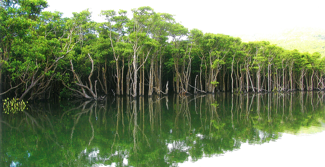
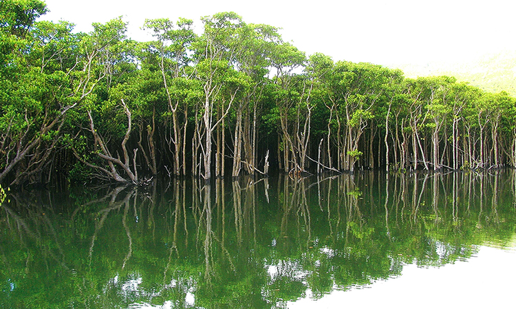
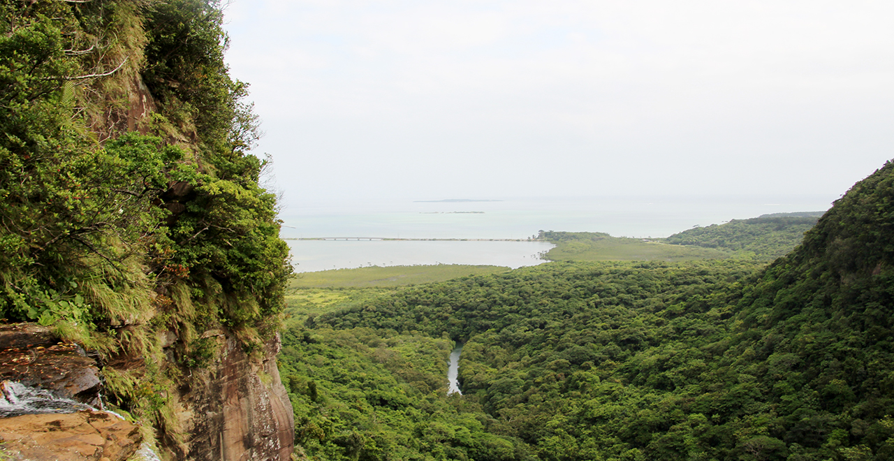
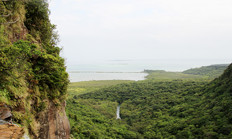
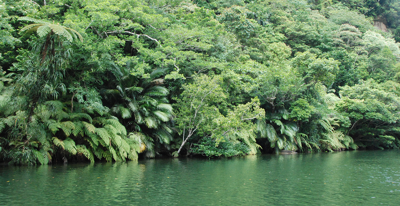
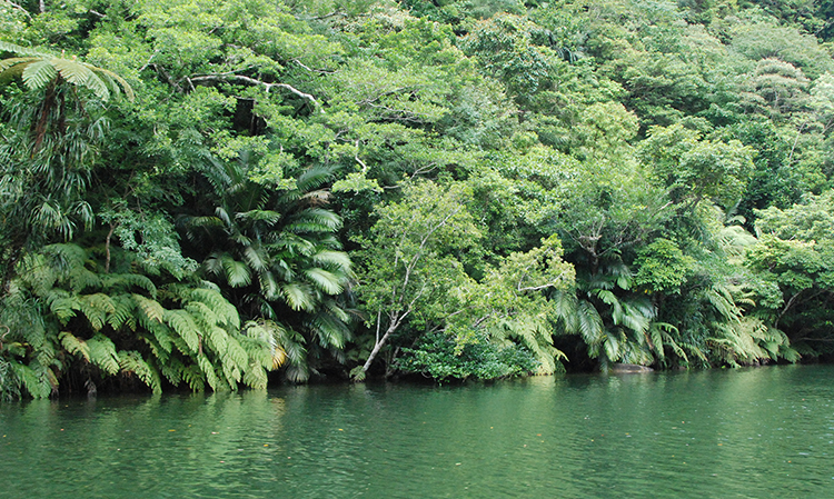
Japan's largest mangrove forest in the Nakama River basin
-
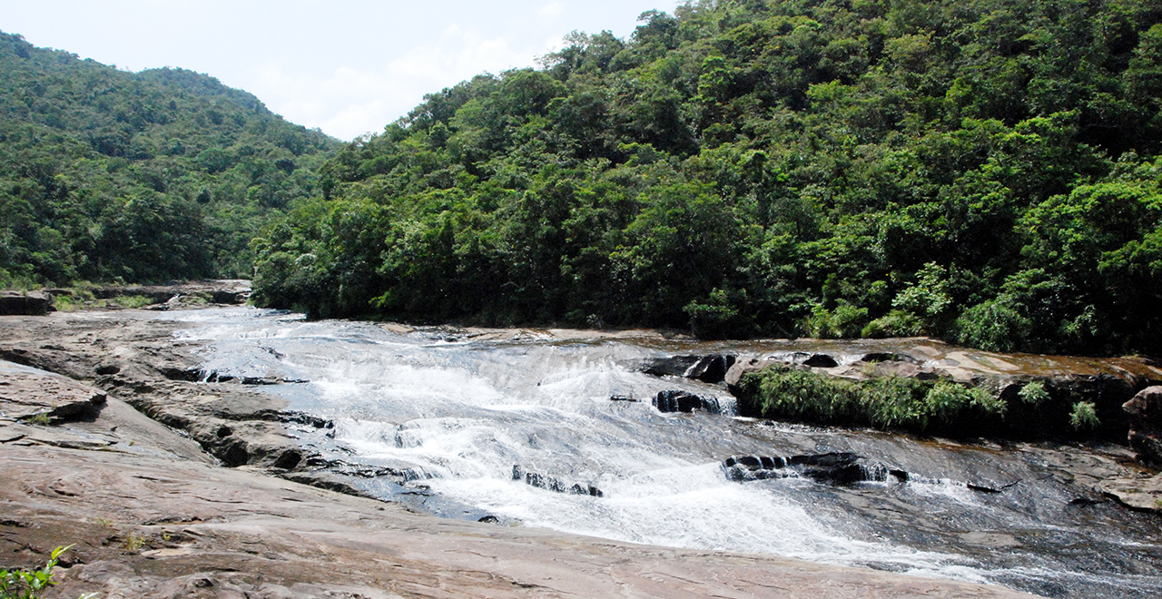
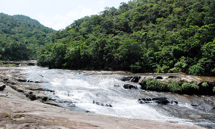
Kampire Falls
-
Magnificent view from the top of the Pinaisara Falls
-
Subtropical forest rich in biodiversity
-
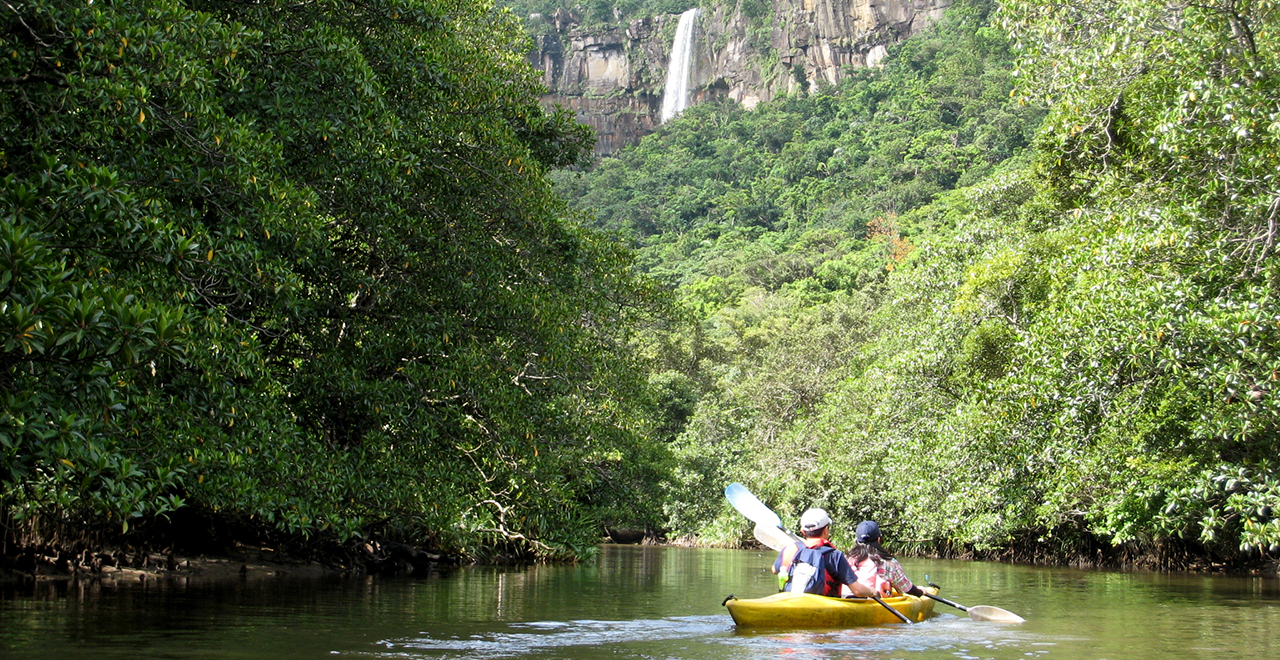
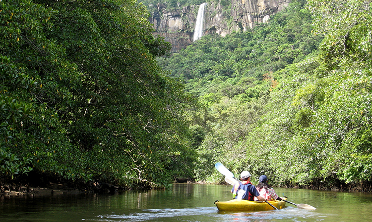
Kayaking to the Pinaisara Falls
-
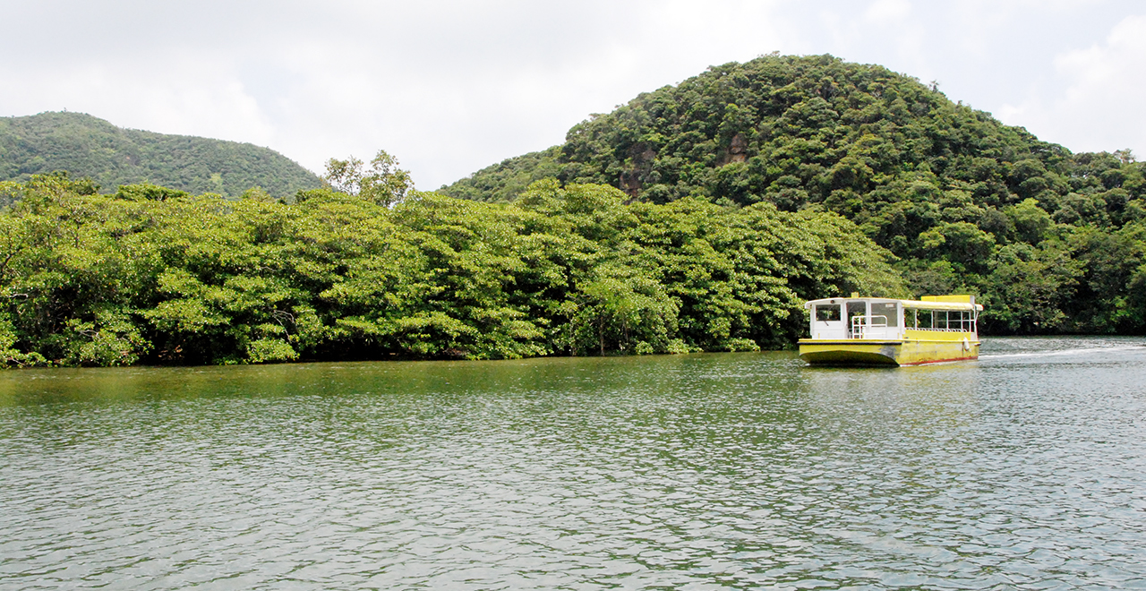
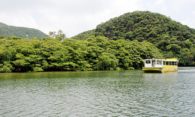
Sightseeing boat
-
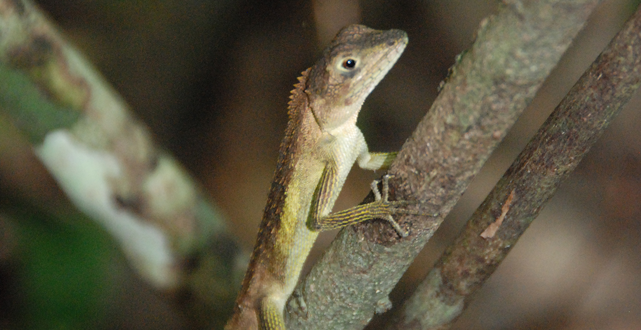
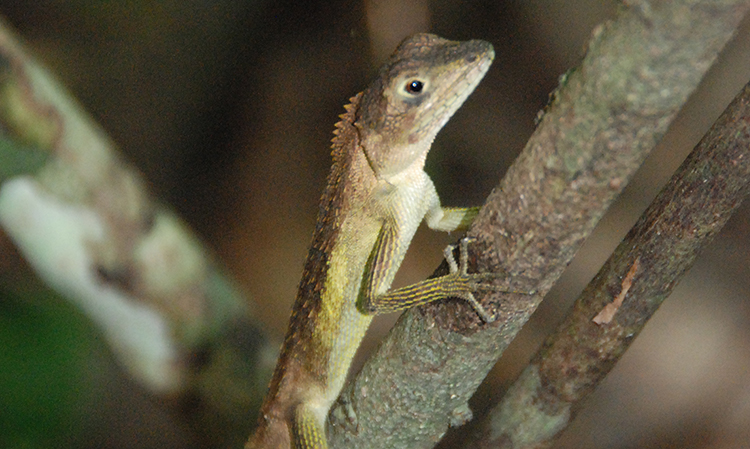
Kinoboritokage (Japalura polygonata)
Iriomote Recreation Forest
2,120.70ha
Elevation Lowest : 10m / Average : 40–120m / Highest : 280m
A natural treasury of a dense subtropical forest
A natural treasury of a dense subtropical forest
- Newest information
- Area
- Activities
- Overview
- Latest Information
- Usage Guide
- Facility
- Map
- Address
- Access
(Distances and times are
provided as a guide only) - Management office
contact details - Information on Other Local
Tourist Attractions - Official Tourist Information
- Recreation Forest
Management Committee - Supporters
- Other
- Newest information
- Gathering information in advance is important to safely enjoy forest recreation that brings you closer to nature.
・CHECK
・When you go out, please check local tourist and related information and gather information on road closures, weather conditions, etc.
- Video
 Drone Footage
- Area
- Kyushu
- Activities
- Waterfall viewing (Includes surrounding area) Birdwatching (Includes surrounding area) Paddling / fishing / boating (pond / lake / river) (Includes surrounding area) : Request for a guide required (Payment required) (Foreign language signs/pamphlets available) Canyoning (River trekking) (Includes surrounding area) : Request for a guide required (Payment required) (Foreign language signs/pamphlets available) Bicycle rental (Outside the forest) (Foreign language signs/pamphlets available) Guided tours (Outside the forest) (Payment required) (Foreign language signs/pamphlets/interpretation available)
- Overview
-
- Geographical/topographical features
- The Iriomotejima Island is located at the west end of Japan, and is the second largest island in Okinawa Prefecture, following Okinawa's main island. The island is mostly mountainous and has a complicated topography with little flat land. Most rocks of the island are moisture-containing sandstone and shale of the Yaeyama Group, and limestone layers are observed in between them. Paleozoic formations spread in the northeastern part of the island, and raised coral reefs are observed in whole area of the northwestern and eastern parts of the island, forming a karst terrain and a large number of limestone caves.
- Historical/cultural features
- One story about the origin of the name "Iriomote" is that, while the east was called "agari" (to rise) and the west was called "iri" (to set) in Okinawa because the sun rises in the east and sets in the west, the island came to be called Iriomote because it is located to the west of the central islands of the Yaeyama Islands such as Ishigakijima Island and Taketomojima Island. Since the life on the island was severe in former days, it was difficult for people to settle down on the island. Iriomote had a population exceeding 8,000 at one time from around 1764, but the population drastically decreased due to tsunami and malaria. (The malaria has been eradicated, and the present population is about 2,000.)
The Shichi Festival, which has been nationally designated as an important intangible cultural property, is a traditional event that has continued for 500 years. The festival is held by the entire village on the day of Tsuchinotoi (a specific date on the old calendar) around October on the old calendar every year. In a neighboring village just across the river, the speeches, costumes, the flow and forms of the festival, and the whole atmosphere would differ completely, indicating how this festival has been passed down in each individual area with a sense of importance. - Climate, flora and fauna
- The Recreation Forest belongs to a subtropical oceanic climate (average annual temperature: 23.7°C; annual precipitation: 2,304 mm). The entire island is surrounded by beautiful coral reefs, while mangrove forests and looking-glass mangroves are found in river basins, and subtropical evergreen broad-leaved trees grow in the mountains. The island is also home to various nationally endangered species of wild fauna and flora, so its scientific value is extremely high, and the unique natural environment resulting from being an island has been highly praised from both in and outside Japan and attracts many tourists.
The four regions of Amami-Oshima Island, Tokunoshima Island, and the Northern part of Okinawa Island in the Central Ryukyus, including Iriomote Island in the South Ryukyus, were registered as World Natural Heritage sites in 2021. - Attractions
- In the Nakama River basin, there are Japan's largest mangrove forest and communities of Yaeyamayashi (Yaeyamaya palm (Satakentia liukiuensis (Hatus.) H.E.Moore)) in Ubunduru, which have been designated as a natural monument. The scenery you can see from a tour boat traveling upstream from the river mouth is reminiscent of an unexplored island. Meanwhile, in the Urauchi River area and the Hinai River area, activities such as kayaking and trekking are actively conducted particularly at the Kampire Falls, the Marudo Falls, and the Pinaisara Falls upstream, and eco tours that make use of the natural environment are very popular.
- Other
- If you are staying on the Iriomotejima Island, we recommend you to experience diving in the beautiful coral reefs, or kayaking from the river to the sea. These activities are not only enjoyable for families, but also adult visitors. You can use guided tours to see a forest filled with the lights of the firefly, Yaeyama-himebotaru (Luciola filiformis yayeyamana), from March to mid-April, or the river surface covered with flowers of Futomomo (rose apple (Syzygium jambos (L.) Alston)) on an early morning in summer, and encounter the mystery of life that can only be observed on this island.
Even if you prefer to enjoy your stay in a more relaxed way, you will surely be released from your daily stress by enjoying meals using the local delicious ingredients, gazing at the milky way and the Southern Cross in the night sky, and waking up to the sound of lapping waves and the song of Akashobin (ruddy kingfisher (Halcyon coromanda)) from deep in the forest.
- Latest Information
-
- Warnings (Flora and fauna)
- Sakishimahabu (Protobothrops elegans) and Himehabu (Ovophis okinavensis): These snakes are found throughout the year. If you see one, do not go near it.
- Warnings (Dangerous areas)
- The surfaces of rocks near waterfalls are slippery and have caused accidents, so please wear grippy shoes.
- Warnings (Other)
- - Due to the oceanic climate, an intense rain often falls locally and suddenly from May through October. Rain gear is essential.
- A rare wide animal may run out on the road and be hit by a car (the top cause of death of Iriomote Yamaneko, The Iriomote wild cat (Prionailurus bengalensis iriomotensis) is said to be traffic accidents). Accidents mainly occur from dusk to nighttime. Please keep under the speed limit and keep a close eye on the road when driving.
- Usage Guide
-
- Entrance fee
- Free of charge
- Opening seasons and hours
- Accessible 24 hours a day
- Accommodation options
- Accommodation facilities are concentrated in the Ohara and Uehara areas.
- Facility
- Toilets and drinking fountains (Includes surrounding area) Footpath / walking trail / nature trail (Includes surrounding area) Bike trail : No cycling road, but bicycles can travel on prefectural roads. Parking lot (Includes surrounding area) Observation platform (Includes surrounding area) Vending machine (Outside the forest) Shop (Outside the forest) Restaurant (Outside the forest) Campsite and/or cabins (Outside the forest) Specimen forest / Botanic garden Resource center / Museum (Outside the forest) World Heritage Site / Cultural Property (nationally designated) (Includes surrounding area) Accommodation facilities (Hotels/Japanese inns) (Outside the forest)
- Map
- Address
- Taketomi Town, Yaeyama County, Okinawa Prefecture (Nakama River area, Urauchi River area, Hinai River area)
- Access
(Distances and times are provided as a guide only) -
- By public transport
-
- - Ishigaki Airport → (Azuma Bus, Karry Kanko Bus: about 40 minutes) → Ishigaki Port Remote Island Terminal → (high-speed ferry: about 35 minutes) → Iriomote Island Nakama Port (common name: Ohara Port)
- * There is also a route from the Ishigaki Port Remote Island Terminal to Iriomote Island Uehara Port, but it is not recommendable due to the small number of sailings and frequent sailing cancellations due to high waves.
- - On the Iriomote Island, take the Iriomotejima Kotsu Bus bound for Shirahama.
- [Nakama River area] Nakama Port (Ohara Port) → (Iriomotejima Kotsu Bus: 4 minutes) → Otomi bus stop → (on foot: about 30 minutes (2.3 km)) → Otomi Footpath start point → (on foot: about 40 minutes (3 km) → Otomi Footpath Observation Platform
- [Hinai River area] Nakama Port (Ohara Port) → (Iriomotejima Kotsu Bus: 53 minutes) → Funaura bus stop (on foot: about 30 minutes (2.5 km)) → Hinai River Area Parking Lot
- [Urauchi River area] Nakama Port (Ohara Port) → (Iriomotejima Kotsu Bus: 82 minutes) → get off at the Urauchigawa bus stop → (on foot: about 1 minute (0.1 km) → near the Urauchi Bridge along Pref. Route 215
- By car
-
<Access, Car parking capacity / parking charges>
- - Nakama Port (Ohara Port) → (rental car: about 20 minutes (3.6 km)) → Otomi Footpath start point (no parking lot available)
- - Nakama Port (Ohara Port) → (rental car: about 55 minutes (35 km)) → Hinai River Area Parking Lot (free parking)
- - Nakama Port (Ohara Port) → (rental car: about 55 minutes (40 km)) → Urauchi River Mouth Parking Lot (free parking for about 10 vehicles)
- Nearby tourist facilities
-
- - Omija Road Park (about 5 minutes by car (5.4 km) from the Funaura Bridge toward Ohara)
- - Community of Sakishimasuonoki (looking-glass mangrove (Heritiera littoralis Dryand.)) (about 5 minutes by car (5 km) from the Otomi bus stop toward Uehara) (Nationally designated Natural Monument)
- - Yufu Island (water buffalo) (about 20 minutes by car (about 10 km) from the Otomi bus stop toward Uehara)
- Management office contact details
-
Okinawa District Forest OfficeTEL:098-918-0210
https://www.rinya.maff.go.jp/kyusyu/okinawa/index.htmlIriomote Forest Ecosystem Conservation CenterTEL:098-918-0210
https://www.rinya.maff.go.jp/kyusyu/iriomote_fc/index.html
- Information on Other Local Tourist Attractions
-
Tourism Guide Ishigakijima Net [External link]
- Official Tourist Information
-
Taketomi Town Tourism Association [External link]
- Recreation Forest Management Committee
-
Iriomote Recreation Forest Management Committee
Taketomi Municipal OfficeTEL:0980-82-6191
- Supporters
- ー
- Other
- ー
PDF形式のファイルをご覧いただく場合には、Adobe Readerが必要です。
Adobe Readerをお持ちでない方は、バナーのリンク先からダウンロードしてください。
![]()