


-
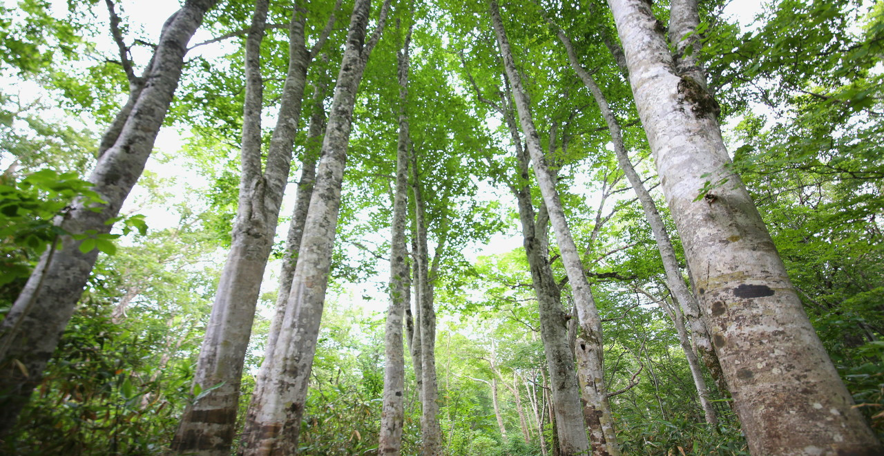
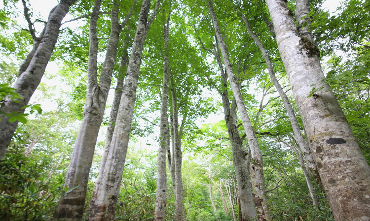
Beach forest
-
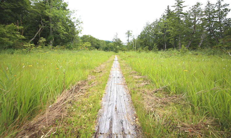
Swamp
-
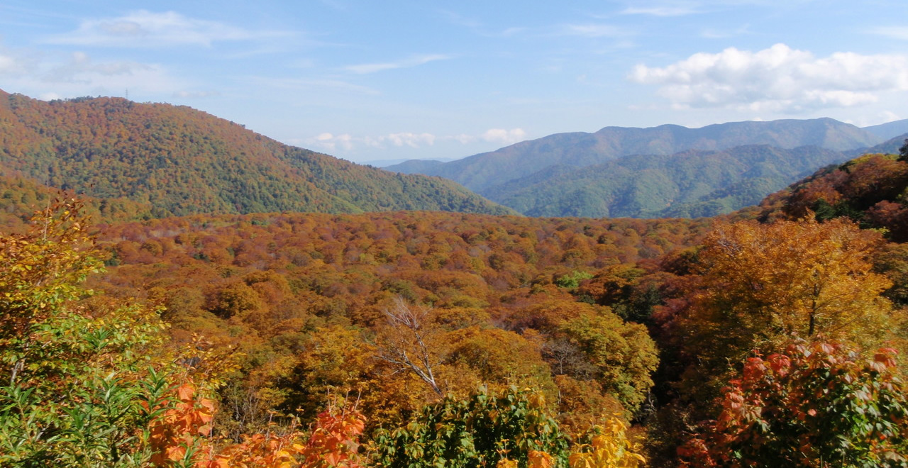
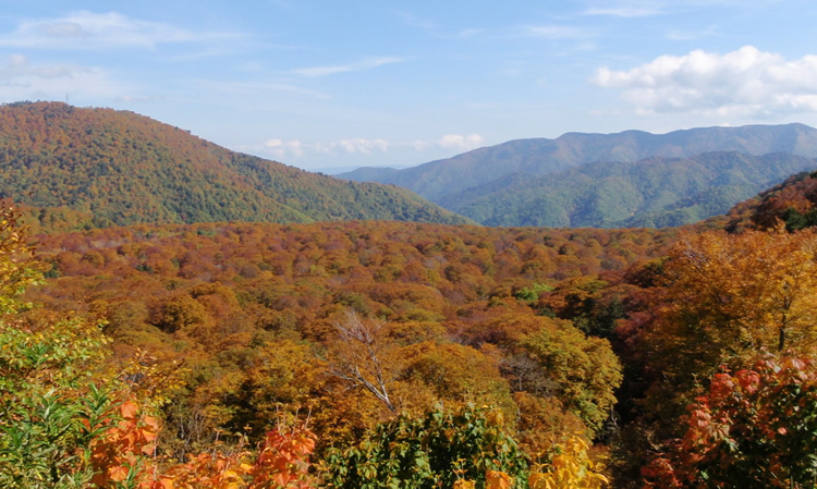
Autumn foliage in Bunadaira
-
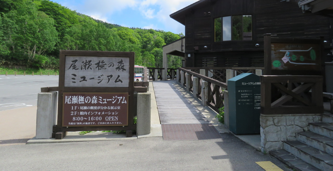
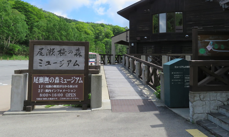
Oze Beach Forest Museum
-
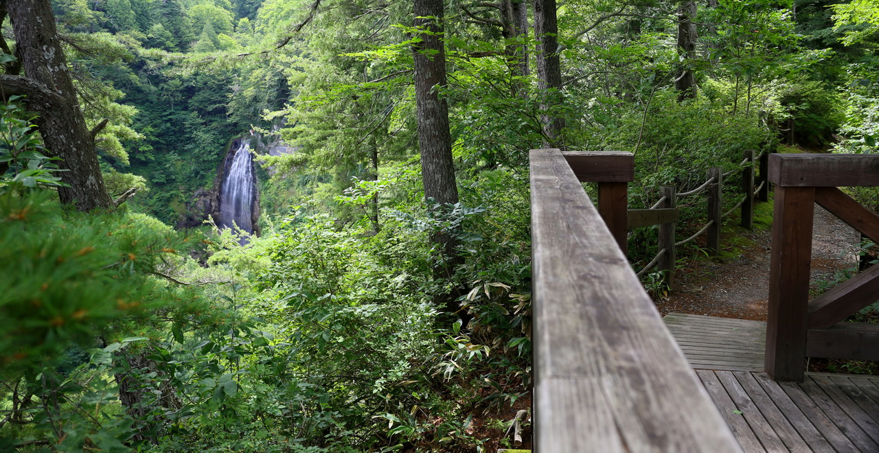
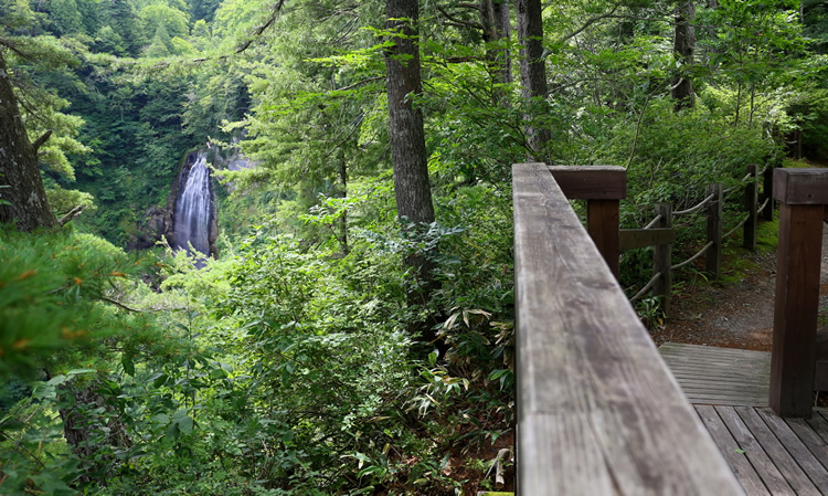
Mokake Falls
-
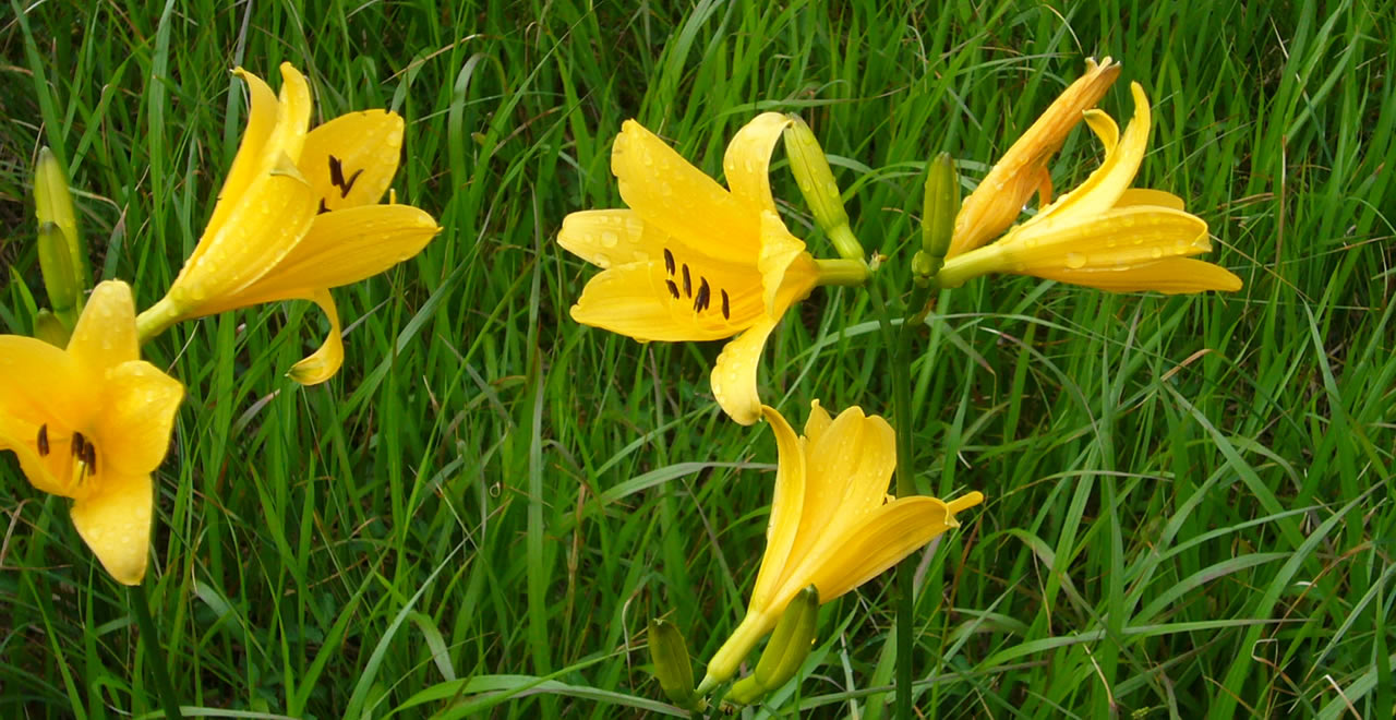
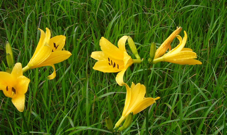
Nikkokisuge – Daylily
-
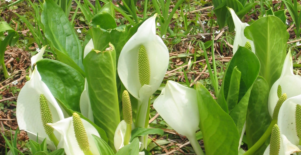
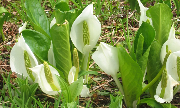
“Water Banana” - Asian skunk cabbage
Miike Bunadaira Recreation Forest
224.38ha
Elevation Average : 1,110―1,530m
Fresh greenery in early summer and scarlet & gold leaves in autumn
ー A magnificent virgin beech forest and unique wetlands stretching all the way to Oze. ー
Fresh greenery in early summer and scarlet & gold leaves in autumn
ー A magnificent virgin beech forest and unique wetlands stretching all the way to Oze. ー
- Newest information
- Area
- Activities
- Overview
- Latest Information
- Usage Guide
- Facility
- Map
- Address
- Access
(Distances and times are
provided as a guide only) - Management office
contact details - Information on Other Local
Tourist Attractions - Official Tourist Information
- Recreation Forest
Management Committee - Supporters
- Other
- Newest information
- Gathering information in advance is important to safely enjoy forest recreation that brings you closer to nature.
・CHECK
・When you go out, please check local tourist and related information and gather information on road closures, weather conditions, etc.
- Area
- Kanto
- Activities
- Autumn leaf viewing (Includes surrounding area) Waterfall viewing (Includes surrounding area) Birdwatching (Includes surrounding area) Picnics (lawn area/park)(Outside the forest) Areas for paddling/fishing (pond/lake/river)(Outside the forest) Cycling (cycle path)(Outside the forest) Skiing (Ski resort)(Outside the forest)
- Overview
-
- Geographical/topographical features
- Located near the borders of Fukushima, Niigata, and Gunma prefectures, this is the area where the Tadami River ― the largest tributary in the Agano River system ― originates. It is close to Oze, which was selected as one of the 100 Landscapes of Japan, and is at the foot of Mount Hiuchigatake, well-known as one of the 100 Famous Japanese Mountains and highest Mountain in Tohoku whose peak is 2,356 meters. Many tourists flock to this area, which serves as the gateway to Oze from the Fukushima Prefecture side.
- Historical/cultural features
- Oze's wetlands are thought to have been formed by eruptive activity about 10,000 years ago and plants that developed during the glacial period still grow wild there today.
- Climate, flora and fauna
- This area has a humid subarctic climate, so it is cool in summer and bitterly cold in winter. It is designated as part of the Oze National Park. Bunadaira has an extensive natural mixed coniferous-broadleaved forest consisting mainly of buna, Japanese beech (Fagus crenata Blume) and Oh-shirabiso (Aomori todomatsu) (Abies mariesii). Mizubasho, Asian skunk cabbage (Lysichiton camtschatcensis) and nikkokisuge (zenteika) (Hemerocallis esculenta) bloom around the several small wetlands dotted about the area, offering visitors the chance to enjoy the great outdoors with ease.
- Attractions
- Located at an altitude of 1,500 m, this area is cool even at the height of summer, so it makes an ideal getaway from the heat and humidity at lower elevations. Amid the extensive virgin beech forest, visitors can catch spectacular views as they drive from Miike to Numayama-toge Pass. In fall, the scarlet and gold leaves are a magnificent sight. The area is also very popular with climbers, as it offers the chance to enjoy proper mountain climbing with an easy approach to both Oze Marsh and Mount Hiuchigatake.
- Other
- Miike Lodge Accommodation (operated by Hinoemata Village, open 8am to 5pm during weekdays, 6am30 to 5pm on holidays, May – October/ Yama-no-Eki “Miike” (Shop, Restaurants and Refreshment Area), Parking lot and Bus Stop. Closed in winter due to the closure of the National Route 352.
- Latest Information
- ー
- Usage Guide
-
- Entrance fee
- None
- Opening times
- Open all year
- Accommodation options
- Miike Lodge (operated by Hinoemata Village)
Please contact the general information center for further details and reservation.
FAX: 0241- 75-2336
Oze-Hinoemata Onsen Information (Japanese)
http://www.ozejin-yamagoya.jp
- Facility
- Toilets and drinking fountains(Includes surrounding area) Toilet (accessible)(Includes surrounding area) Walking trail (Includes surrounding area) Walking trail (accessible)(Includes surrounding area) Car park (Includes surrounding area) Observation platform (Includes surrounding area) Visitor center (staffed only)(Outside the forest) Vending machine (Includes surrounding area) Shop (Includes surrounding area) Restaurant (Includes surrounding area) Campsite and/or cabins (Outside the forest) Cultural Property (nationally designated)(Outside the forest):Hinoemata Kabuki Stage Accommodation facilities (Hotels / Japanese inns)(Includes surrounding area)
- Map
- Address
- Hinoemata-mura, Minamiaizu-gun, Fukushima Prefecture
- Access
(Distances and times are provided as a guide only) -
- By public transport
-
<Access from major transport hubs to nearest railway station / bus stop>
- ・Tokyo Station (JR Joban Line: 20 minutes) → Kita-Senju Station (Tobu Skytree Line / Tobu Nikko Line Revaty limited express: 90 minutes) → Shimo-Imaichi Station (Tobu Kinugawa Line / Aizu Kinugawa Line Aizu Mount Express (Yagan Railway): 75 minutes) → Aizukogen-Ozeguchi Station
- ・Aizu Bus: Aizukogen-Ozeguchi Station entrance → Hinoemata Municipal Office (Hinoemata Yakuba-mae) → Oze-Miike (100 minutes)
- ・Asakusa Station(Tobu Skytree Line / Tobu Nikko Line / Tobu Kinugawa Line / Aizu Kinugawa Line (Yagan Railway):3 hours)→ Aizukogen-Ozeguchi Station
- By car
-
<Access><From Tokyo via the Tohoku Expressway>
- ・Tohoku Expressway Nishinasuno-Shiobara IC → Route 400 → Route 121 → Route 352 → Recreation Forest (approximately 112 km)
(From Tohoku via the Tohoku Expressway) - ・Tohoku Expressway Shirakawa IC → Route 289 → Route 121 → Route 289 → Route 401 → Route 352 → Recreation Forest (approximately 132 km)
(From Joshin'etsu via the Ban-etsu Expressway) - ・Ban-etsu Expressway Aizubange IC → Route 252 → Route 289 → Route 401 → Route 352 → Recreation Forest (approximately 137 km)
- ・Ban-etsu Expressway Aizuwakamatsu IC → Route 118 → Route 121 → Route 289 → Route 401 → Route 352 → Recreation Forest (approximately 122 km)
(From Joshin'etsu via the Kan-etsu Expressway) - ・Kan-etsu Expressway Koide IC → Route 17 → Route 252 → Route 289 → Route 401 → Route 352 → Recreation Forest (approximately 132 km)
* One section of Route 252 is reduced to a single lane, with each direction of traffic passing through in turn. This road is closed in winter. - ・Kan-etsu Expressway Koide IC → Route 352 (Okutadami Silver Line → Ginzandaira → Lake Okutadami → Miike) → Recreation Forest (approximately 73 km)
* Part of the section between Ginzandaira and Miike is reduced to a single lane, with each direction of traffic passing through in turn. Restrictions apply regarding the type of vehicle permitted to use this road (vehicles with the size of a minibus or smaller may use this road). Please note that this route has many curves and is narrow in places, as it runs alongside the dam. (National Route 352 will be impassable in winter due to heavy snow. )
<Car parking capacity / parking charges>Miike car park Space for 400 standard-sized cars ¥1,000 per visit (first 2 hours free of charge)
Car park space near the observation platform “Mokake Falls” for 15 standard-sized cars (free for charge)
Pref. Route 1 : Public vehicles prohibited (Shuttle bus service available). - ・Tohoku Expressway Nishinasuno-Shiobara IC → Route 400 → Route 121 → Route 352 → Recreation Forest (approximately 112 km)
- Nearby tourism facilities
-
- ・Oze Hinoemata Onsen hot spring resort
- ・Mini Oze Park
- ・Hinoemata Kabuki Stage
- Management office contact details
-
Minami-Aizu Branch Office, Aizu District Forest OfficeTEL:0241-72-2323
https://www.rinya.maff.go.jp/kanto/minamiaizu/index.html
- Information on Other Local Tourist Attractions
- ー
- Official Tourist Information
-
Oze Hinoemata Onsen Tourism Association [External link]
- Recreation Forest Management Committee
-
Committee name and contact details:FAX:0241-72-8010
Hinoemata Municipal Office
- Supporters
- ー
- Other
- ー
PDF形式のファイルをご覧いただく場合には、Adobe Readerが必要です。
Adobe Readerをお持ちでない方は、バナーのリンク先からダウンロードしてください。
![]()