


-
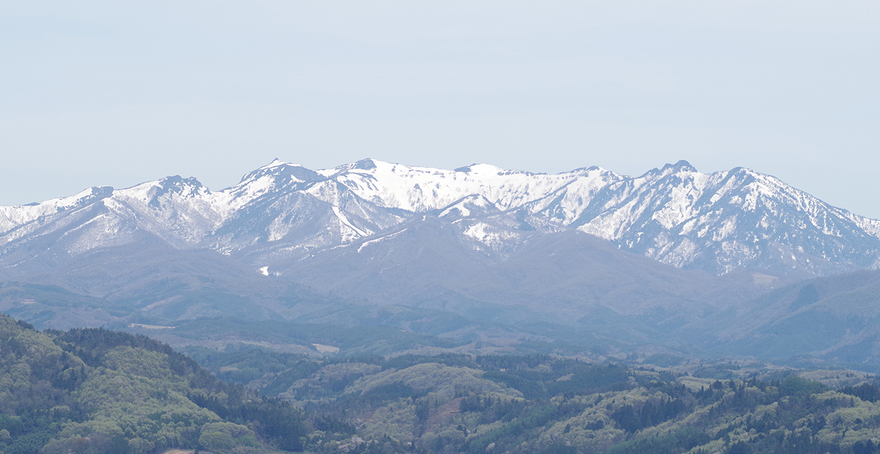
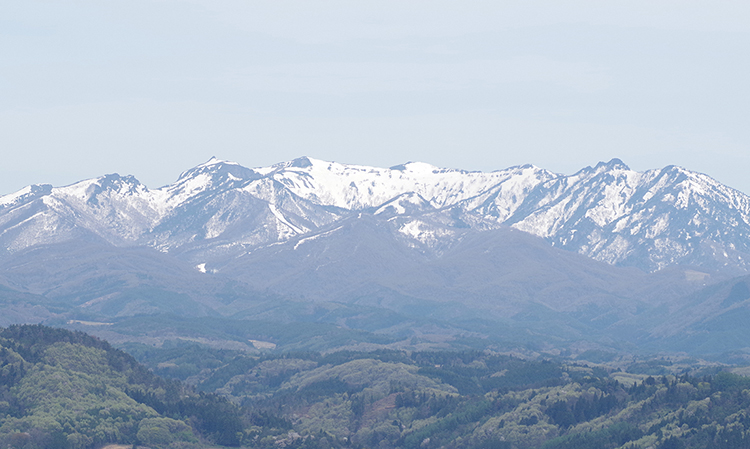
View of Mt. Hotaka from Numata City
-
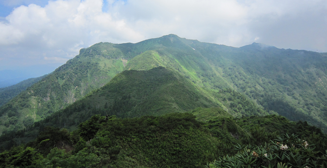
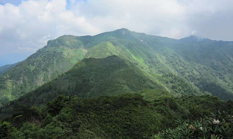
Mt. Hotaka in summer
-
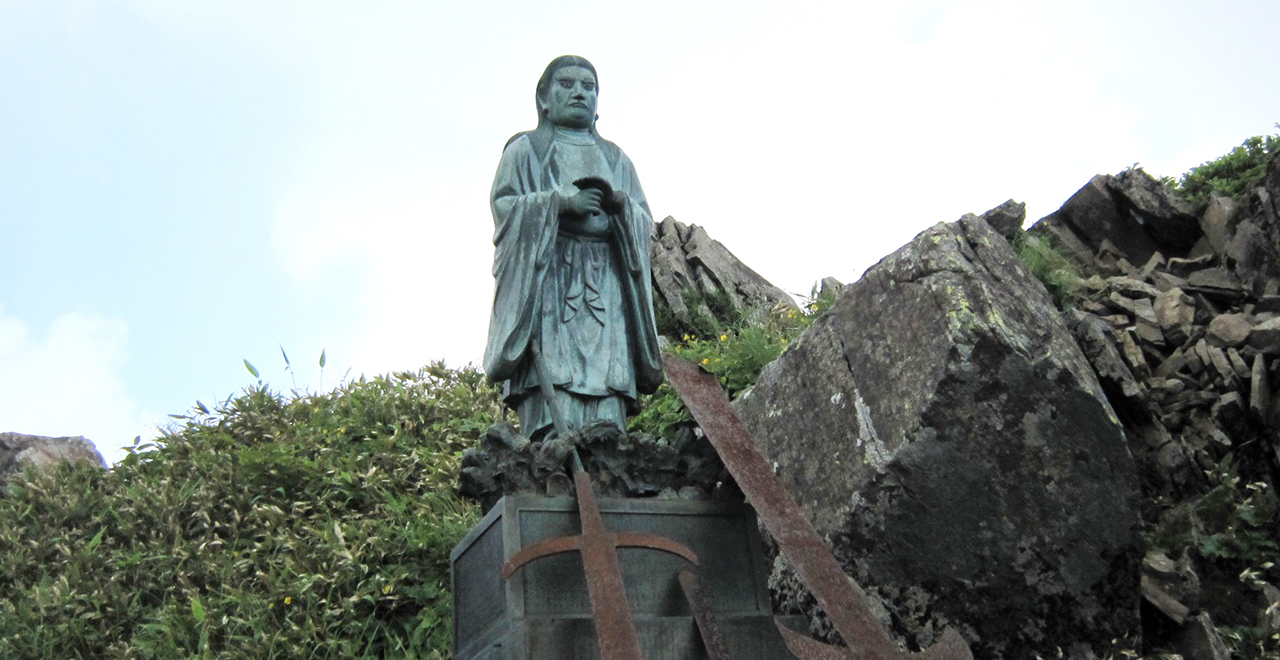
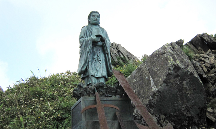
Statue of Yamato Takeru No Mikoto (Prince Yamato Takeru)
-
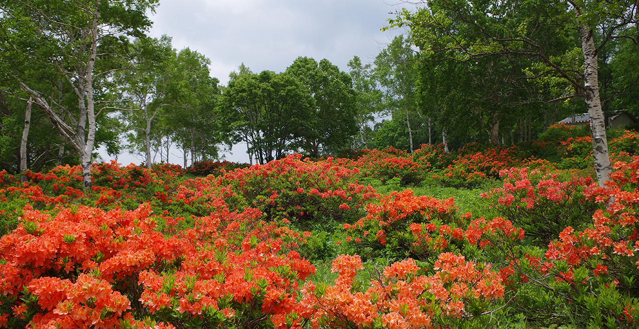
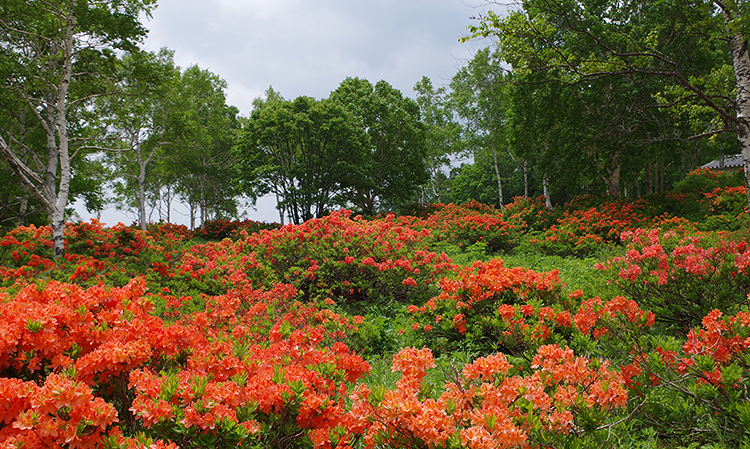
Rengetsutsuji (Japanese azalea (Rhododendron molle subsp. japonicum)) in full bloom
-
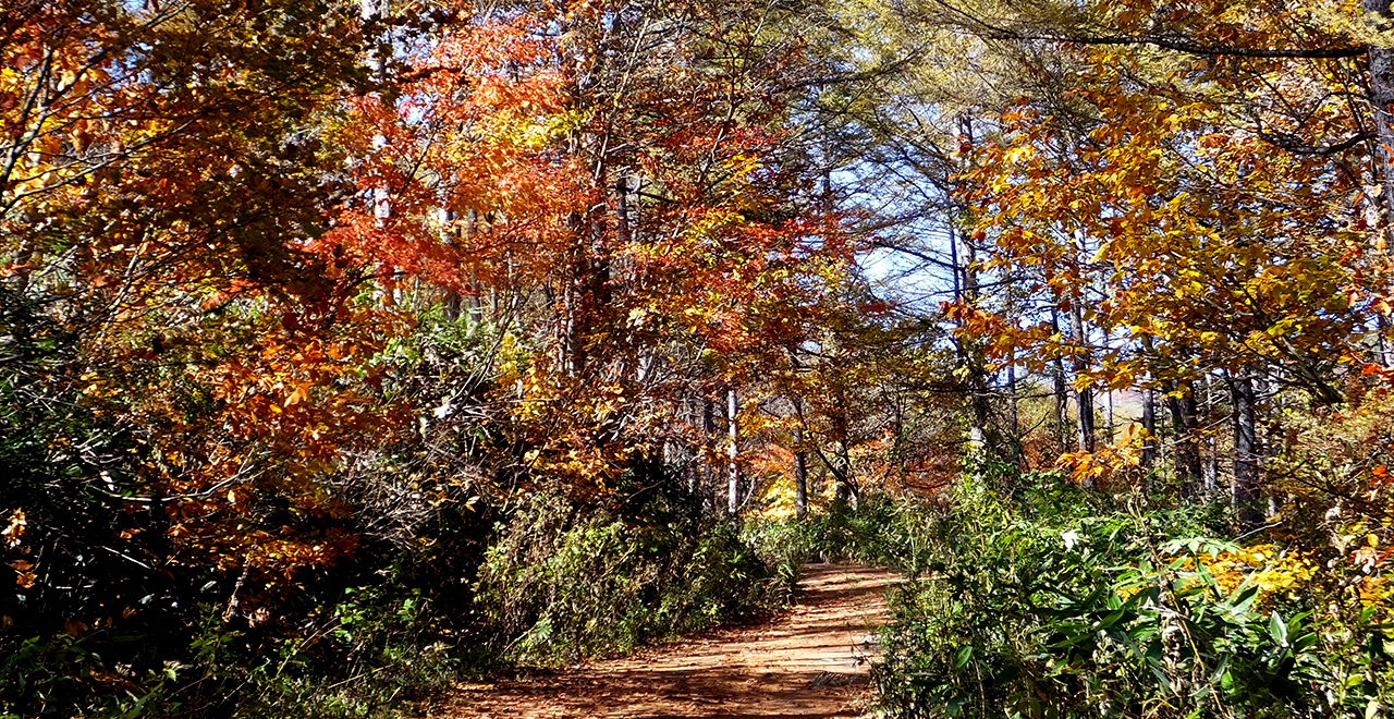
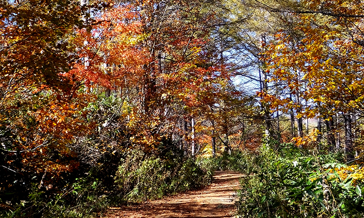
Mountain trail in autumn
-
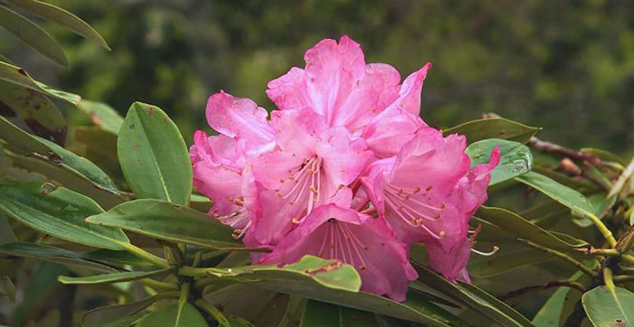
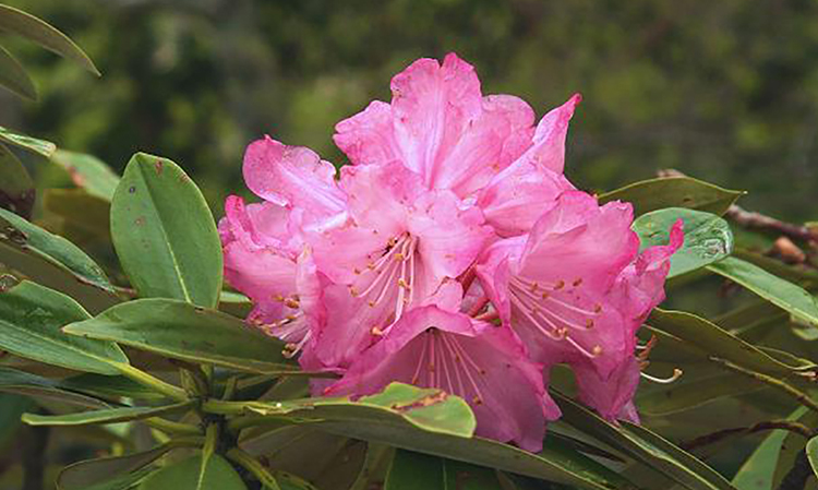
Azuma Shakunage (Rhododendron degronianum Carrière)
Hotaka Recreation Forest
1,393.57ha
Elevation Lowest : 1,030m / Average : 1,030–2,158m / Highest : 2,158m (Mt. Hotaka (Okihotaka Peak))
Mountain of legend and worship, offering a 360-degree stunning vista at the summit
Mountain of legend and worship, offering a 360-degree stunning vista at the summit
- Newest information
- Area
- Activities
- Overview
- Latest Information
- Usage Guide
- Facility
- Map
- Address
- Access
(Distances and times are
provided as a guide only) - Management office
contact details - Information on Other Local
Tourist Attractions - Official Tourist Information
- Recreation Forest
Management Committee - Supporters
- Other
- Newest information
- Gathering information in advance is important to safely enjoy forest recreation that brings you closer to nature.
・CHECK
・When you go out, please check local tourist and related information and gather information on road closures, weather conditions, etc.
- Area
- Kanto
- Activities
- Flower-viewing (Rengetsutsuji (Japanese azalea (Rhododendron molle subsp. japonicum))) : Hotaka Bokujo Camping Ground (Outside the forest) Autumn leaf viewing (Includes surrounding area) : Teriha Gorge (Minakami) Waterfall viewing : Urami Falls, Fukiware Falls (pay parking lot) (Outside the forest) Birdwatching (Includes surrounding area) Mountain climbing (Includes surrounding area) Canyoning (River trekking) : Minakami Town, Katashina Village (reservation required) (Outside the forest) Hands-on forestry / woodworking experience : Takuminosato, etc. (Outside the forest) Hot Spring (Outside the forest) Oguna Hotaka Ski Resort, Kawaba Ski Area, etc. (no. of trails: 23) Medium-long distance Trail (Includes surrounding area) : Joshu Hotakasan Sky View Trail (Payment required in some cases) Shrine / Temple visit : Kichijouji Temple, etc. (Outside the forest)
- Overview
-
- Geographical/topographical features
- Mt. Hotaka, located in the northwest part of Gunma Prefecture, is a famous mountain with seven 2,000 m class peaks, including Maehotaka Peak, Okihotaka Peak (the main peak), and Kengamine Peak. It belongs to the Nasu Volcanic Belt, and the mountain system consists of the northward ridge, the southward ridge, and westward ridge stemming from Mt. Hotaka.
- Historical/cultural features
- The name Mt. Hotaka is said to have derived from a legend that Yamato Takeru No Mikoto (Prince Yamato Takeru) trekked the mountain on his eastern expedition. Mt. Hotaka has been trekked by many worshipers as a sacred mountain in old days and by many hikers, including young people, today.
- Climate, flora and fauna
- The forest has a climate distinctive to the Pacific side of Japan, but is also affected by the climate of the Sea of Japan side. It is located at a high elevation of 1,030 m to 2,158 m, with cool summers and severe winters. The forest at an elevation of 1,000 m to 1,600 m belongs to the montane zone. It consists of a natural broad-leaved forest of Buna (Japanese beech (Fagus crenata Blume)) and Mizunara (Japanese oak mizu-nara (Quercus crispula Blume)) and a planted forest of Karamatsu (Japanese larch (Larix kaempferi)), and also has a small marsh. The forest at 1,600 m and higher belongs to the subalpine zone, and is a natural coniferous forest of Aomori Todomatsu (Marie's fir (Abies mariesii Mast.)) and Shirabe (Christmastree (Abies veitchii Lindl.)). The forest at 1,900 and higher belongs to the alpine zone, and mainly consists of shrubs of Haimatsu (Siberian dwarf pine (Pinus pumila)) and Azuma Shakunage (Rhododendron degronianum Carrière).
Due to such diverse vegetation, you can see pretty flowers of alpine plants from spring to summer, and beautiful colored leaves in autumn. - Attractions
- Mt. Hotaka has trekking courses that can be enjoyed by hikers of all levels from beginners to experts. Every June, events are held at Kawashina Village (Hotaka Bokujo Camping Ground), Kawaba Village (Kawaba Campsite), and Minakami Town (Hotaka Shrine) to announce the start of the Mt. Hotaka climbing season.
You can enjoy various seasonal expressions of Mt. Hotaka throughout the year, such as by looking at alpine plants in the marsh from spring to summer, viewing the colored leaves of the Japanese beech virgin forest in autumn, and observing frost-covered trees while trekking using the lifts of the ski area (Kawaba) in winter. Furthermore, from Mt. Hotaka's summit, which provides a 360-degree panoramic view, you may be able to see Mt. Fuji if the weather is clear.
Every September, a trail running event called the Joshu Hotakasan Sky View Trail (three courses: Katashina Village Sky View Trail 30, Minakami Town Sky View Trail 70, and Kawaba Village Yamada Noboru Memorial Cup 120) is held along the ridges (mountain trails) of Mt. Hotaka. Nearly 1,000 participants run on the mountain.
The Okutone Suigen No Mori Forest has been developed as an area where visitors can learn about greenery and water. Camping space is available for use as a base for strolling through the Japanese beech forest or enjoying wading in the mountain streams.
At about 9.9 km, the Hotaka Nature Trail is a long circuit that takes approximately five to six hours to complete. Visitors can enjoy various attractive spots along the way, such as the virgin Japanese beech forest and the Hanasaki Marshland, where clusters of marsh plants grow, including Mizubasho (Asian skunk cabbage (Lysichiton camtschatcensis)).
- Latest Information
-
- Regular events
- Joshu Hotakasan Sky View Trail (September every year (3 days; registration required to participate))
- Warnings (Flora and fauna)
- Asian black bear: Tsukinowaguma (Asian black bear (Ursus thibetanus)) may be present during the period from May to November. When entering the forest, please carry a bear bell and stay in a group. Check for local information on bear sightings and warnings and follow instructions.
Ticks: Please note that ticks are present in bamboo grass areas. Wearing long sleeves and long trousers is essential. - Warnings (Dangerous areas)
- Some parts of the mountain trails are equipped with chains to help you climb or are slippery, so be careful not to slip down the slope.
The Hotaka Nature Trail crosses streams and runs through marshlands, so hikers need appropriate equipment in accordance with their experience levels.
Some courses in the Okutone Suigen No Mori Forest may be closed, so please try to obtain the most up-to-date information available. - Warnings (Other)
- The section of the Prefectural Road (Minakami-Katashina Line) between Fujiwara, Minakami Town, and Tokura, Katashina Village is closed during winter (mid-November through late May).
The Higashimata Parking Lot is currently unavailable.
- Usage Guide
-
- Entrance fee
- Free of charge
- Opening seasons and hours
- Accessible 24 hours a day (However, take care when entering the mountain after dark because some trail sections are very steep and require you to grasp the chains installed there.)
- Accommodation options
- [Inside the forest] Kawaba Campsite
[Outside the forest] Hotaka Bokujo Camping Ground (1.5 km on foot), Base Camp Kawaba (4.5 km on foot), Hodaigi Campsite (4.7 km), Hanasaku Hot Spring (8 km by car or 1.5 km on foot), Kawaba Hot Spring (8.9 km by car or 4.5 km on foot), Minakami Hot Spring (18.8 km by car, 4.7 km on foot)
- Facility
- Toilets and drinking fountains (Includes surrounding area) : Okutone Suigen No Mori Forest, Hotaka Bokujo Camping Ground Toilet (accessible) 1 location in the Okutone Suigen No Mori Forest Footpath / walking trail / nature trail (Includes surrounding area) : Mountain trails (from 1 town and 2 villages), Hotaka Nature Trail Walking trail (accessible) 1 trail in the Okutone Suigen No Mori Forest Parking lot (Includes surrounding area) 1 parking lot in the Okutone Suigen No Mori Forest, and a parking lot at each trailhead Vending machine (Outside the forest) Shop (Outside the forest) Restaurant (Outside the forest) Suigen No Mori Forest (free campsites; no cabins), Hotaka Bokujo Camping Ground, Hodaigi Campsite Accommodation facilities (Hotels/Japanese inns) (Outside the forest)
- Map
- Address
- Katashina Village, Kawaba Village, and Minakami Town, Tone County, Gunma Prefecture
- Access
(Distances and times are provided as a guide only) -
- By public transport
-
<Access from nearest railway station / bus stop>
- * Please use a taxi or rental car from the nearest station.
- ・Katashina Village trailhead (from Hotaka Bokujo Camping Ground): Numata Station → (public road: about 70 minutes) → Hotaka Recreation Forest
- ・Kawaba Village trailheads (from Base Camp Kawaba or Kawaba Ski Area): Numata Station → (public road: about 30 minutes) → Hotaka Recreation Forest
- ・Minakami Town trailhead (from the Urami Falls Parking Lot): Minakami Station → (public road: about 40 minutes) → Hotaka Recreation Forest
<Access from major transport hubs to nearest railway station / bus stop>- ・JR Takasaki Station → (Joetsu Line: 47 minutes) → JR Numata Station
- ・JR Jomo Kogen Station → (Kan-etsu Kotsu Bus: 25 minutes) → Kita-Shimizucho bus stop → (4 minutes on foot) → JR Numata Station
- ・JR Jomo Kogen Station → (Kan-etsu Kotsu Bus: 25 minutes) → JR Minakami Station
- By car
-
<Access>
- ・Katashina Village side: Numata IC on Kan-Etsu Expressway → (public road: about 55 minutes (33 km)) → Hotaka Recreation Forest
- ・Kawaba Village side: Numata IC on Kan-Etsu Expressway → (public road: about 30 minutes (17.5 km)) → Hotaka Recreation Forest
- ・Minakami Town side: Minakami IC on Kan-Etsu Expressway → (public road: about 50 minutes (26.6 km)) → Hotaka Recreation Forest
<Car parking capacity / parking charges>・Minakami Town: Free parking for 20 vehicles at the Urami Falls Parking Lot; free parking for 10 vehicles at the Hotaka Shrine Parking Lot
・Kawaba Village: Free parking for 150 vehicles at Base Camp Kawaba (formerly Kawaba Campground); free parking for 100 vehicles at Kawaba Campsite - Nearby tourist facilities
-
- ・Katashina Village: Hotaka Bokujo Camping Ground, Roadside Rest Area "Oze Katashina," Station of Flower Katashina "Hanasaku No Yu" (hot spring facility), Oze National Park, Mt. Nikko-Shirane
- ・Kawaba Village: Kawaba Ski Area, Roadside Rest Area "Kawaba-Denen Plaza," Kichijyouji Temple
- ・Minakami Town: Hodaigi Campsite, Minakami Hot Spring, Tanigawadake Ropeway, Takuminosato (traditional Japanese craft-making hamlet)
- Management office contact details
-
Tonenumata District Forest OfficeTEL:0274-24-5535
https://www.rinya.maff.go.jp/kanto/tone_numata/index.html
- Information on Other Local Tourist Attractions
-
OZE-HOSHISORA GLAMPING&CAMP RESORT[External link]
(Hotaka Bokujo Camping Ground)Gunma Minakami Hodaigi Campsite [External link]
- Official Tourist Information
-
Katashina Village Tourism Association [External link]Kawaba Village Tourist Association [External link]Minakami Tourism Association [External link]
- Recreation Forest Management Committee
- ー
- Supporters
- ー
- Other
- ー
PDF形式のファイルをご覧いただく場合には、Adobe Readerが必要です。
Adobe Readerをお持ちでない方は、バナーのリンク先からダウンロードしてください。
![]()