


-
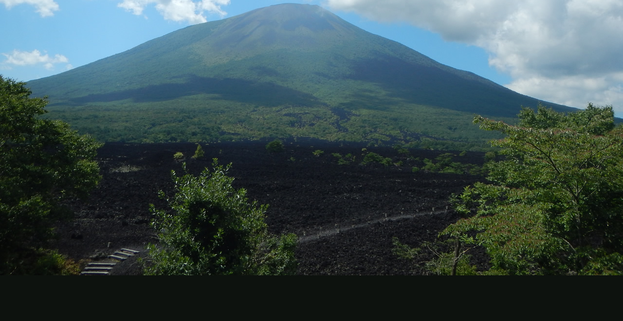
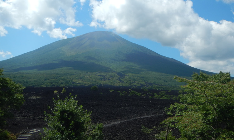
Yakehashiri Lava Flow and Mount Iwate
-
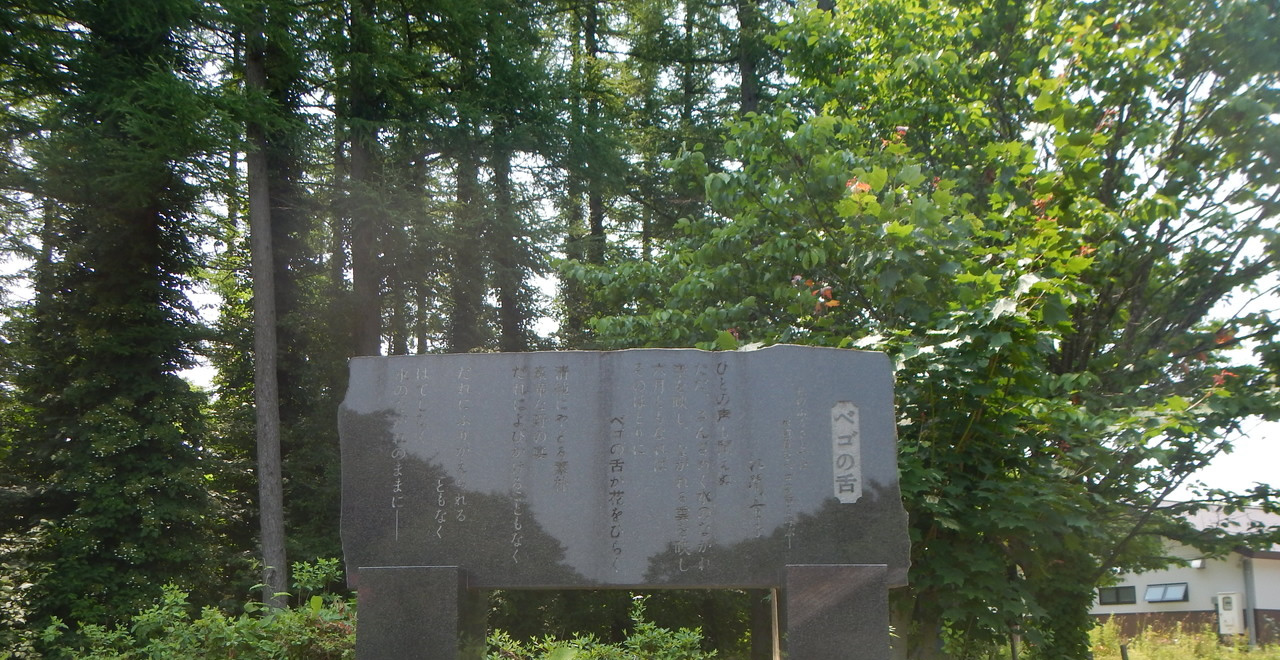
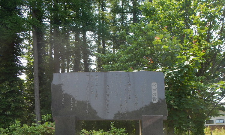
Poetry Monument
-
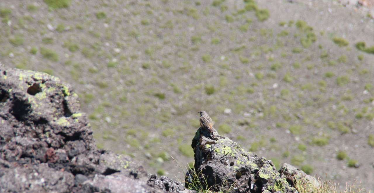
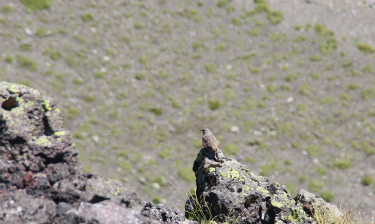
Alpine accentor
-
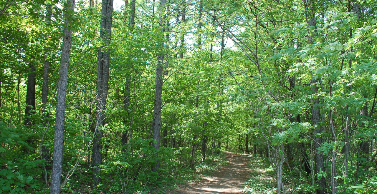
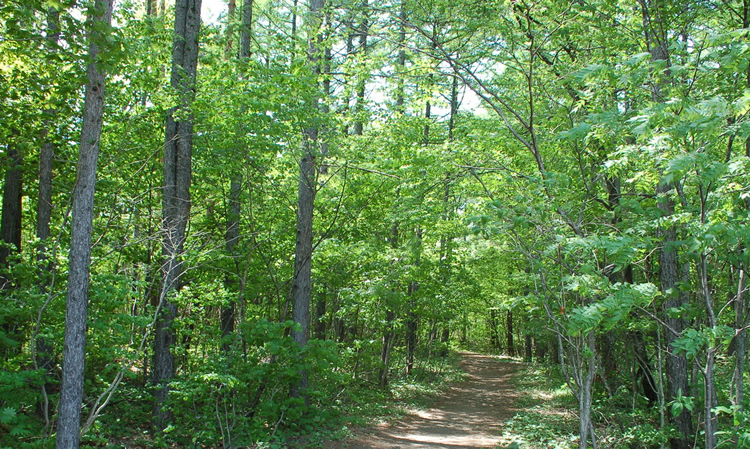
Mountain trail entrance
-
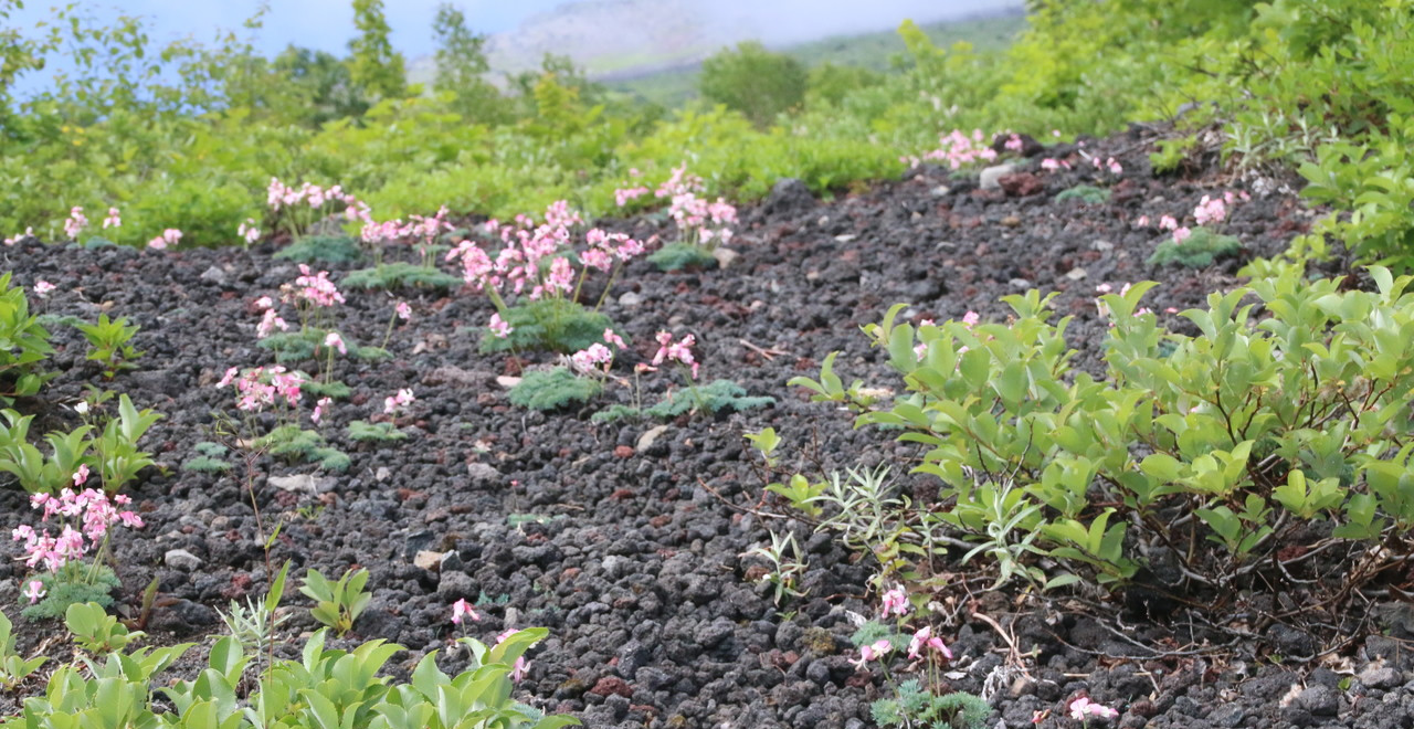
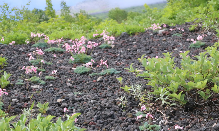
Komakusa habitats
Yakehashiri Recreation Forest
241.13ha
Elevation Average : 500―600m / Highest : 850m
Enjoy the contrast between the lava flow and the four seasons at the foot of Mount Iwate
Enjoy the contrast between the lava flow and the four seasons at the foot of Mount Iwate
- Newest information
- Area
- Activities
- Overview
- Latest Information
- Usage Guide
- Facility
- Map
- Address
- Access
(Distances and times are
provided as a guide only) - Management office
contact details - Information on Other Local
Tourist Attractions - Official Tourist Information
- Recreation Forest
Management Committee - Supporters
- Other
- Newest information
- Gathering information in advance is important to safely enjoy forest recreation that brings you closer to nature.
・CHECK
・When you go out, please check local tourist and related information and gather information on road closures, weather conditions, etc.
- Area
- Tohoku
- Activities
- Flower-viewing Autumn leaf viewing Birdwatching Picnics (lawn area/park) Star-Watching-Observatory (Outside the forest) Hot Spring(Outside the forest)
- Overview
-
- Geographical/topographical features
- Covering an area of 149.63ha, Yakehashiri Lava Flow is about 3-4 km long and approximately 1-1.5 km wide at its broadest points
- Historical/cultural features
- Yakehashiri Lava Flow was formed when lava discharged by the eruption of Mount Iwate in the 1700s solidified. It has been preserved in its natural state through to the present day and was designated as a special natural monument by the government in 1952. In 1957, it was designated as a special protection zone of Towada-Hachimantai National Park.
- Climate, flora and fauna
- Most of Yakehashiri Lava Flow is occupied by bryophytes such as shimofurigoke, woolly fringemoss (Racomitrium lanuginosum) and haiirokigoke, Vesuvius snow lichen (Stereocaulon vesuvianum), along with a variety of different lichens (composite organisms arising from a symbiotic relationship between fungi and algae). The restoration of vegetation is a slow process, so the transition underway can still be seen even now.
The gravel zone in the upper part of the remains of the Yakehashiri Lava Flow’s first fumarole (Elevation 1,220m) is one of Japan’s largest komakusa (Dicentra peregrina) habitats, so pretty, peach-colored flowers can be seen blooming along the mountain trails in early summer. - Attractions
- A nature trail about 2 km long passes through the lava flow and the surrounding area, enabling visitors to get a close-up view of the remarkable dark brown soil and the 2,038-meter-tall Mount Iwate. The recreation forest, Yakehashiri Lava Flow, and the Mount Iwate Yakehashiri trailhead are all within a 100-meter radius of the free car park, while nearby Iwate Yakehashiri International Exchange Village offers a hot spring, restaurant, and campsite. Thus, visitors can fully enjoy the great outdoors at the foot of Mount Iwate with all five senses.
- Other
- This forest is next to Towada-Hachimantai National park. Let’s visit and fully enjoy National Parks as well.
National Parks of Japan -Stories to Experience-
URL:https://www.env.go.jp/en/nature/nps/park/towada/index.html
- Latest Information
-
- Events
- (1) Yakehashiri Lava Flow Festival and Classic Car Meet in Hachimantai
Classic Car Meet: This is a big gathering of classic cars from across Japan!
As well as being a chance for owners who share a love of classic cars to get together, it offers members of the public the opportunity to chat with owners.
Date: It is generally held on the third Sunday in June. If it clashes with another event, it takes place on an earlier or later Sunday.
Venue: Iwate Yakehashiri International Exchange Village
(2) Iwate Yakehashiri Marathon
Date: It is generally held on the first Sunday in July. July 1 marks the beginning of the mountaineering season on Mount Iwate, so if there is a clash, this event is held on the second Sunday in July. Venue: Iwate Yakehashiri International Exchange Village and its surrounding area
- Usage Guide
-
- Entrance fee
- Free
- Opening times
- Open all year
- Accommodation options
- Ikoinomura Iwate at Iwatesan Yakehashiri Onsen is 15 minutes by car from the entrance to the Recreation Forest
The campsite in Iwate Yakehashiri International Exchange Village is 5 minutes on foot from the entrance to the Recreation Forest
- Facility
- Toilets and drinking fountains Walking trail Car park Observation platform Shop (Outside the forest) Restaurant (Outside the forest) Campsite and/or cabins (Outside the forest)(charge applies) Cultural Property (nationally designated) (Signs in English, etc.) Accommodation facilities (Hotels / Japanese inns)(Outside the forest)
- Map
- Address
- Hirakasa, Hachimantai City, Iwate Prefecture
- Access
(Distances and times are provided as a guide only) -
- By public transport
-
<Access from nearest railway station / bus stop>
- ・15 minutes by taxi from Obuke Station on the JR Hanawa Line
<Access from major transport hubs to nearest railway station / bus stop>- ・Morioka Station (Iwate Galaxy Railway: 25 minutes) → change at Koma Station (JR Hanawa Line: 15 minutes) → Obuke Station
- By car
-
<Access>
- ・Tohoku Expressway Nishine IC → Route 282 → Pref. Route 233 (10 km)
- ・Tohoku Expressway Nishine IC → Route 282 → Mizusawa-sen Municipal Road (6 km)
(*Mizusawa-sen Municipal Road is closed to traffic in winter (an alternative route is available))
<Car parking capacity / parking charges>Space for about 17 vehicles in the asphalt car park and around 30 in the gravel car park Free of charge
- Nearby tourism facilities
-
- ・5 minutes on foot from Iwate Yakehashiri International Exchange Village to the entrance to the Recreation Forest
- Management office contact details
-
Iwate-hokubu District Forest Office
- Information on Other Local Tourist Attractions
-
Iwate Yakehashiri International Exchange Village [External link]
- Official Tourist Information
-
Hachimantai City Tourism Association [External link]
- Recreation Forest Management Committee
-
Committee name and contact details:Tel: 0195-74-2111
Hachimantai Regional General Forest Recreation Area Management Committee
(Within the Commerce, Industry, and Tourism Division, Hachimantai Municipal Office)
FAX: 0195-74-2102
- Supporters
- ー
- Other
- ー
PDF形式のファイルをご覧いただく場合には、Adobe Readerが必要です。
Adobe Readerをお持ちでない方は、バナーのリンク先からダウンロードしてください。
![]()