


-
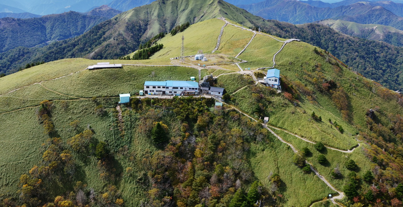
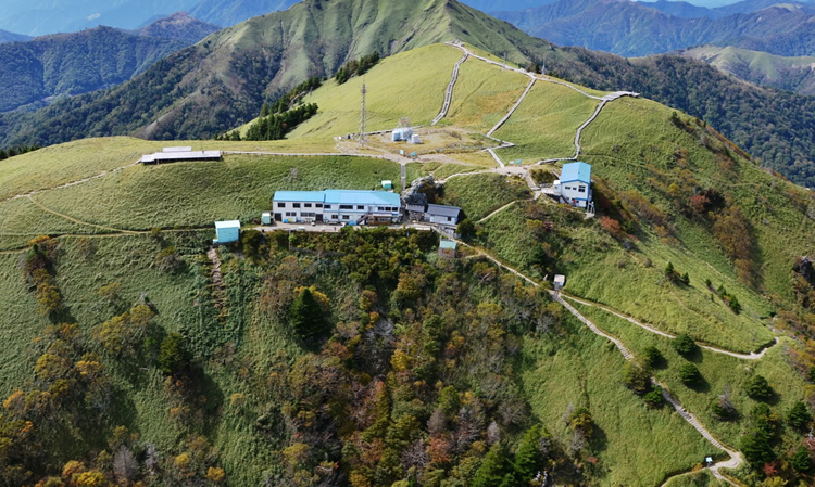
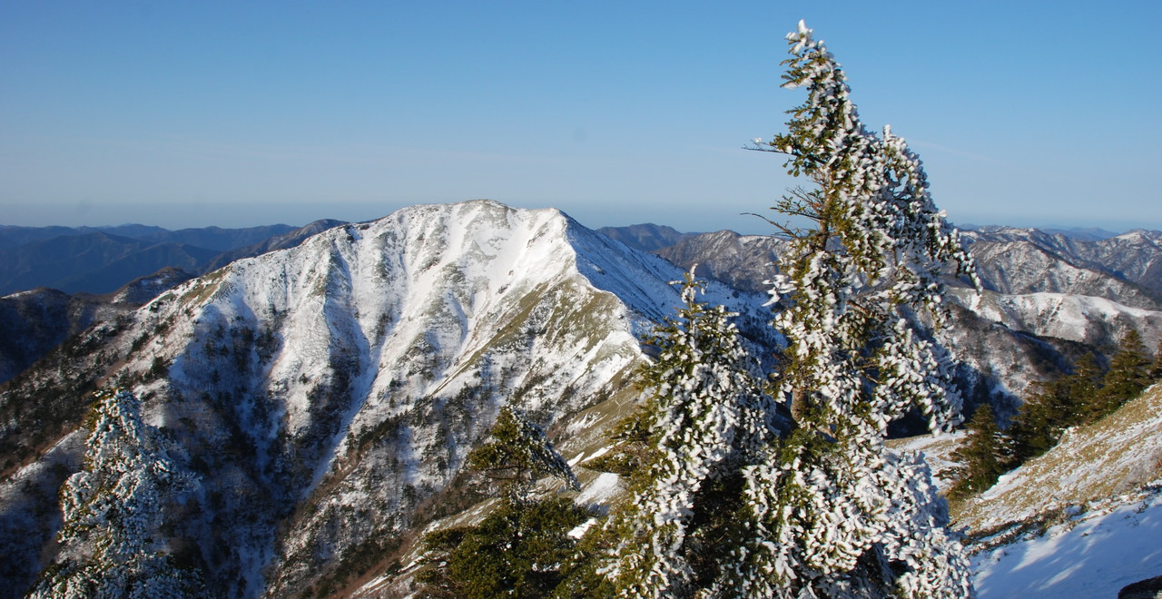
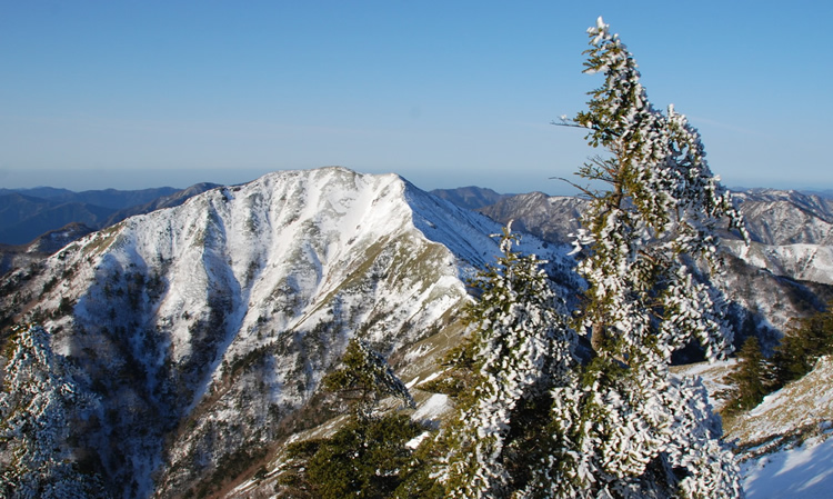
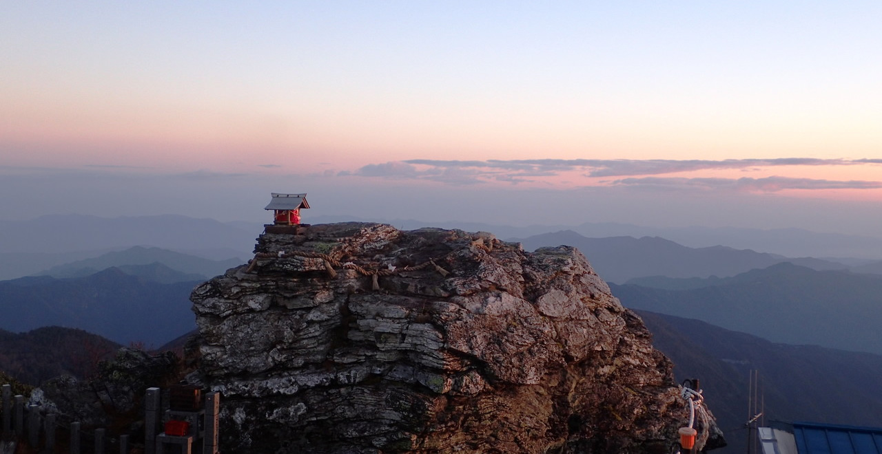
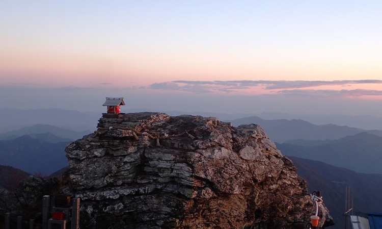
Summit of Mt. Tsurugi
-
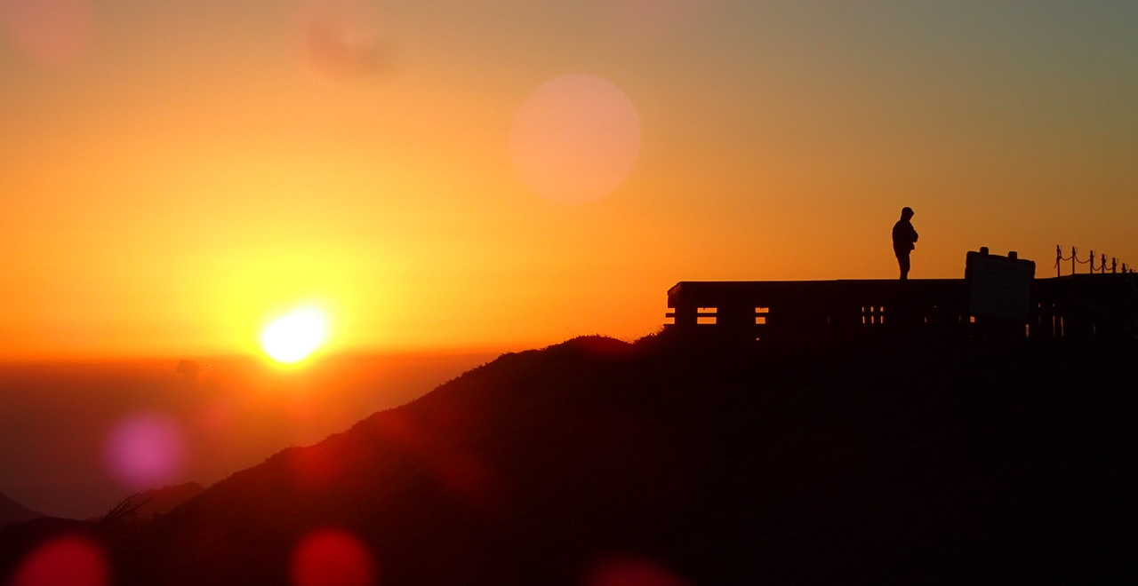
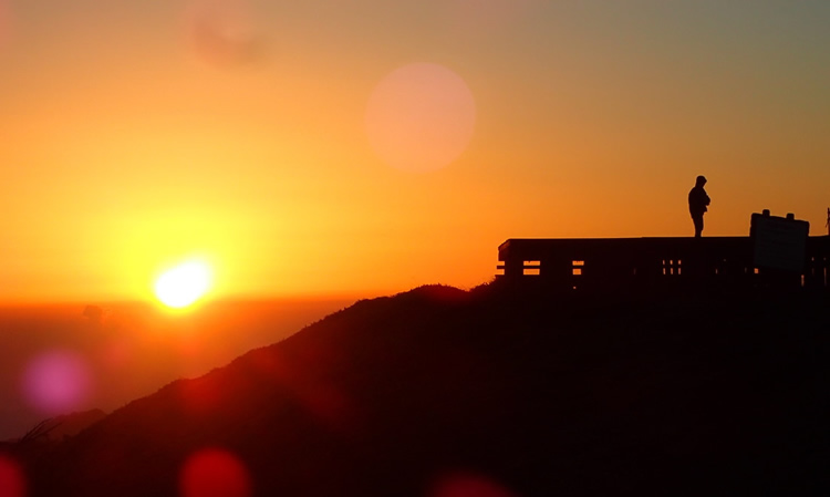
Early-morning Sunlight
-
Mt. Tsurugi with snow
-
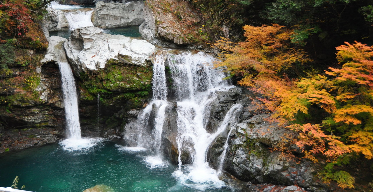
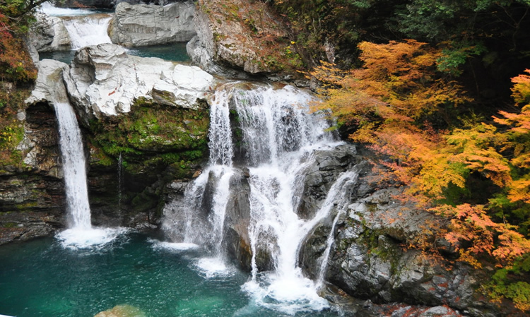
Otodoro-no-taki falls
-
Sunrise color
Tsurugisan Recreation Forest
1246.08ha
Elevation Highest : 1,955m (Mount Tsurugi's Summit)
Vivid natural beauty in all four seasons
The home of sacred Mount Tsurugi and little-explored scenic gems
Vivid natural beauty in all four seasons
The home of sacred Mount Tsurugi and little-explored scenic gems
- Newest information
- Area
- Activities
- Overview
- Latest Information
- Usage Guide
- Facility
- Map
- Address
- Access
(Distances and times are
provided as a guide only) - Management office
contact details - Information on Other Local
Tourist Attractions - Official Tourist Information
- Recreation Forest
Management Committee - Supporters
- Other
- Newest information
- Gathering information in advance is important to safely enjoy forest recreation that brings you closer to nature.
・CHECK
・When you go out, please check local tourist and related information and gather information on road closures, weather conditions, etc.
- Video
 Drone Footage
- Area
- Shikoku
- Activities
- Flower-viewing Autumn leaf viewingMountain climbing (Includes surrounding area)
- Overview
-
- Geographical/topographical features
- Mount Tsurugi is the second highest peak in western Japan after Mount Ishizuchi in Ehime Prefecture, with an elevation of 1,955 m. Mount Tsurugi has been chosen as one of the 100 Famous Japanese Mountains. In addition, the forest at its foot was selected by the Forestry Agency for inclusion in its Top 100 Water Resource Forests, as a forest fed by the water resources of Mount Tsurugi, while the sacred spring of Mount Tsurugi, near the summit, was chosen by the Ministry of the Environment as one of its Selected 100 Exquisite and Well Conserved Waters.
- Historical/cultural features
- Mount Tsurugi has been famed as an object of veneration since ancient times. On its northern slopes, close to the summit, is a spot called a “gyoba,” a place used for ascetic practices, which is accessible only with difficulty. A number of shrines can be found on this mountain, including Tsurugi Shrine, the main shrine; Otsurugi Shrine, which enshrines a huge rock considered sacred; and Hozoseki Shrine, which is believed to enshrine the sacred sword of Emperor Antoku, whose name lives on in the tragic tale of the Genpei War(1180–1185) . The word “tsurugi” itself means “sword” and there are a number of theories about the origins of the mountain’s name. Some say that it refers to the sacred sword of Emperor Antoku; some, that it was so named because of the mountain’s sword-like shape, formed by the erosion of limestone; and some, that it is connected to Crane Rock and Turtle Rock, two rocks near the summit, as the characters for crane and turtle can be pronounced “tsuruki” when put together. There is one other legend about Emperor Antoku here. The legend has it that, while ascending Mount Tsurugi to place the sacred sword at the summit, Emperor Antoku noticed that his attendant was respectfully carrying the sword without wiping the sweat from his brow. “Katanakake Pine”, standing today along the walking trail from Nishijima station of chair lift to the “gyoba” is said to be the pine on which Emperor Antoku suggested hanging the sword and invited his servant to rest.
- Climate, flora and fauna
- This natural forest mainly consists of broad-leaved trees, including buna, Japanese beech (Fagus crenata Blume); oak (Quercus); mizunara, Japanese oak mizu-nara (Quercus crispula Blume); and maple (Acer), interspersed with momi, fir (Abies firma) and tsuga, Japanese hemlock (Tsuga sieboldii). The majority of the Recreation Forest is old-growth forest, with trees in excess of 100 years old. Alpine plants and shrubs such as shakunage (Rhododendron subg. Hymenanthes) and tsutsuji (Rhododendron subsect. Tsutsusi) are widely distributed throughout the forest’s substratum. The forest provides a habitat for approximately 1,200 varieties of plant, about 90 bird species, around 50 mammalian species, and roughly 1,300 insect species.
- Attractions
- Mountain trails have been laid and the route from the northern side is also served by a chair lift from Minokoshi to Nishijima, from where the summit can be reached in just an hour, making it a climb that many people can enjoy. There is also a southern route for the physically fit that climbs from the Mount Tsurugi Super Forest Road (unpaved), allowing climbers to enjoy mountain climbing according to their physical fitness level.
The forest presents different facets of its natural beauty in every season: young leaves in spring, a riot of flowers and trees in bloom from early through late summer, and the flaming scarlet and gold hues of the leaves in autumn.
Visitors descending from Minokoshi toward Iya can view Iya's kazura-bashi vine bridges, which have been designated as an Important Tangible Folk Cultural Property by both the national and the prefectural governments.
The Miyoshi Geopark, which was designated in 2024, is characterized by environmental conservation around Mount Tsurugi and the lifestyles of people facing nature, such as the kazura-bashi vine bridges, and activities such as education and disaster prevention are being promoted.
- Latest Information
-
- Events
- Late April Start of the mountaineering season , June–July Mount Tsurugi Summer Festival (grand festival) , Early October Mount Tsurugi Autumn Leaves Festival
- Warnings
- ・Please note that ticks are particularly present in this area between April and September, so particular caution is required. Please wear clothes that cover up your skin. Insect repellent is also effective.
・Mountain trails may be closed due to landslides, etc. following torrential rain or when snow is melting.
・Tree guards have been installed to prevent damage by deer or other creatures. Please do not remove these guards.
- Usage Guide
-
- Entrance fee
- Entry is free of charge
For further details about the Mount Tsurugi Chair Lift, please contact Mount Tsurugi Tourist Chair Lift Co., Ltd. (Tel・FAX: 0883-67-5277). - Opening seasons and hours
- Open all year
* Operation hours by staff: Tsurugisan Chojo Hutte (privately run) April – End-November (full-time) - Accommodation options
- There are mountain huts at the summit of Mount Tsurugi and accommodation facilities near the trailhead (in the Minokoshi area). Please note that these are not open during winter.
There are also lodgings at the foot of Mount Tsurugi, at Iya and Oboke, among others.
- Facility
- Toilets and drinking fountains Walking trail Parking lot Observation platform Vending machine Shop Restaurant Campsite and/or cabins Specimen forest/Botanic garden/Museum(No foreign language support available) Cultural Property (nationally designated) (Outside the forest) Accommodation facilities (Hotels/Japanese inns)
- Map
- Address
- Minokoshi Higashiiyasugeoi, Miyoshi-shi, Tokushima Prefecture
- Access
(Distances and times are provided as a guide only) -
- By public transport
-
<Access from nearest railway station / bus stop>
- ・Special buses run between the nearest stations and Mount Tsurugi during high season only. For details of how to get there, please contact the relevant municipality.
<Access from major transport hubs to nearest railway station / bus stop>- ・Tokushima Station (Tokushima Line: about 1 hour 10 minutes) → Awa-Ikeda Station (Dosan Line: about 20 minutes) → Oboke Station (Miyoshi City)
- ・Tokushima Station (Tokushima Line: about 50 minutes) → Sadamitsu Station (Tsurugi-cho)
- ・Tokushima Station (Tokushima Line: about 40 minutes) → Anabuki Station (Mima City)
- By car
-
<Access>
- ・Ikawa-Ikeda IC → Route 192 → Route 438 (about 66 km to Minokoshi)
- ・Mima IC → Route 438 (about 43 km to Minokoshi)
- ・Wakimachi IC → Route 192 → Route 438 (about 50 km to Minokoshi)
<Car parking capacity / parking charges>・Tsurugisan Minokoshi No. 1 Parking Lot: Space for about 120 vehicles No parking fees
・Tsurugisan Minokoshi No. 2 Parking Lot: Space for about 40 vehicles No parking fees - Nearby tourist facilities
-
- ・One hour by car from the kazura-bashi vine bridges to the Mount Tsurugi Chair Lift.
- * The lift can be used to get part of the way up Mount Tsurugi from the foot of the mountain, where Tsurugisan Minokoshi Parking Lot is located. There are three trails leading to the summit from the point where the chair lift ends.
- Management office contact details
-
Tokushima District Forest OfficeTEL : 088-637-1230
https://www.rinya.maff.go.jp/shikoku/tokusima/
- Information on Other Local Tourist Attractions
-
Miyoshi City [External link]Mima City [External link]Tsurugi-cho [External link]Naka-cho [External link]
- Official Tourist Information
-
Tsurugisan Tourism Promotion Council [External link]
- Recreation Forest Management Committee
-
Tsurugisan Recreation Forest Protection and Management Committee contact details(within the Smart Forestry Division, Agriculture, Forestry, and Fisheries Department, Tokushima Prefectural Office, 1-1 Bandai-cho, Tokushima-shi, Tokushima Prefecture Tel:088-621-2458 FAX:088-621-2861)
- Supporters
- ー
- Other
- ー
PDF形式のファイルをご覧いただく場合には、Adobe Readerが必要です。
Adobe Readerをお持ちでない方は、バナーのリンク先からダウンロードしてください。
![]()