


-
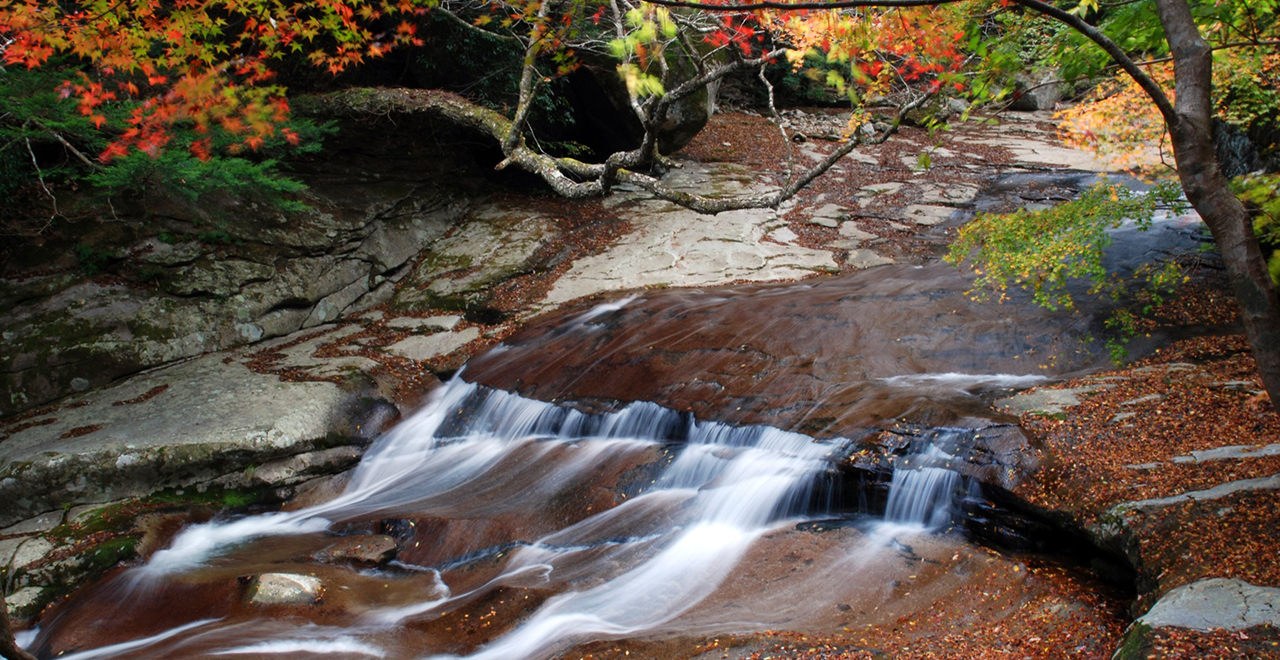
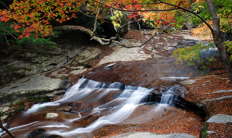
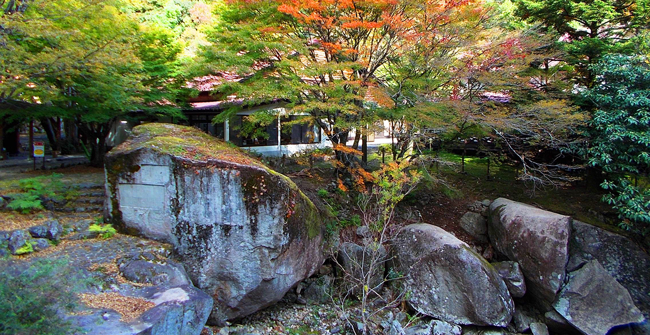
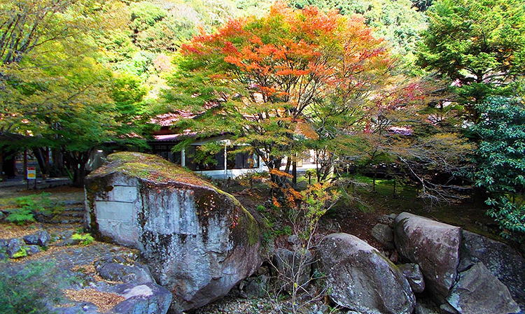
Nametoko in autumn colors
-
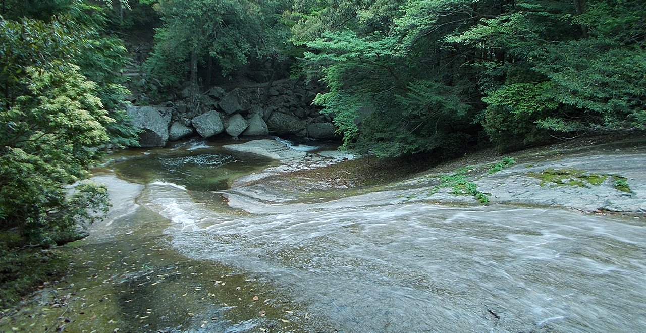
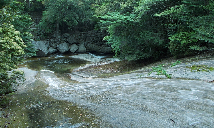
Smooth river bed
-
Natural stone monument
-
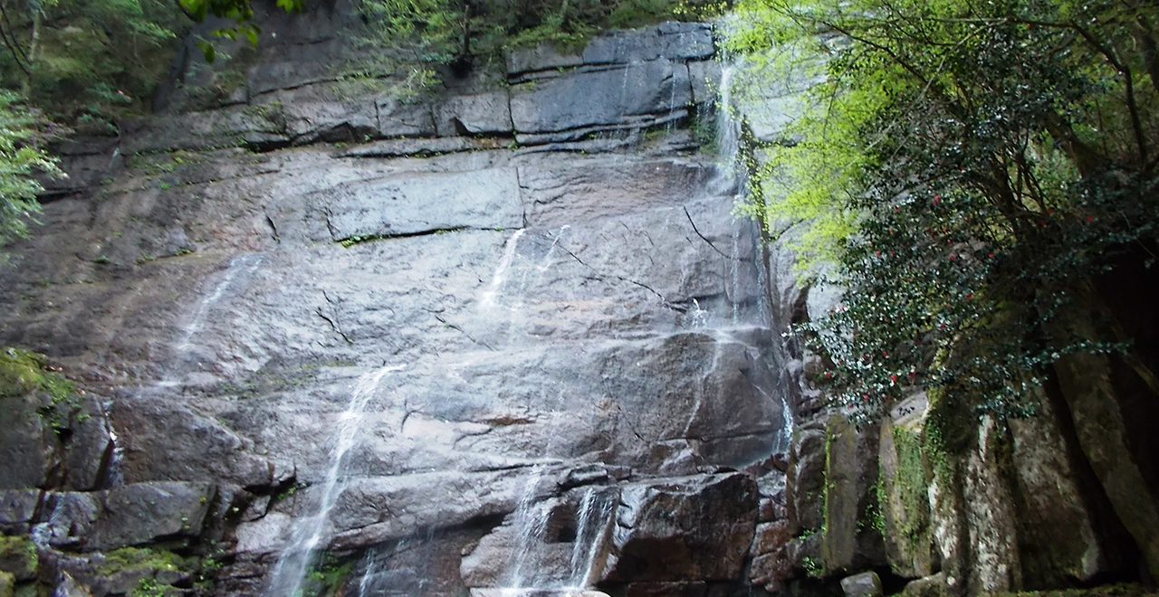
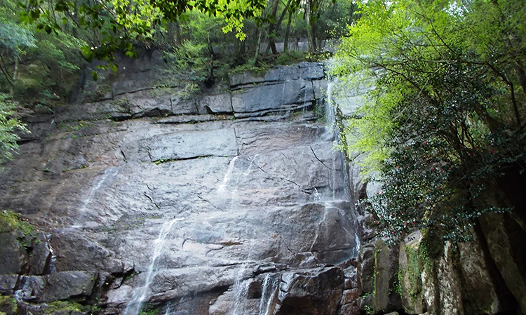
Okura Falls in the with bright green new foliage
-
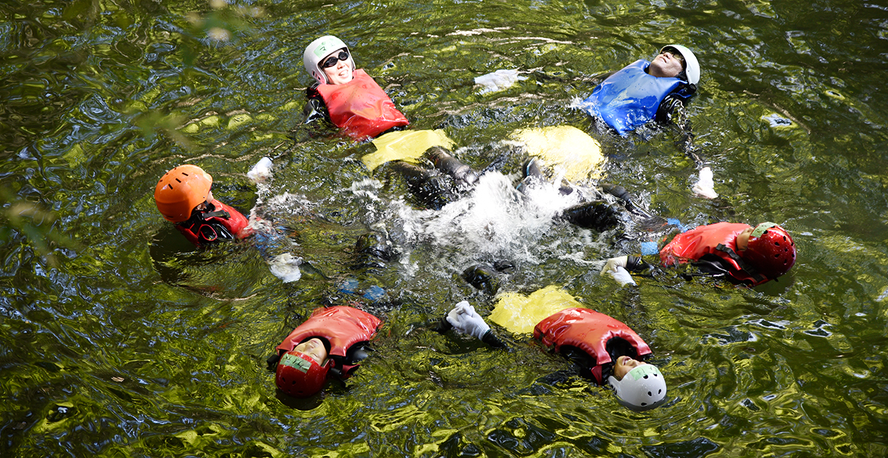
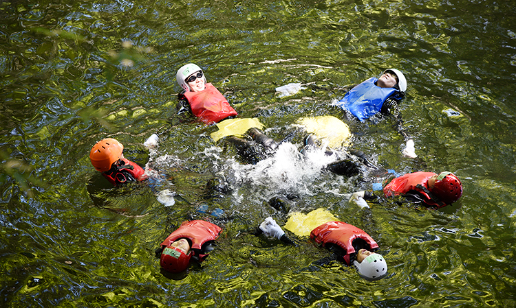
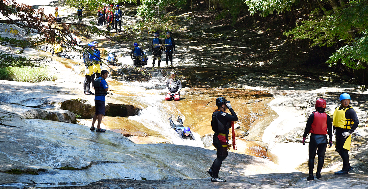
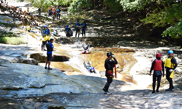
Fully enjoy Nametoko by canyoning
-
Exciting canyoning
-
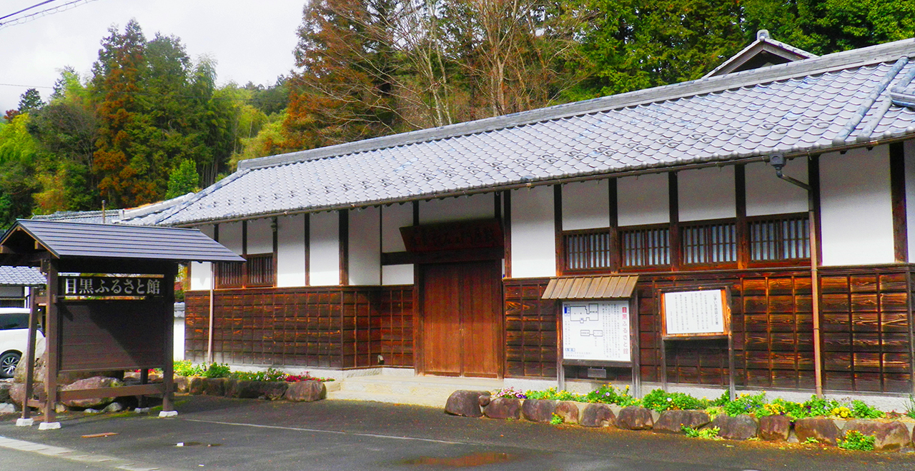
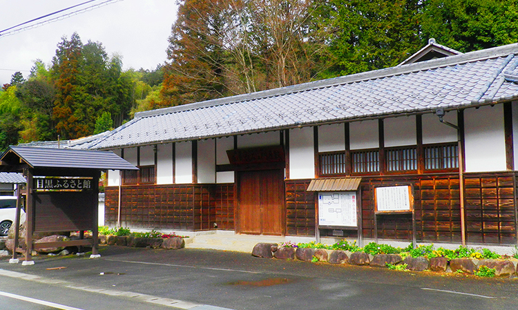
Meguro Furusatokan
-
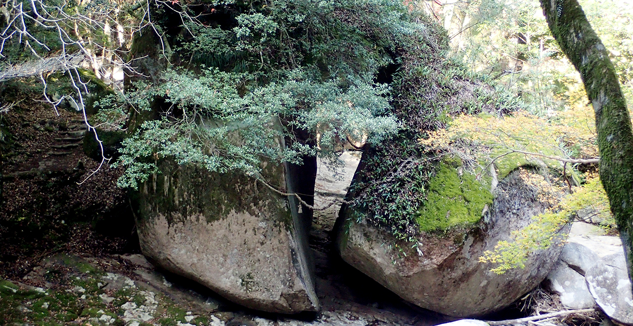
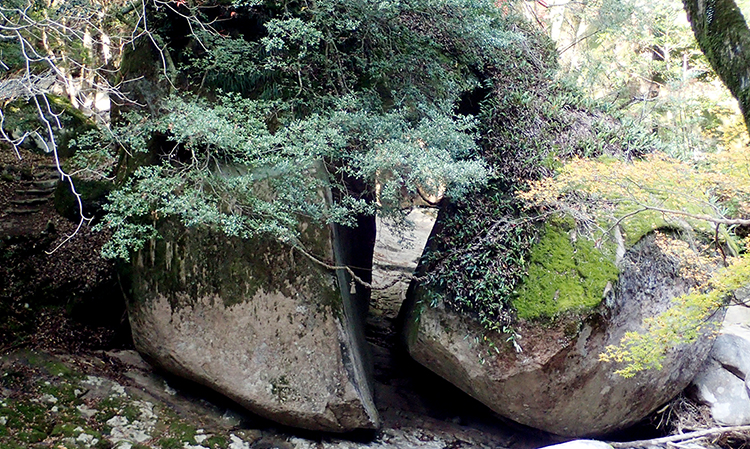
Torii Rock
Nametoko Recreation Forest
1,232.83ha
Elevation Lowest : 460m / Average : 460–1,229m / Highest : 1,229m
Mori no Kuni (Land of Forest) Nametoko ― Forest for Activities and Learning
Mori no Kuni (Land of Forest) Nametoko ― Forest for Activities and Learning
- Newest information
- Area
- Activities
- Overview
- Latest Information
- Usage Guide
- Facility
- Map
- Address
- Access
(Distances and times are
provided as a guide only) - Management office
contact details - Information on Other Local
Tourist Attractions - Official Tourist Information
- Recreation Forest
Management Committee - Supporters
- Other
- Newest information
- Gathering information in advance is important to safely enjoy forest recreation that brings you closer to nature.
・CHECK
・When you go out, please check local tourist and related information and gather information on road closures, weather conditions, etc.
- Area
- Shikoku
- Activities
- Flower-viewing (species: Yamazakura (Japanese mountain cherry (Cerasus jamasakura), Shakunage (Rhododendron subg. Hymenanthes)) (Includes surrounding area) Autumn leaf viewing (Includes surrounding area) Waterfall viewing (Includes surrounding area) : Yukiwa Falls Birdwatching (Includes surrounding area) Picnics (lawn area/park) Mountain climbing (Includes surrounding area) Paddling / fishing / boating (pond / lake / river) (Includes surrounding area) (Payment required for use of facilities and participation in activities) Canyoning (River trekking) (Includes surrounding area) (Payment required for use of facilities and participation in activities) Bicycle rental (Outside the forest) Guided tours : Nametoko Outdoor Center (Payment required) Hot Spring (Includes surrounding area) (Payment required) Medium-long distance Trail (Includes surrounding area) : A part of a trekking route of the Onigajo Mountains Shrine / Temple visit (Outside the forest)
- Overview
-
- Geographical/topographical features
- The Nametoko Recreation Forest is located near the border between southwestern Ehime Prefecture and western Kochi Prefecture. It consists of two areas. The Nametoko area encompasses Mt. Takatsuki (1,229 m) as the highest peak and is surrounded by Mt. Kakko and Mt. Furuonigajo in the east, Mt. Keyama which further extends to Mt. Nakadake in the west, and Mt. Okubo, Mt. Yazura, Mt. Yokonomori, and Mt. Oiwai in the south. Meanwhile, the Narukawa area consists of a belt of ridges running from Mt.Takatsuki toward the west and a belt of ridges stretching from Umeganaru Pass toward the north along a stream. Both areas offer beautiful scenery of the gorges named after the respective areas, and are highly reputed for the splendor of the dense natural forest and the clear water and the smooth river bed of a stream winding through the forest. The stream brings a cool breeze in summer and reflects colored leaves in autumn, and entertains visitors together with groups of wild monkeys playing in the gorge. A hot spring wells in the Narukawa area, and this spring water is used at the Takatsuki Hot Spring.
- Historical/cultural features
- Mt. Sanbongui (1,226 m), which literally means a mountain of three posts, is a representative mountain on the south side of the Nametoko Gorge. The name derives from the fact that, during the feudal government period, posts that marked the boundaries between the Uwajima Domain, Iyo-Yoshida Domain, and Tosa Domain stood near the summit. In the downstream area, there is Meguro Furusatokan, a resource center exhibiting the "Meguro Mountain Model (Meguro Mountain Boundary Conflict) Produced in 1665," which is a wooden mountain model which was used as a material in a trial on a conflict over the mountain boundary between the Uwajima Domain and the Iyo-Yoshida Domain in the early Edo period in the 1660s, along with related old documents (Nationally designated important cultural properties). Near the Manen Bridge which serves as a gateway to the Nametoko Gorge, a huge, old natural stone monument stands to commemorate the opening of a road linking the Uwajima Domain and the Tosa Domain, reminding visitors of people traveling along the road in those times.
- Climate, flora and fauna
- The vegetation of this Recreation Forest mainly consists of temperate vegetation including Momi (fir (Abies firma)), Tsuga (Japanese hemlock (Tsuga sieboldii)), and Hinoki (Japanese cypress (Chamaecyparis obtuse)) up to the elevation of about 900 m, and warm-temperate vegetation such as Himeshara (tall stewartia (stewartia monadelpha)), maple (Acer), Mizunara (Japanese oak mizu-nara (Quercus crispula Blume)), and Buna (Japanese Beech (Fagus crenata Blume)) at higher elevations. As undergrowth in both vegetation class areas, subcanopy trees and shrubs such as Kuromoji (Lindera umbellata Thunb.), Asebi, Japanese pieris (Pieris japonica (Thunb.) D.Don ex G.Don), and Hisakaki (Eurya japonica) are found. The areas near the summit form an alpine zone where Miyakozasa (Sasa nipponica (Makino) Makino et Shibata) grows. Below that zone, Shakunage (Rhododendron subg. Hymenanthes) grows in clusters here and there, giving bloom to flowers in the mist and creating a fantastic sight. These natural forests are also habitats of diverse flora and fauna, including animals such as Nihon Zaru (Japanese macaque (Macaca fuscata)), Inoshishi (wild boar (Sus scrofa leucomystax)), and Nihonjika (shika deer (Cervus nippon)), fish such as Ishizuchi-Sansyouo (Hynobius hirosei Lantz, 1931) and trout, birds such as Yamadori (copper pheasant (Syrmaticus soemmerringii)) and Hototogisu (lesser cuckoo (Cuculus poliocephalus)), and various insects. Therefore, the Recreation Forest is also used as a nature exploration site.
- Attractions
- The Nametoko Gorge and the Narukawa Gorge, which are located inside the Ashizuri-Uwakai National Park, have abundant river water, and give a soft bright impression due to their white riverbeds of large and smooth granite rock.
The flow of the river by "Narukawa Gorge," a trailhead to Mt.Takatsuki, is calm, so that even small children can enjoy sliding on rocks and paddling in the water. Hot spring baths, lodges, and a campsite are also available there, so it is a place also fit for casual day camping. In addition, the natural forest on the mountain side has a large number of Yamazakura trees (Japanese mountain cherry (Cerasus jamasakura)), which offer a magnificent view in the cherry blooming season in spring, known as "Hitome Senbon Zakura" (a thousand cherry blossom trees in one view).
The Nametoko Gorge boasts abundant river water and is popular as one of Japan's top canyoning spots. The Yukiwa Falls (300 m long) where you can experience a 40 m dynamic waterfall sliding is a scenic spot that has been selected as one of Japan's 100 best waterfalls. The river offers both beautiful scenery and fun water activities. It is particularly impressive to appreciate the view of the gorge from inside the river. Walking trail strollers can also relax and enjoy the beauty of the gorge throughout the seasons by lying down on the riverbed at leisure or walking through the gorge under the sunshine filtered through foliage. If you book an overnight stay at the Reverside Lodge in the gorge, you can spend a superb time, surrounded by the murmur of the river in the early morning tranquility of the forest. Good walkers can walk on the walking trail along the gorge and up the mountain trail where the Nametoko Suigen no Mori that has been selected as one of the Top 100 Water Resource Forests extends wide and the walkers can feel themselves being wrapped around by trees.
Furthermore, if you head to Mt. Sanbongui from the trailhead at the place called "Shika no Col" (the dear col) along the Kuroson Super Forest Road, you can reach the summit in less than two hours. The course has been popular for the ability to easily enjoy the view of the forest of Buna (Japanese Beech (Fagus crenata Blume)) along the ridge and the Uwakai Sea.
- Latest Information
-
- Major events
- ・Narukawa Gorge Cherry Festival (early April)
・Nametoko Gorge Mountain Opening Festival (late April)
・Nametoko Summer Festival (mid-July – mid-August)
・Matsuno Shimanto Bike Race (autumn) - Warnings (Flora and fauna)
- Monkeys, wild boars, and deer: Do not go near them.
Ticks: Please note that ticks are present in bamboo grass areas. Wearing long sleeves and long trousers is essential. - Warnings (Dangerous areas)
- ・There is a risk of a flash flood near a stream. When a heavy rain falls, move away from the stream and descend the mountain promptly.
After a heavy rain, do not enter the mountain due to the risk of falling branches. Do not walk over a bridge when the river has swollen.
・Although the area has a temperate climate, it has a lot of snowfall during winter, so equipment for winter mountains is needed.
- Usage Guide
-
- Entrance fee
- Free of charge
- Opening seasons and hours
- Accessible 24 hours a day
- Staffed facilities such as administration buildings
- ・Narukawa Keikoku Kyuyo Center Closed on the 2nd and 4th Tuesdays (excluding August), or the following day if it is a holiday; check-in: 4: 00 p.m., check-out: 10: 00 a.m.
・Nametoko Outdoor Center (operation on irregular basis) 9: 00 a.m. ― 4: 00 p.m. - Accommodation options
- [Inside the forest] Narukawa Keikoku Kyuyo Center, Takatsuki Hot Spring, Narukawa Lodge, Narukawa Gorge Campsite (only during summer), Reverside Lodge (Previously known as "Morinokuni Hotel"), Nametoko Campsite
[Outside the forest] Suehiro Inn (about 15 km / 30minutes)
- Facility
- Toilets Toilet (accessible) Footpath / walking trail / nature trail (Includes surrounding area) Parking lot Observation platform Visitor center (staffed only) Vending machine (Includes surrounding area) Shop (Includes surrounding area) Restaurant (Includes surrounding area) Campsite and/or cabins (Includes surrounding area) (Payment required for use of facilities and participation in activities) Free public wireless LAN (Wi-Fi) (Only inside facilities) Resource center (Outside the forest) (Payment required) Cultural Property (nationally designated) (Outside the forest) (Payment required) Accommodation facilities (Hotels/Japanese inns) (Includes surrounding area)
- Map
- Address
- Nametokoyama National Forest, Nogawa, Uwajima City, Ehime Prefecture / Naraokuyama National Forest, Nara, Kihoku Town, Kita-Uwa County, Ehime Prefecture
- Access
(Distances and times are provided as a guide only) -
- By public transport
-
<Access from nearest railway station / bus stop>
- [Narukawa Gorge] JR Matsuyama Station → (Yosan Line: about 60 minutes) → JR Uwajima Station → Uwajima-Ekimae bus stop → (Uwajima Bus: about 10 minutes) → Narukawa bus stop → (on foot: about 40 minutes) → Narukawa Keikoku Kyuyo Center
- [Nametoko Gorge] JR Matsuyama Station → (Yosan Line: about 90 minutes) → JR Uwajima Station (Yodo Line: about 50 minutes) → JR Matsumaru Station (taxi: about 30 minutes) → Reverside Lodge (Previously known as "Morinokuni Hotel")
- [Mt. Sanbongui, Mt.Onigajo] JR Matsuyama Station → (Yosan Line: about 90 minutes) → JR Uwajima Station (taxi: about 90 minutes) → Mt. Sanbongui trailhead (Shika no Col)
- By car
-
<Access>
- [Narukawa Gorge] Matsuyama IC → (Matsuyama Expressway) → Uwajima Asahi IC → public road → Narukawa Keikoku Kyuyo Center (about 100 km, about 90 minutes)
- [Nametoko Gorge] Matsuyama IC → (Matsuyama Expressway) → Mima IC → (Pref. Route 57 → Pref. Route 8 → Pref. Route 270*) → Reverside Lodge/Previously known as "Morinokuni Hotel" (about 110 km, about 120 minutes)
- * Pref. Route 317 which is sometimes indicated on the car navigation system is a narrow, rough road, so caution is required.
- [Mt. Sanbongui, Mt.Onigajo] Matsuyama IC → Uwajima Asahi IC → Route 320 → Kuroson Super Forest Road → Mt. Sanbongui trailhead (Shika no Col) (about 105 km, about 180 minutes)
<Car parking capacity / parking charges>Narukawa Gorge : free parking for about 40 vehicles
Nametoko Gorge : free parking for about 150 vehicles
Mt. Sanbongui trailhead : free parking for about 5 vehicles - Nearby tourist facilities
-
- Meguro Furusatokan: 11 minutes by car from the Nametoko Outdoor Center
- Management office contact details
-
Ehime District Forest OfficeTEL:089-924-0550
https://www.rinya.maff.go.jp/shikoku/ehime/
- Information on Other Local Tourist Attractions
-
Uwjima City [External link]Matsuno Town [External link]Kihoku Town [External link]Ainan Town [External link]
- Official Tourist Information
-
Ehime Prefecture official tourism website [Visit Ehime Japan] [External link]
- Recreation Forest Management Committee
-
Nametoko Recreation Forest, etc. Management Committee
(in the Hometown Creation Division, Matsuno Municipal Office)TEL:0895-42-1116
FAX:0895-42-1119
- Supporters
- ー
- Other
- ー
PDF形式のファイルをご覧いただく場合には、Adobe Readerが必要です。
Adobe Readerをお持ちでない方は、バナーのリンク先からダウンロードしてください。
![]()