


-
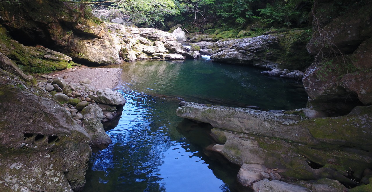
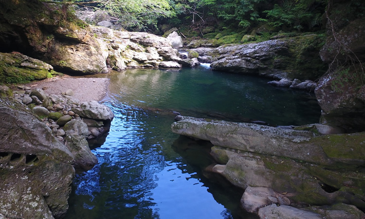
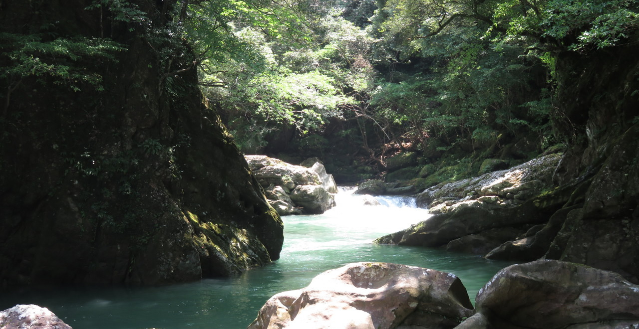
Hyotan-buchi
-
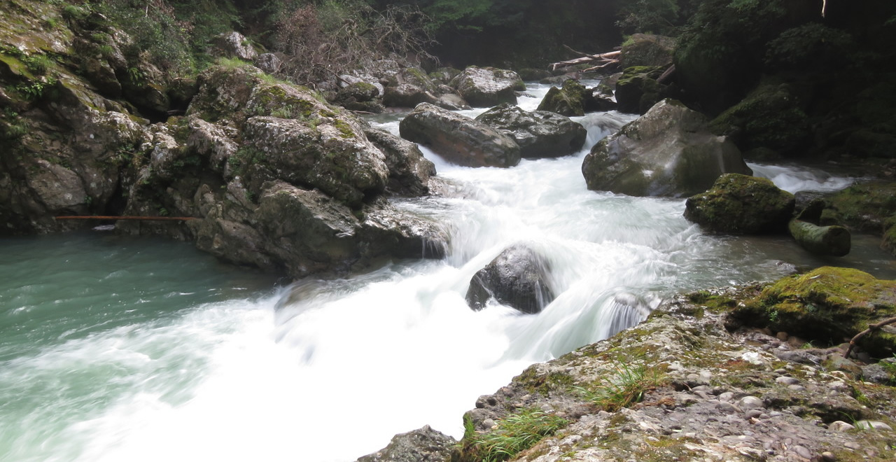
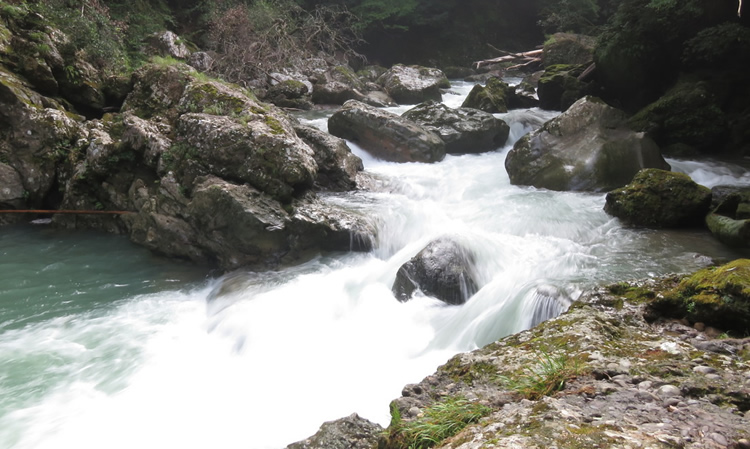
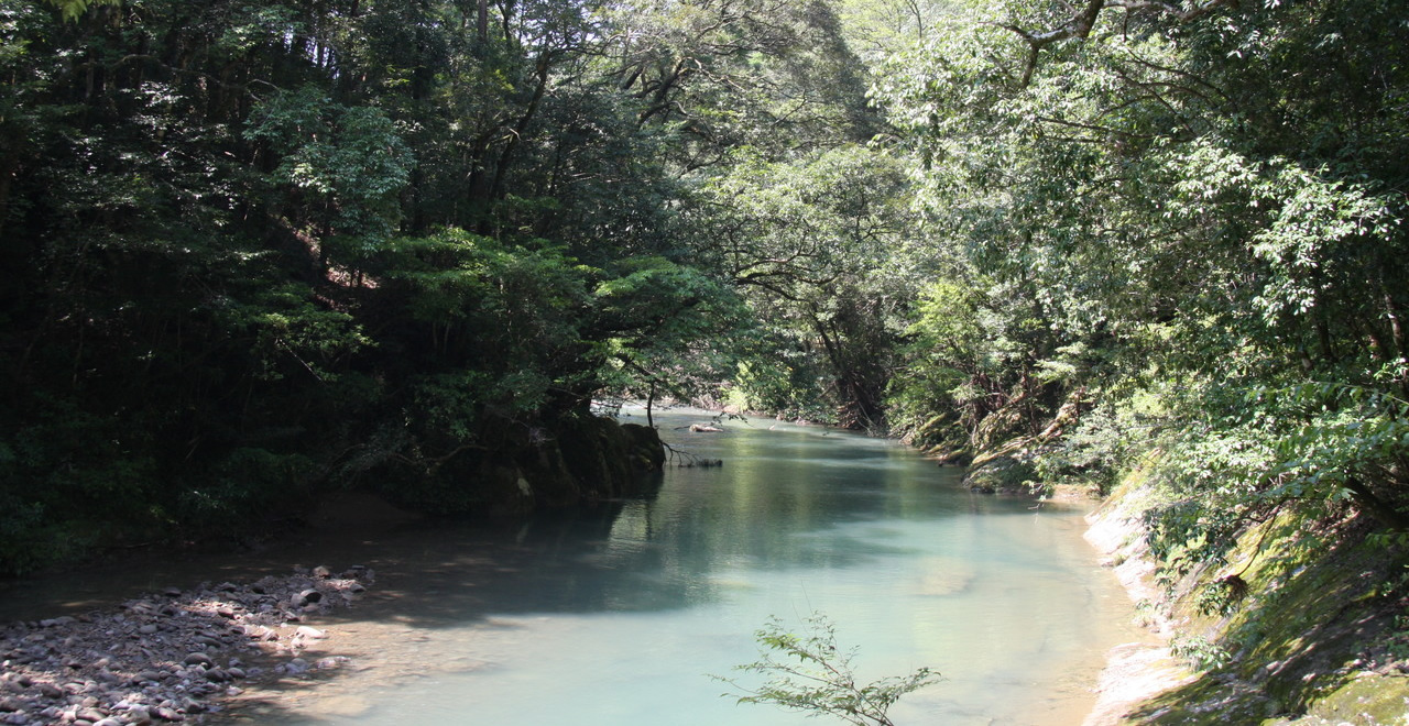
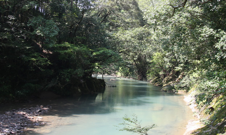
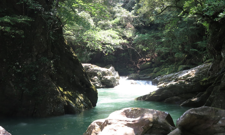
Kaeda Valley
-
Kaeda Valley
-
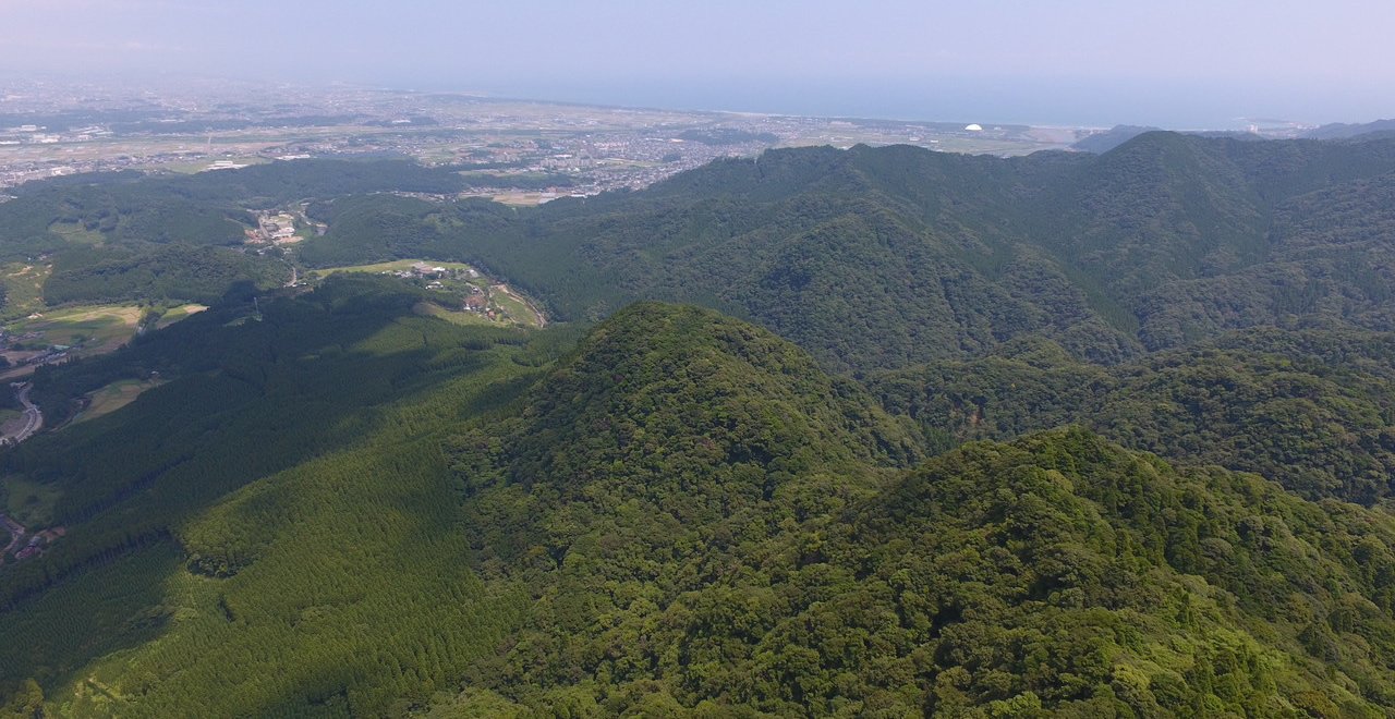
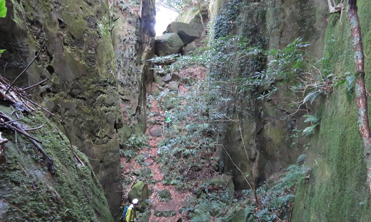
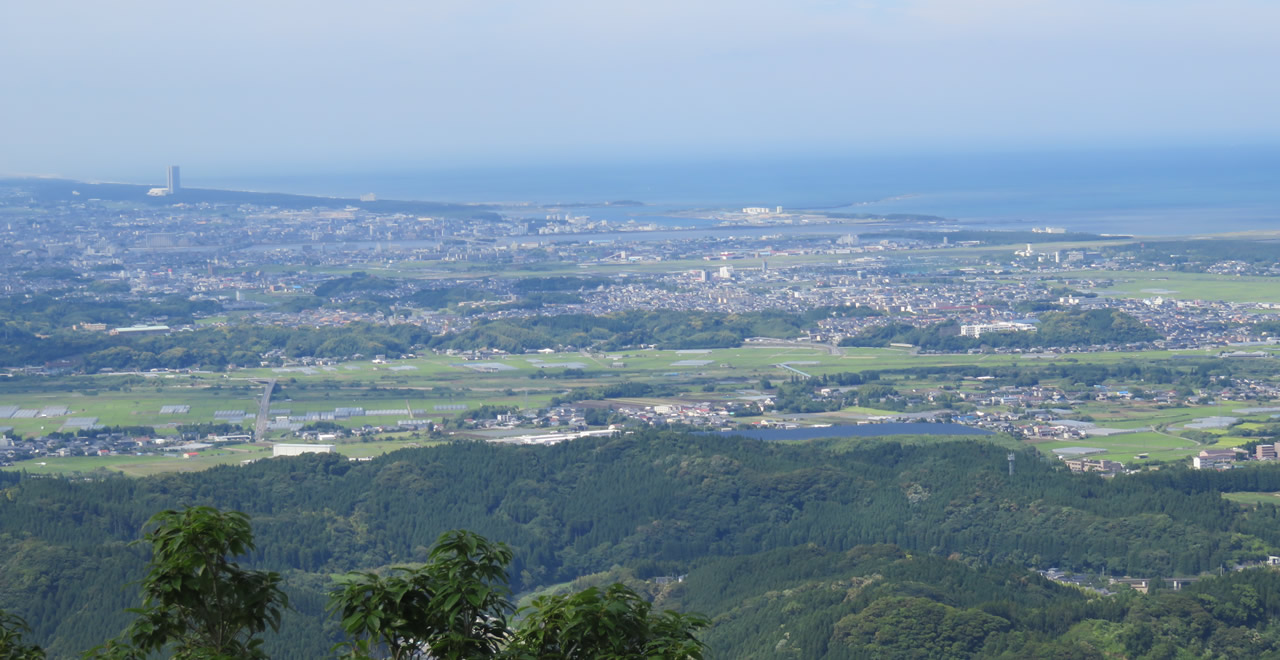
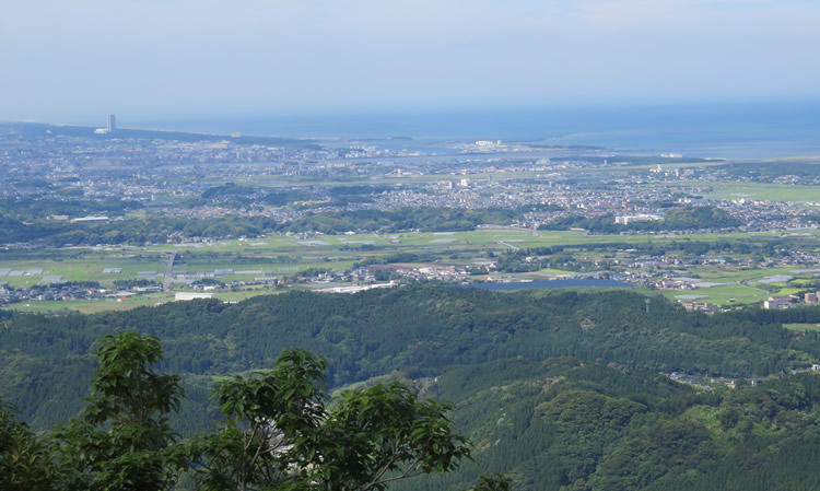
Panoramic views from Observation Platform
-
Hyotan-buchi
-
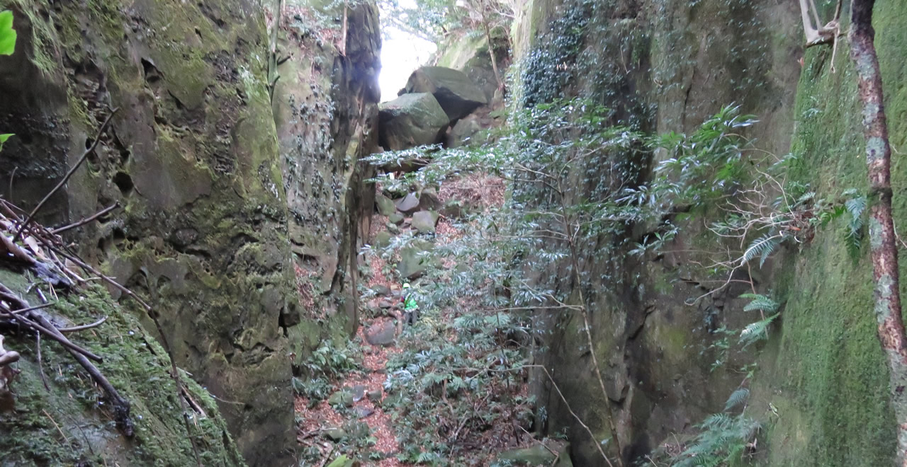
Karaike
-
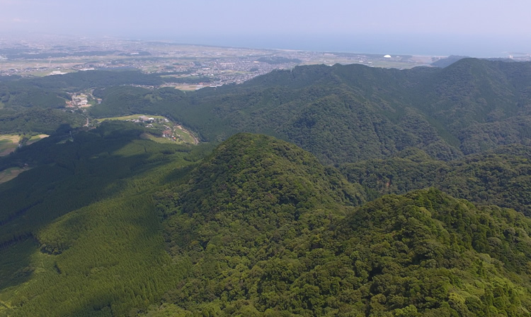
Panoramic views from Observation Platform
Miyazaki Recreation Forest
1444.07ha
Elevation Mainly 20–500m / Highest : 670m (Mt.Hanakiriyama summit)
Oddly shaped peaks and beautiful valleys carved out by natural erosion
Oddly shaped peaks and beautiful valleys carved out by natural erosion
- Newest information
- Area
- Activities
- Overview
- Latest Information
- Usage Guide
- Facility
- Map
- Address
- Access
(Distances and times are
provided as a guide only) - Management office
contact details - Information on Other Local
Tourist Attractions - Official Tourist Information
- Recreation Forest
Management Committee - Supporters
- Other
- Newest information
- Gathering information in advance is important to safely enjoy forest recreation that brings you closer to nature.
・CHECK
・When you go out, please check local tourist and related information and gather information on road closures, weather conditions, etc.
- Area
- Kyushu
- Activities
- Flower-viewing Autumn leaf viewing Waterfall viewing Birdwatching Picnics Areas for paddling/fishing Remains of Forest Railway Guided tours (reservation required)(No foreign languages spoken)
- Overview
-
- Geographical/topographical features
- This Recreation Forest encompasses the Boroishi and Tokuso mountains, along with the Kaeda Valley, which lies between them.
Geologically speaking, Mount Boroishi is made up of sandstone and conglomerate, with a particularly high proportion of the latter. As a result, the mountain has many lofty, strangely shaped rocks. The most distinctive of these include Tengu-iwa Rock (named for its resemblance to a goblin), Zo-no-hakaba (“Elephant's Graveyard,” a belt of massive stones), Karaike (a huge wall of rock), and Hari-no-mimi (“Ear of the Needle,” a cave). These unusual names rarely fail to delight visitors to this area. - Historical/cultural features
- From ancient times, Mount Boroishi was regarded as a sacred mountain by adherents of Japan's tradition of mountain worship. Sites where practitioners of Shugendo undertook ascetic practices and the remains thereof can be found throughout the area beyond Ubagatake Shrine (known affectionately to locals as Bira-no-gongen-sama), which is located on the western side of the Recreation Forest and is believed to have been founded in 1776. Interestingly, the sacred water drawn within the precincts of Ubagatake Shrine is called the Water of Kokonobira-no-gongen and, legend has it, will produce a bountiful harvest if sprinkled on fields and rice paddies. In 1969, Mount Boroishi was awarded the designation of National Natural Monuments, as a location where a virgin laurel forest still remains.
- Climate, flora and fauna
- This Recreation Forest mainly consists of natural stands of subtropical broad-leaved trees, mostly composed of laurels such as tsuburajii, Japanese chinquapin (Castanopsis cuspidata), live (evergreen) oaks, and tabunoki (Machilus thunbergii).
The forest's plant life includes kibananohototogisu (Tricyrtis flava Maxim.) and hyugagiboshi (Hosta kikutii var. kikutii). Among the animals that can be seen here are yamane, Japanese dormouse (Glirulus japonicus) and Kyushu musasabi, Japanese giant flying squirrel (Petaurista leucogenys), while bird species include koshijiroyamadori, Ijima copper pheasant (Phasianus soemmerringii ijimae); kiji, green pheasant (Phasianus versicolor); aogera, Japanese green woodpecker (Picus awokera); and akashobin, ruddy kingfisher (Halcyon coromanda). - Attractions
- Mountain climbing: Located about 30 minutes from the Shiozuru and Kotani trailheads, with Tengu-iwa Rock towering up behind it, Iwaya Shrine is venerated as the “Ear of the Needle Shrine,” due to a legend that it has the power to heal otherwise-incurable diseases of the ear. Further on can be found Karaike, a depression surrounded on all four sides by large rocks. Those who continue on toward the summit can enjoy a panoramic view of central Miyazaki City from the No. 2 Observation Platform if the weather is fine.
20 minutes southwest of the No. 2 Observation Platform is a mountain hut, with the summit of Mount Boroishi another 25 minutes from there, at an elevation of 509 m.
Valley: From the Maruno Parking Lot north of the Recreation Forest, the Kaeda Valley stretches for 9.4 km, ending close to Tsubakiyama Forest Park to the southwest of the forest. The valley has a diverse array of strangely shaped rocks formed by water erosion and its beauty has led to its being nicknamed the “Hyuga Line”.
Visitors can enjoy a round-trip walk from the Maruno Parking Lot, thanks to a footpath developed on what was once the forest railway in the days when forestry was at its height in this area. The path runs from Hyotan-buchi (a pool of clear, blue water with a mystical beauty, named for its resemblance to a gourd) and takes in Iodani (a valley named for the sulfur-rich cold mineral spring that bubbles up here), Amacha-no-Izumi (“Sweet Tea Spring”), Shibaseki (the remains of a dam built to transport felled logs downstream), Sei-no-tani (“Silent Valley”), and the Multi-purpose Plaza (formerly the Kaeda Campsite and still used as a place of rest and relaxation today).
From Kaichigo Bridge No.1, visitors can enjoy the footpath further and reach its end near Tsubakiyama Forest Park, or, mountain trail to the Hanakiriyama. - Other
- Since 2013, the Miyazaki Kagamizunomori Trail Run has been held in May each year, with around 150 people taking part.
- Latest Information
-
- Warnings
- ・The paths are highly treacherous underfoot in places, so please take adequate care while walking.
・There is a risk of flash flooding near mountain streams. Please keep your distance from mountain streams in the event of severe thunderstorms.
- Usage Guide
-
- Entrance fee
- Free of charge
- Opening seasons and hours
- Accessible throughout the year.
- Facility
- Toilets and drinking fountains Walking trail Parking lot Observation platform Vending machine Cultural Property (nationally designated)(Mount Boroishi Natural Monuments) Accommodation facilities (Hotels/Japanese inns)(In Miyazaki City, etc.)
- Map
- Address
- Kaichigo, Oaza Kagamizu, Miyazaki-shi, Miyazaki Prefecture
- Access
(Distances and times are provided as a guide only) -
- By public transport
-
<Access from nearest railway station / bus stop>
- ・JR Nichinan Line Kibana Station → A Coop Kibana Shop (5 minutes on foot) → Kibana Community Bus (12 minutes) → Miyazaki Recreation Forest : Mount Boroishi’s Shiozuru trailhead
- ・JR Nichinan Line Kibana Station → A Coop Kibana Shop (5 minutes on foot) → Kibana Community Bus (9 minutes) → Miyazaki Recreation Forest : Kaeda Valley
- By car
-
<Access>
- ・Miyazaki Station → Pref. Route 27 → Obi Kaido → Maruno Park (15 km / 36 minutes)
- ・Miyazaki Airport → by car via Pref. Route 27 (14 km / 30 minutes)
- ・JR Nichinan Line Kibana Station → Pref. Route 339 → Maruno Park (6 km / 17 minutes)
(Parking lot (Maruno Parking Lot)) Capacity: space for 100 vehicles Parking charges: free of charge
- Nearby tourist facilities
-
- ・Aoshima Kodomo-no-kuni Children’s Land
- Management office contact details
-
Miyazaki District Forest OfficeTEL : 0985-29-2311
- Information on Other Local Tourist Attractions
-
Miyazaki City Tourism Association website [External link]
- Official Tourist Information
-
Miyazaki City website [External link]
- Recreation Forest Management Committee
-
Miyazaki Recreation Forest Protection and Management Committee(within the Forestry and Fisheries Division, Agricultural Policy Department, Miyazaki City Office)
- Supporters
- ー
- Other
- ー
PDF形式のファイルをご覧いただく場合には、Adobe Readerが必要です。
Adobe Readerをお持ちでない方は、バナーのリンク先からダウンロードしてください。
![]()