


-
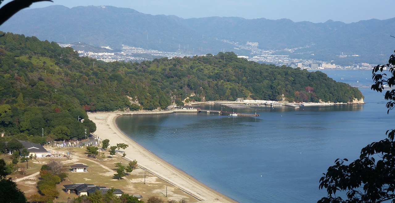
Miyajima Recreation Forest and Tsutsumigaura Beach in autumn
-
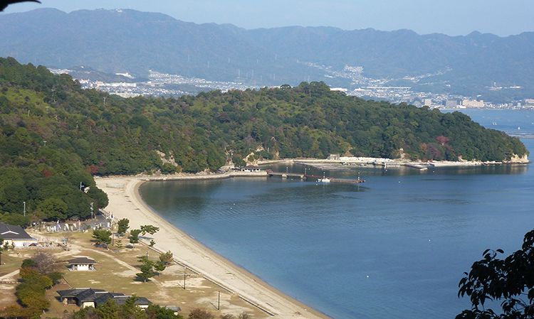
View of the island of the gods
-
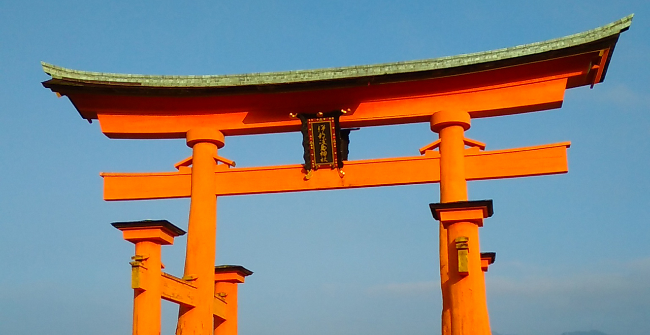
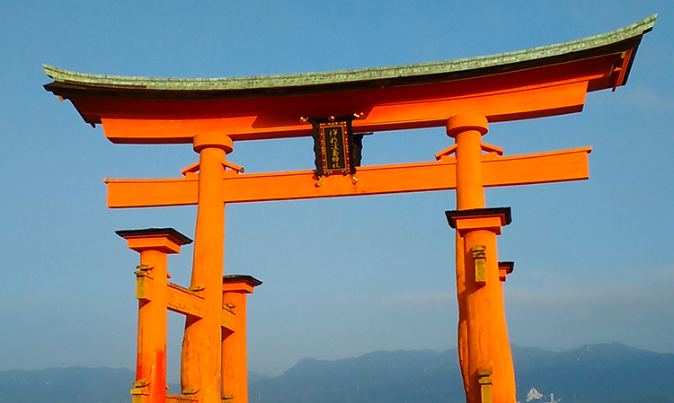
Otorii Gate of the Itsukusihma Shrine
-
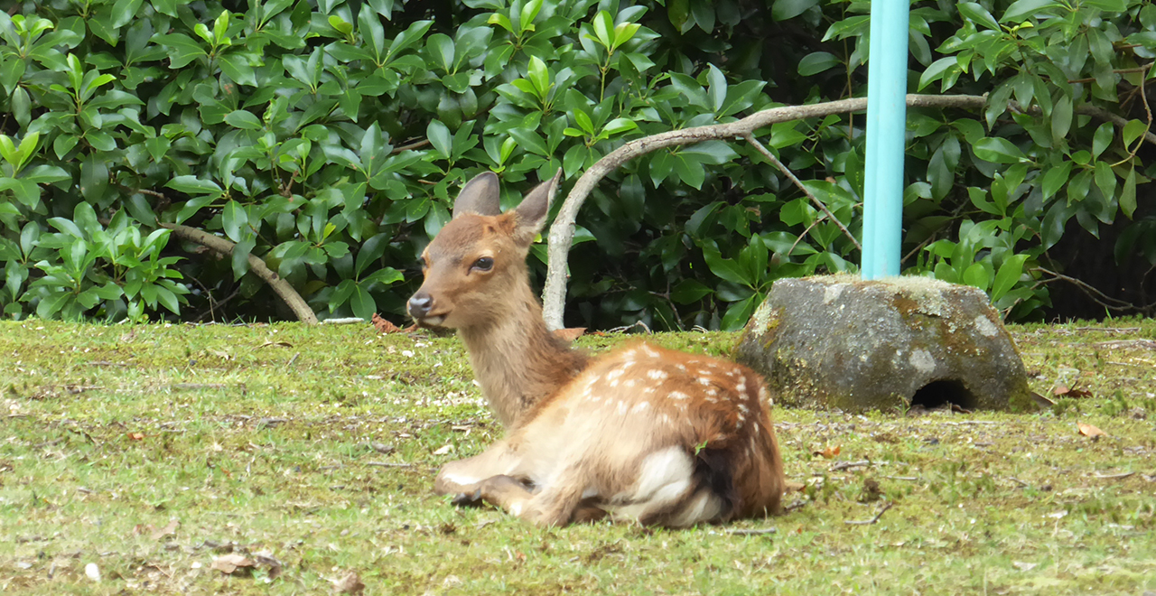
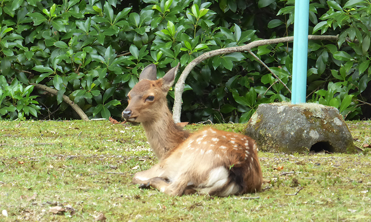
Nihonjika (Japanese sika deer (Cervus nippon)) in Miyajima are said to have been messengers of the gods
-
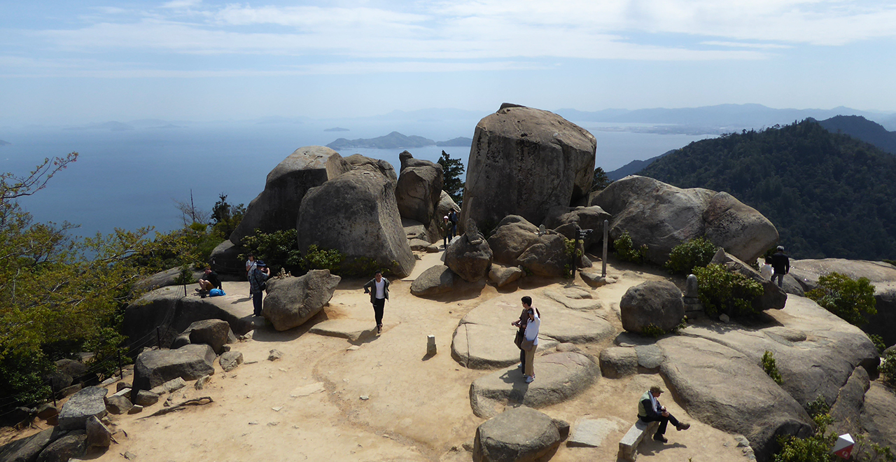
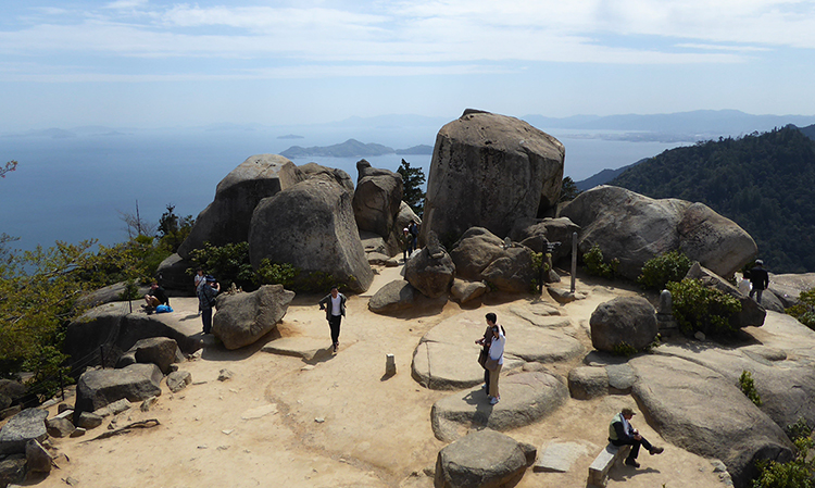
Stunning view from Mt. Misen
-
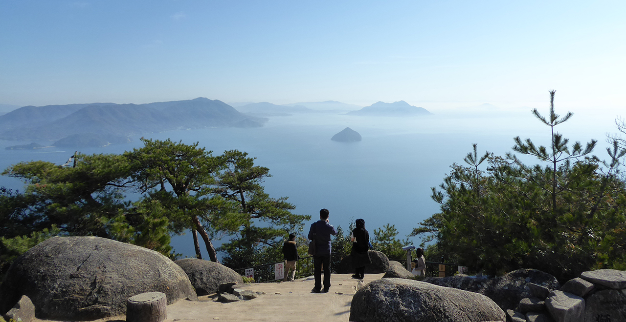
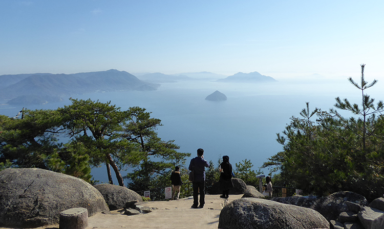
Panoramic view from Shishiiwa Observatory
-
Takasunoura Shrine with the Miyajima Recreation Forest at the back
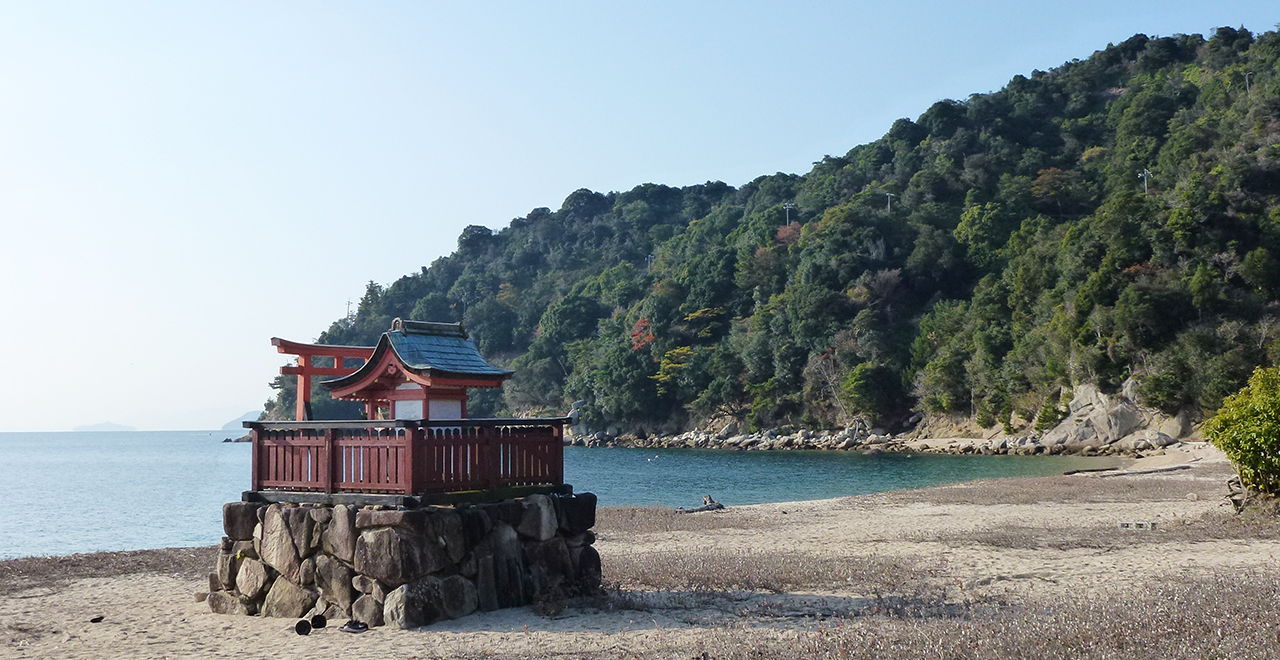
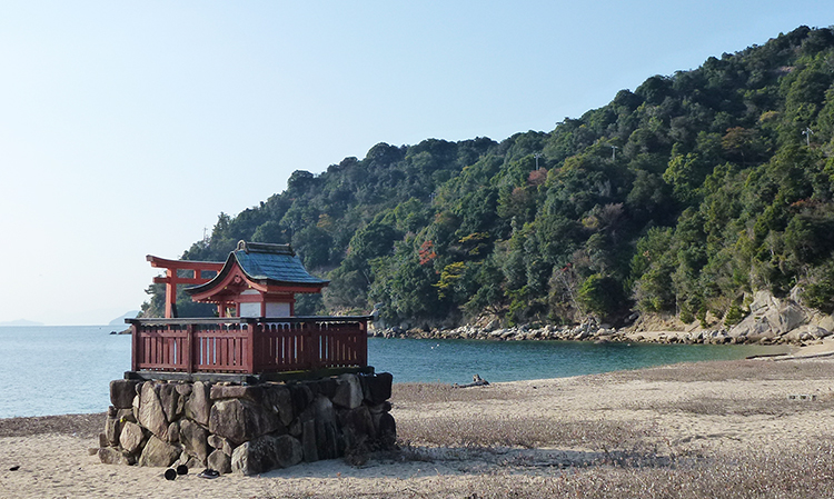
Miyajima Recreation Forest
1,322.73ha
Elevation Lowest : 20m / Average : 80–400m / Highest : 529m (Mt. Misen)
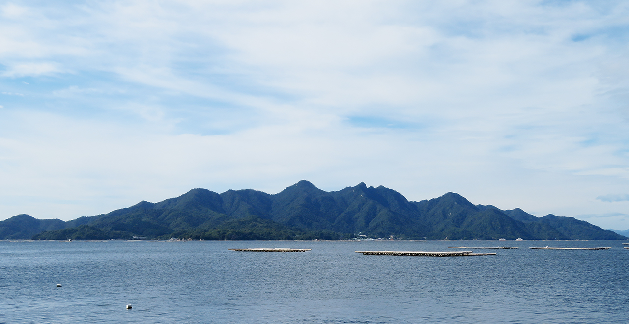
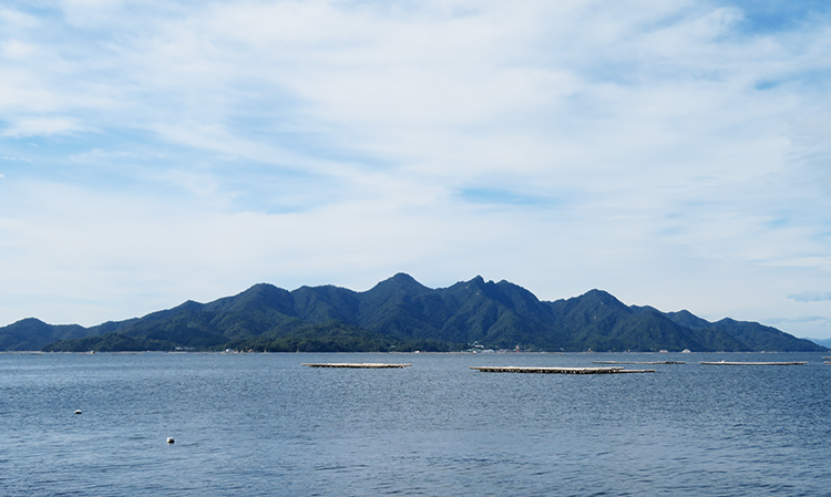
Miyajima ― a god-dwelling island that lies in the beautiful Setonaikai Sea
Miyajima ― a god-dwelling island that lies in the beautiful Setonaikai Sea
- Newest information
- Area
- Activities
- Overview
- Latest Information
- Usage Guide
- Facility
- Map
- Address
- Access
(Distances and times are
provided as a guide only) - Management office
contact details - Information on Other Local
Tourist Attractions - Official Tourist Information
- Recreation Forest
Management Committee - Supporters
- Other
- Newest information
- Gathering information in advance is important to safely enjoy forest recreation that brings you closer to nature.
・CHECK
・When you go out, please check local tourist and related information and gather information on road closures, weather conditions, etc.
- Area
- Kinki Chugoku
- Activities
- Flower-viewing (Momo, Peach (Prunus persica (L.) Batsch.), Kiku (Chrysanthemum morifolium Ramat.)) (Includes surrounding area) Autumn leaf viewing (Includes surrounding area) Mountain climbing (Includes surrounding area) Guided tours (Outside the forest) (Payment required) (Foreign language support available) Shrine / Temple visit (Outside the forest) (Payment required) (Foreign language signs/pamphlets available)
- Overview
-
- Geographical/topographical features
- Miyajima is a precipitous island with a circumference of 30 km and an elevation of 529 m, lying in the beautiful Setonaikai Sea 20 km southwest of Hiroshima City. A vast national forest covers up to 80% of the total area of the island.
- Historical/cultural features
- Miyajima is known as one of the three most scenic places in Japan, along with Amanohashidate and Matsushima. Due to its scenic importance, it has been designated as a scenic site conservation forest, a special zone of the Setonaikai National Park, and a special historic site and special place of scenic beauty "Itsukushima Island".
Meanwhile, the main shrine buildings (shaden) of the Itsukushima Shrine were built in a manner that they protrude over the sea, because Miyajima had been worshiped from ancient times as "kami wo itsuki matsuru shima" (an island for worshiping and enshrining gods" and it was considered disrespectful to build shrine buildings on the sacred land. Since these shrine buildings enshrine Mt. Misen that rises behind the shrine as the object of worship, the nature of Mt. Misen has been protected intact from ancient days. The Itsukushima Shrine and its object of worship, Mt. Misen, together create Miyajima's unique scenery that cannot be found anywhere else in the world, and that has also been designated as a Cultural World Heritage Site. - Climate, flora and fauna
- The area has a mild, Setonaikai climate. It is home to animals such as Nihonjika (shika deer (Cervus nippon)). Deer have long been cherished on the island. The vegetation consists of a forest of Akamatsu trees (Japanese red pine (Pinus densiflora)), a mixed forest of Japanese red pine and evergreen broad-leaved trees, and an evergreen broad-leaved forest of Urajirogashi (Quercus salicina Blume) and Akagashi (Japanese evergreen oak (Quercus acuta)).
- Attractions
- Since the founding of a temple by Buddhist priest Kukai (Kobodaishi) in 806, sacred Mt. Misen, the highest peak of Miyajima, has been worshiped by key figures such as Taira no Kiyomori and Ito Hirobumi. Many historical footprints and legends still remain at Mt. Misen. The summit of Mt. Misen can be reached from three hiking trails (Momijidani Course, Daishoin Course, and Omoto Course), and also by a route using a ropeway (after a 15-minute ride on the ropeway, a 40-minute hike to the summit). Along the way, you can enjoy the view of the mainland shore across from the island and the island's virgin forest. Many spiritual sites are scattered over a small area on the summit. In particular, the observation platform offers a stunning 360° panoramic view of the beautiful islands of the Setonaikai Sea and, on clear days, the Shikoku mountain range in the distance. Every year, more than 200,000 tourists visit Miyajima from inside and outside Japan. A large number of stores and restaurants line up along the road leading up to the Itsukushima Shrine, and visitors can enjoy a variety of local specialty dishes such as yaki-gaki (grilled oysters) and anago-meshi (broiled conger eel on top of rice).
- Other
- The northern side of the island, which serves as the gateway to the island, is full of tourism resources including the Itsukushima Shrine, which stores many historical national treasures and important cultural properties. In particular, the vermilion-color Otorii Gate of the shrine is 16 m tall, which is approximately the same height as the Great Buddha, and its main pillars are made of 500 to 600 year-old Kusunoki wood (camphor tree (Cinnamomum camphora (L.) J.Presl). The Tsutsumigaura Natural Park on the east side of the island has a playground that can be used for baseball, soccer, and softball.
- Latest Information
- ー
- Usage Guide
-
- Entrance fee
- Free of charge
- Opening seasons and hours
- Accessible 24 hours a day
- Accommodation options
- Hotels and Japanese inns
- Facility
- Toilets and drinking fountains (Includes surrounding area) Toilet (accessible) (Outside the forest) Footpath / walking trail / nature trail (Includes surrounding area) Parking lot (Includes surrounding area) Observation platform (Includes surrounding area) Vending machine (Outside the forest) Shop (Outside the forest) Restaurant (Outside the forest) Resource center / Museum (Outside the forest) (Payment required for use of facilities and participation in activities) (Foreign language signs/pamphlets available) World Heritage Site / Cultural Property (nationally designated) (Outside the forest) (Payment required for use of facilities and participation in activities) (Foreign language signs/pamphlets available) Accommodation facilities (Hotels/Japanese inns) (Outside the forest) (Foreign language signs/pamphlets available)
- Map
- Address
- Miyajimacho, Hatsukaichi City, Hiroshima Prefecture
- Access
(Distances and times are provided as a guide only) -
- By public transport
-
<Access from nearest railway station / bus stop>
- Miyajima Island → (about 15 minutes on foot) → Momijidani Station → (Miyajima Ropeway: about 10 minutes) → Shishiiwa Station → (about 30 minutes on foot) → Miyajima Recreation Forest
<Access from major transport hubs to nearest railway station / bus stop>- JR Hiroshima Station → (JR Sanyo Main Line: about 30 minutes) → JR Miyajimaguchi Station → (1 minute on foot) → Miyajimaguchi Pier → (Ferry: about 10 minutes) → Miyajima Island
- By car
-
<Access>
- San-yo Expressway (Kochi IC) → Hiroshima-Iwakuni Road (Hatsukaichi IC) → Miyajimaguchi Pier → (Ferry: about 10 minutes) → Miyajima Island (about 70 minutes in total)
<Car parking capacity / parking charges>Use parking lots around Miyajimaguchi Pier to go to Miyajima Island. Generally about 1,000 yen per day.
- Nearby tourist facilities
-
- Itsukushima Shrine, Itsukushima Shrine Treasure Hall, Miyajima History and Folklore Museum, Tsutsumigaura Natural Park
- Management office contact details
-
Hiroshima District Forest Office
- Information on Other Local Tourist Attractions
-
Miyajima Tourist Association [External link]
- Official Tourist Information
-
Hatsukaichi City Tourism Information [External link]
- Recreation Forest Management Committee
- ー
- Supporters
- ー
- Other
- ー
PDF形式のファイルをご覧いただく場合には、Adobe Readerが必要です。
Adobe Readerをお持ちでない方は、バナーのリンク先からダウンロードしてください。
![]()