


-
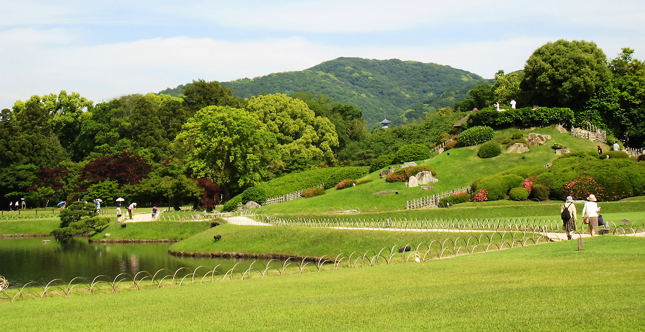
View of Misaoyama Hill from Korakuen
-
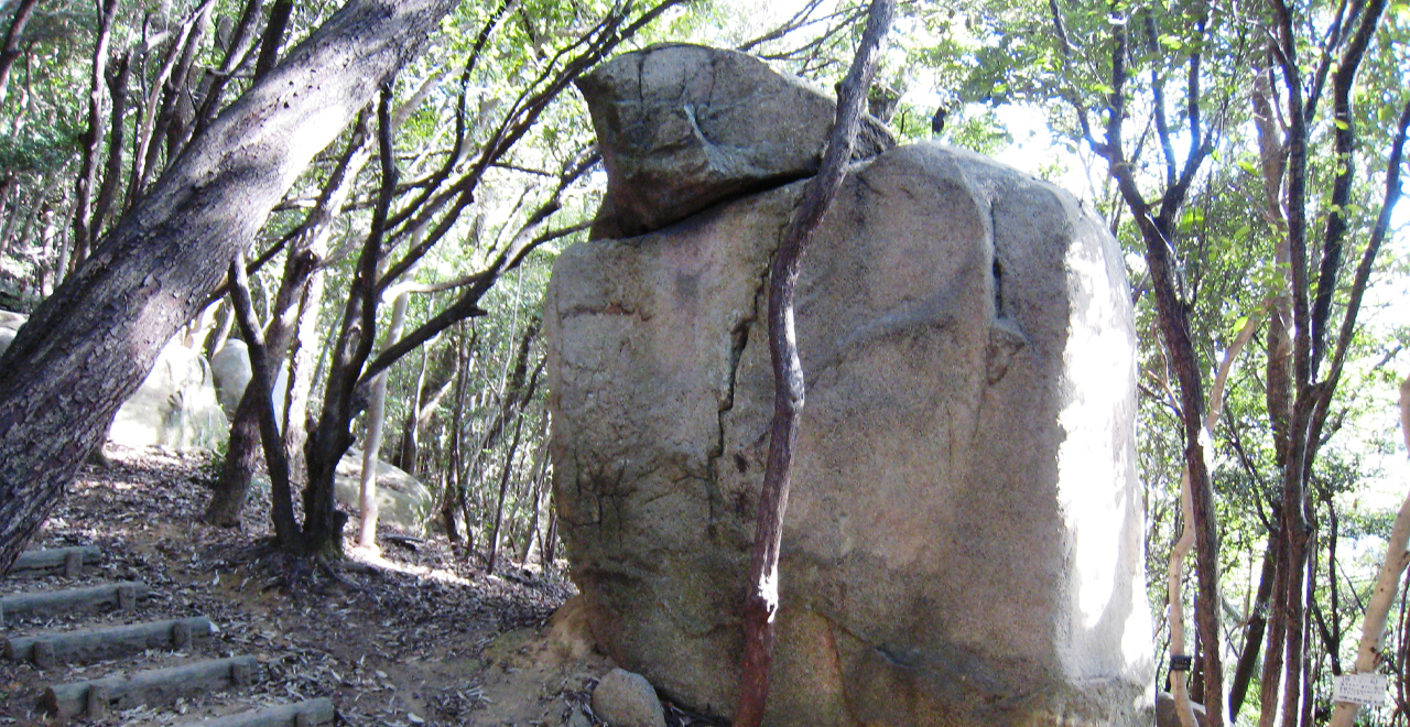
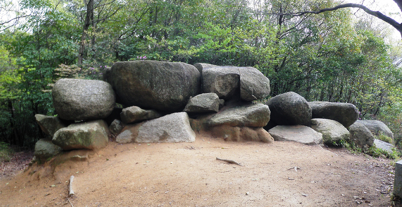
Unfalling Rock
-
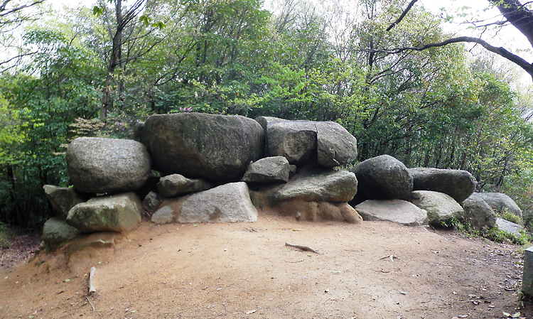
Hachijoiwa Burial Mound
-
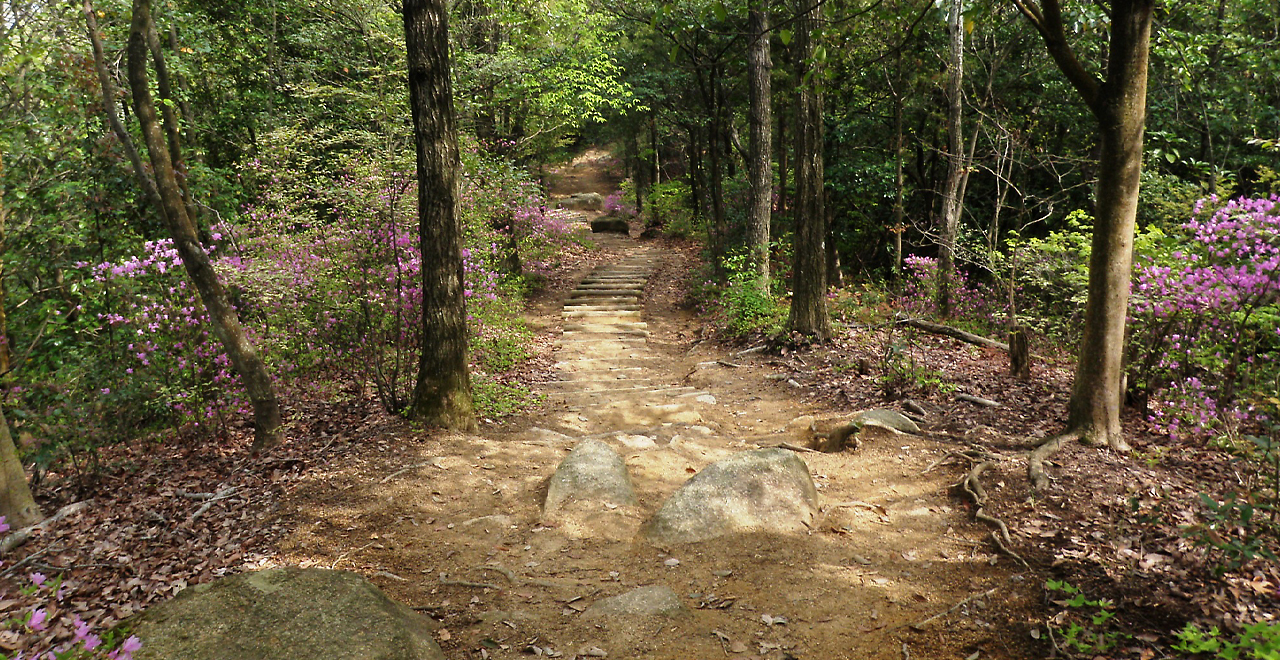
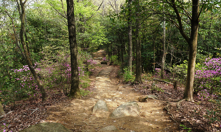
Walking trail with azalea in full bloom
-
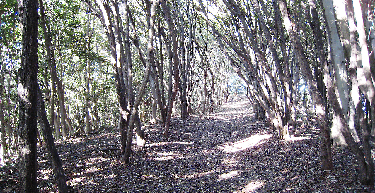
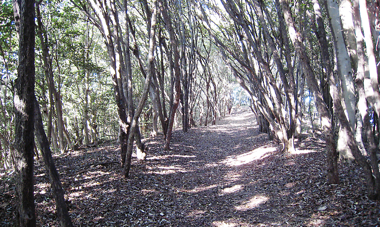
Tunnel of Japanese photinia
Misaoyama Hill Recreation Forest
125.55ha
Elevation: 5–169 m
A forest that complements the scenery of Korakuen―one of Japan's three most outstanding traditional Japanese gardens―and offers a place of relaxation for locals with many historic sites to explore, including ancient burial mounds and medieval castle ruins
A forest that complements the scenery of Korakuen―one of Japan's three most outstanding traditional Japanese gardens―and offers a place of relaxation for locals with many historic sites to explore, including ancient burial mounds and medieval castle ruins
- Newest information
- Area
- Activities
- Overview
- Latest Information
- Usage Guide
- Facility
- Map
- Location
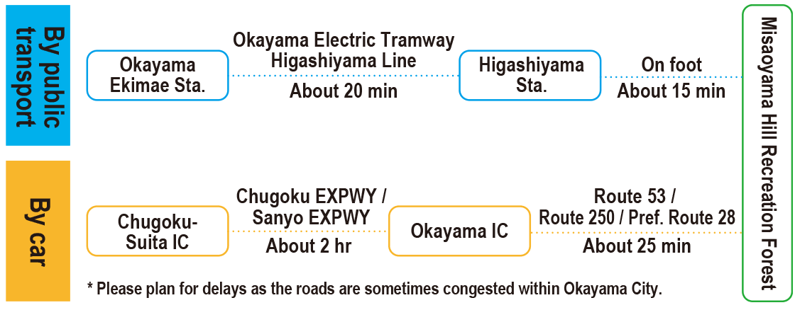
- Access
(Distances and times are
provided as a guide only) - Management office
contact details - Information on Other Local
Tourist Attractions - Official Tourist Information
- Recreation Forest
Management Committee - Supporters
- Other
- Newest information
- Gathering information in advance is important to safely enjoy forest recreation that brings you closer to nature.
・CHECK
・When you go out, please check local tourist and related information and gather information on road closures, weather conditions, etc.
- Area
- Kinki Chugoku
- Activities
- Flower-viewing (Outside the forest) Birdwatching (Includes surrounding area) Picnics (lawn area/park) (Outside the forest) Paddling / fishing / boating (pond / lake / river) (Outside the forest) Shrine / Temple (Outside the forest)
- Overview
-
- Geographical/topographical features
- The Recreation Forest lies at the center of the Okayama metropolitan area, about 4 km to the east of JR Okayama Station. The area consists of a row of hills with elevations of 130―170 m running from east to west. The southern slopes have been urbanized and transformed into residential areas, but the northern slopes are spotted with rural settlements and vast orchards, agricultural fields and bamboo groves. The 130 m-high Hatafuridai Observatory provides a panoramic view of Kojima Bay and islands in the Seto Inland Sea.
- Historical/cultural features
- Okayama Korakuen is one of Japan's three most outstanding traditional Japanese gardens, sharing this ranking with Kairakuen in Mito and Kenrokuen in Kanazawa.
It was constructed about 300 years ago by the 2nd lord of the Okayama Domain, Ikeda Tsunamasa, and represents the Genroku culture that flourished from the late 17th to early 18th century.
It has been nationally designated as a special place of scenic beauty. Misaoyama Hill was originally a forest called "onbayashi" that was property of the Okayama Domain, and its beautiful landscape has been maintained and compliments the scenery of Korakuen.
The forest also serves as a backdrop forest for nearby temples such as Anju-in Temple and Shorin-ji Temple, making it an extremely important forest for the local landscape.
The area is also home to a large number of ancient burial mounds, Buddha statues placed beside rural paths and medieval castle ruins.
Misaoyama Hill alone has over 50 burial mounds, forming a group called the Misaoyama Kofungun. Visitors can see a succession of burial mounds of various shapes and sizes that were built during different periods, such as the Hachijoiwa Burial Mound and the Haginozuka Burial Mound. - Climate, flora and fauna
- Okayama Prefecture has a temperate Seto Inland Sea climate. Because it receives a large number of hours of sunlight annually (about 2,000 hours) and relatively little annual precipitation for Japan (about 1,100 mm), the prefecture has dubbed itself the "Land of Sunshine." The weather is generally comfortable year-round.
The Recreation Forest has a mix of trees, including Kashi (evergreen oak (Quercus)), Nara (oak (Quercus)) and Kunugi (sawtooth oak (Quercus acutissima Carruth.)), as well as Kanamemochi (Japanese photinia (Photinia glabra)) trees that have been planted to prevent the spread of fire.
It is also a habitat for various animals and birds such as Ruribitaki (red-flanked bushrobin (Tarsiger cyanurus)), Jobitaki (Daurian redstart (Phoenicurus auroreus)) and Kogera (Japanese pygmy woodpecker (Dendrocopos kizuki)), while insects including Ruritateha (blue admiral (Kaniska canace)), Tsubameshijimi (short-tailed blue (Everes argiades)) and Hanmyo (Cicindela japonica) can also be found. - Attractions
- Despite its location at the center of the Okayama metropolitan area, Misaoyama Hill offers a place of relaxation for locals rich in natural beauty and with many historic sites, including ancient burial mounds and medieval castle ruins. The Okuichi Park Sports Field, where the trails start, is about a 12 minute walk from Higashiyama Station on the Okayama Electric Tramway. The location is also convenient for sightseeing, with Okayama Korakuen and Okayama Castle within a 30-minute walk.
There are several short trails. The summit of Misaoyama Hill is about a 50-minute walk from the trailheads by the Okuichi Park Sports Field. Descending from the summit to the western ridge, there is a trail along which Japanese photinia trees form a tunnel.
Also, many burial mounds of various shapes and sizes can be found along the route from the Hatafuridai Observatory to the Hachijoiwa Burial Mound, and the Hatafuridai Observatory offers a stunning view of Kojima Bay. Situated at the northern base of Misaoyama Hill, the Misaoyama Park Satoyama Center operated by the Okayama City Park Association offers visitors a chance to learn about Misaoyama's abundant natural splendor and the rural way of life of the local people who live in harmony with it.
It is a popular spot where families can take part in nature programs, such as birdwatching and insect observation.
- Latest Information
-
- Warnings (Dangerous areas)
- Please be aware that some parts of the footpaths are currently impassable due to damage caused by torrential rain.
- Usage Guide
-
- Entrance fee
- Free
- Operating hours and seasons
- Accessible 24 hours a day, 365 days a year.
- Accommodation options
- [Outside the forest]
Accommodations are available in the Okayama city area.
- Facility
- Toilets and drinking fountains (Outside the forest) Walking trail (Includes surrounding area) Parking lot (Outside the forest) Observation platform (Includes surrounding area) Visitor center (staffed only) : Misaoyama Park Satoyama Center (Outside the forest) Vending machine (Outside the forest) Cultural Property (nationally designated) (Outside the forest) Accommodation facilities (Hotels/Japanese inns) (Outside the forest) Hot Spring (Outside the forest) (Payment required in some cases)
- Map
- Location
- Sawada / Haraoshima 4-chome / Kunitomi 3-chome / Okuichi / Maruyama / Minato, Naka Ward, Okayama City, Okayama Prefecture
- Access
(Distances and times are provided as a guide only) -
-
Parking lot capacity / parking charges- The Recreation Forest does not have a parking lot, so please use a parking lot elsewhere in the vicinity.
- Nearby tourism facilities
- Access from the trailheads located by the Okuichi Park Sports Field
- ・Okayamaken Gokoku Shrine (1 minute by car / 3 minutes on foot)
- ・Okayama Korakuen (8 minutes by car / 26 minutes on foot)
- ・Okayama Castle (9 minutes by car / 27 minutes on foot)
- Management office contact details
-
Okayama District Forest OfficeTEL:050-3160-6135
- Information on Other Local Tourist Attractions
-
Okayama Visitors & Convention Association [External link]
- Official Tourist Information
-
Misaoyama Park Satoyama Center [External link]Okayama City [External link]Okayama City Park Association [External link]
- Recreation Forest Management Committee
-
Misaoyama Hill Recreation Forest Management CommitteeSecretariat: Misaoyama Park Satoyama Center
TEL : 086-270-3308
FAX:086-270-8353
- Supporters
- ー
- Other
- ー
PDF形式のファイルをご覧いただく場合には、Adobe Readerが必要です。
Adobe Readerをお持ちでない方は、バナーのリンク先からダウンロードしてください。
![]()