


-
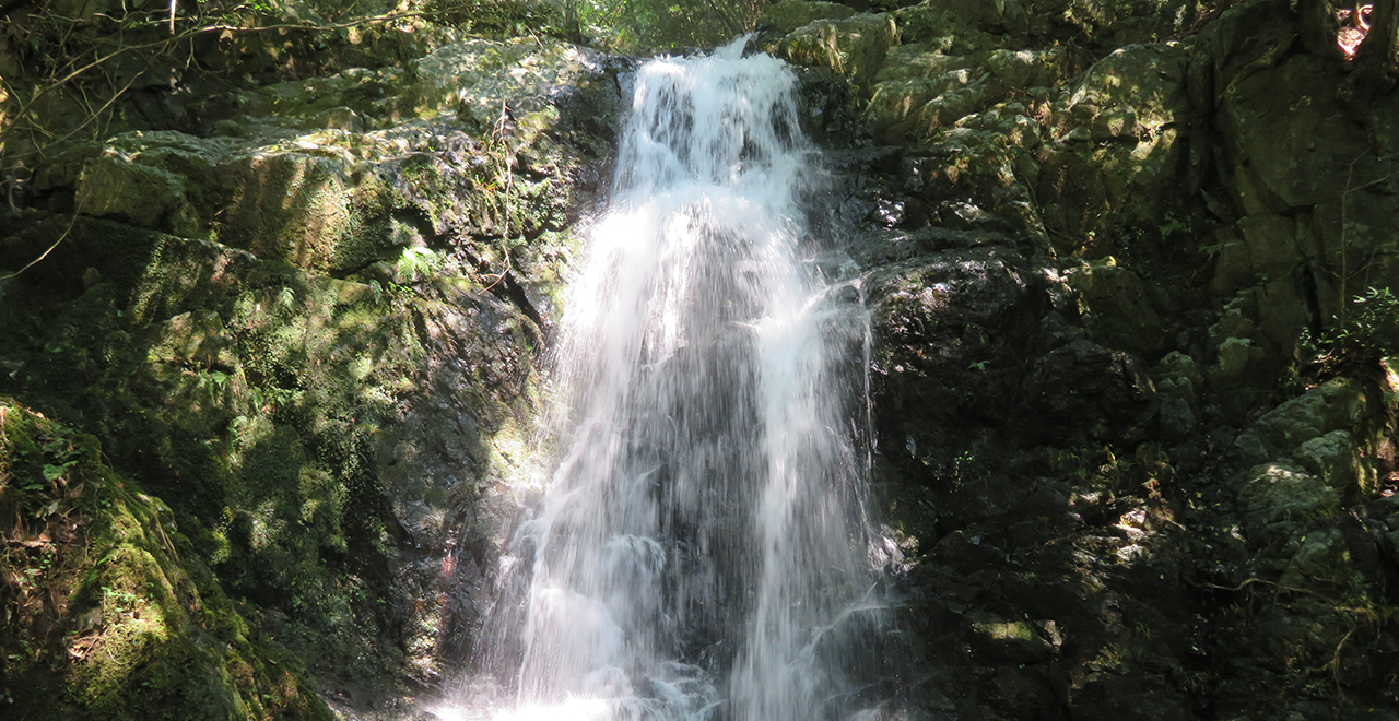
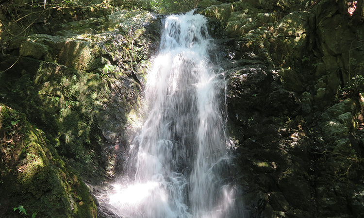
Nana Falls (seventh waterfall) of the Nanae waterfall system (seven waterfalls)
-
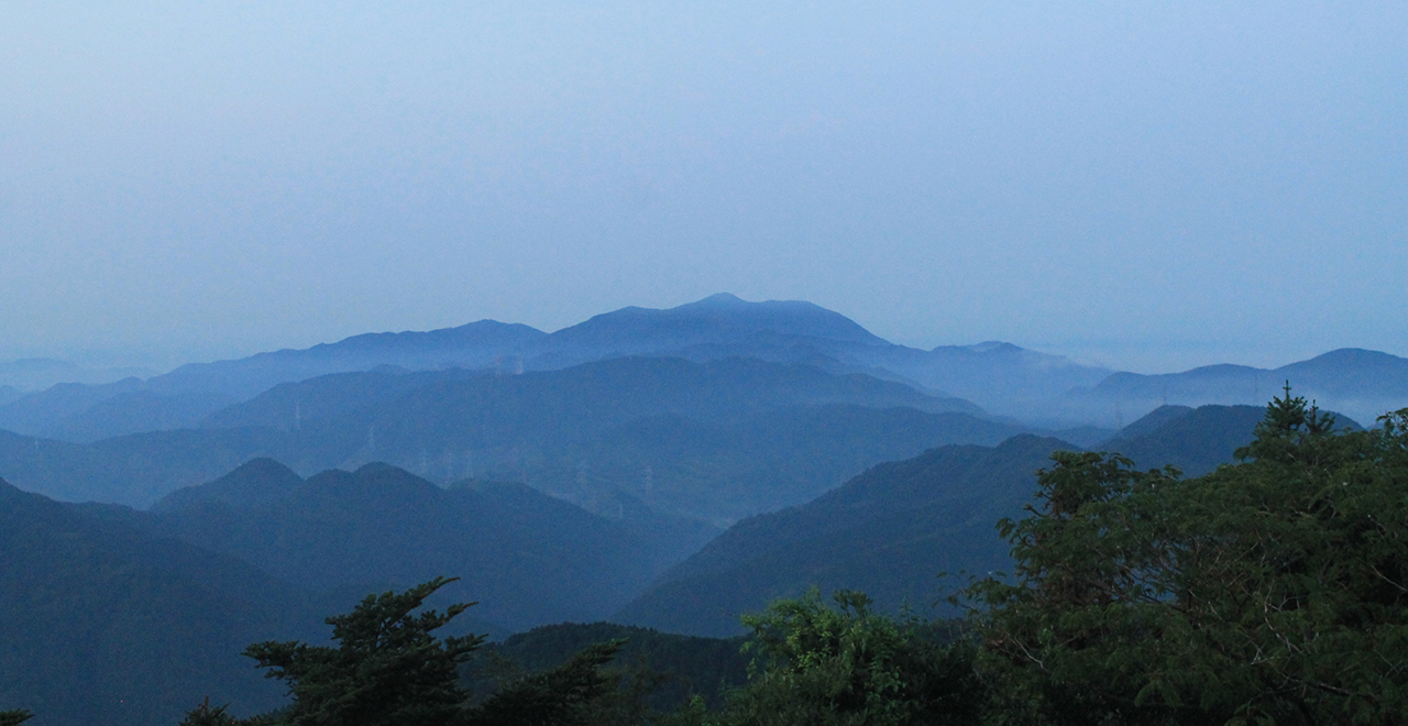
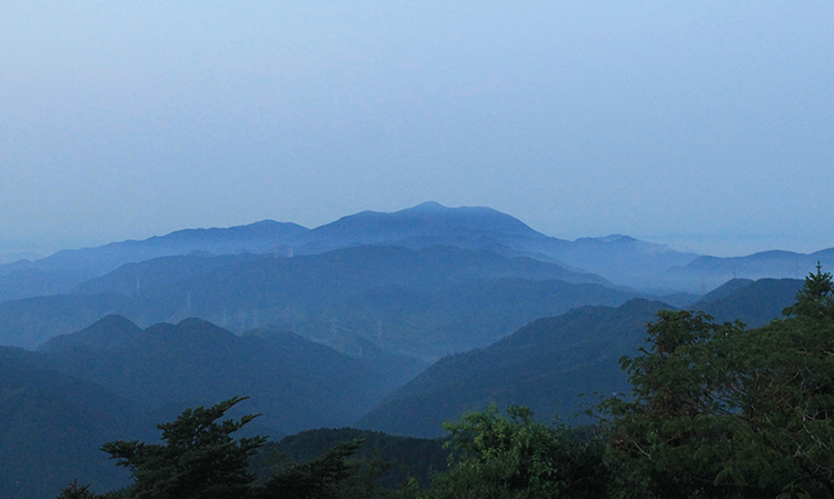
View of Mt. Fukuchi from Mt. Sarakura at dawn
-
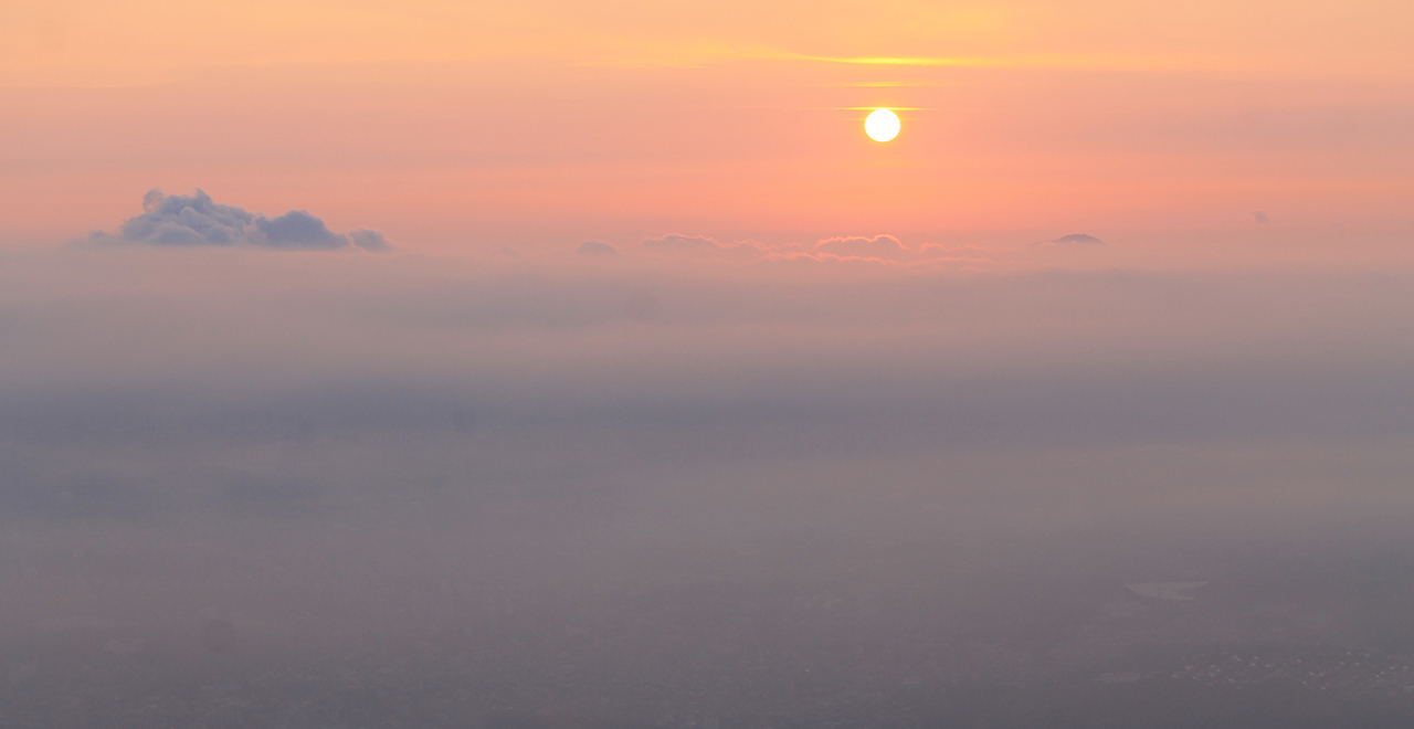
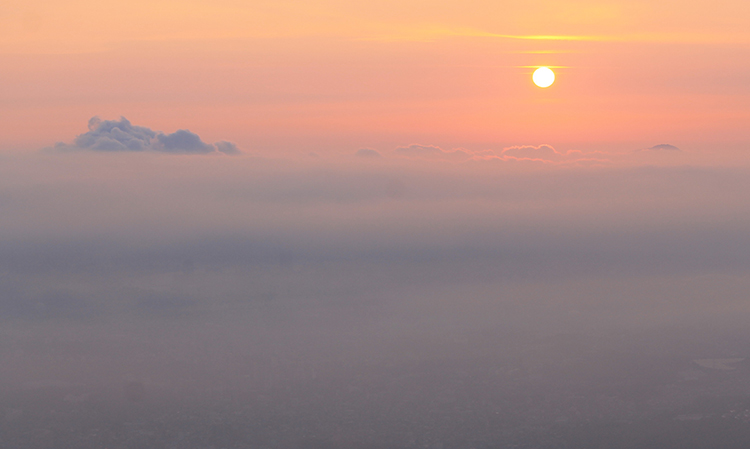
Admiring the rising sun from Mt. Sarakura
-
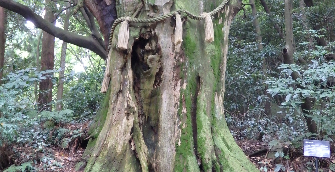
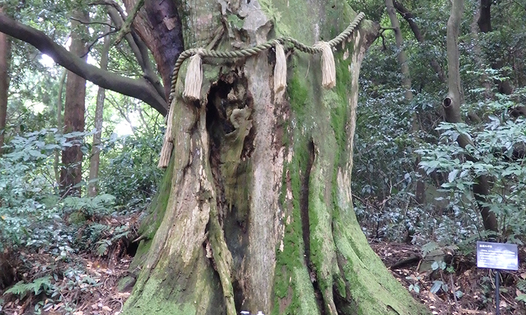
Kogo Cedar (Empress Cedar) on Mt. Sarakura
-
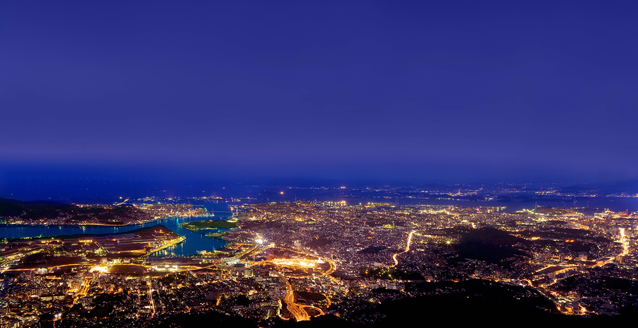
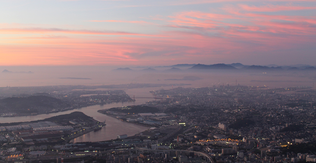
"10 billion dollar night view" from Mt. Sarakura
-
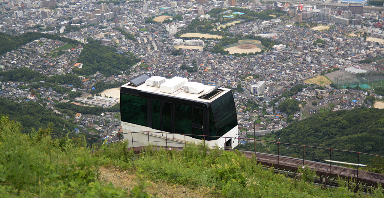
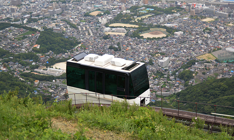
Cable car ascending from Sanroku Station
-
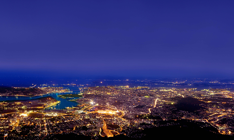
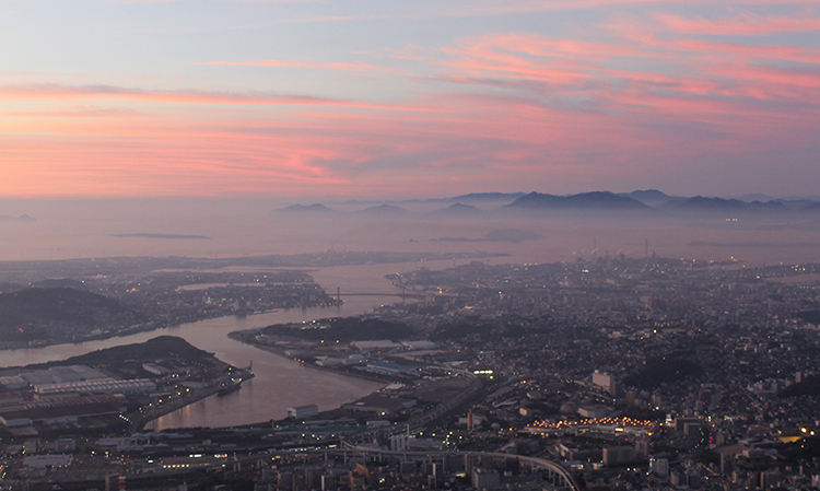
Dokai Bay at a magical hour
Kitakyushu Recreation Forest
1,291.58ha
Elevation Lowest : 140m / Average : 200–900m / Highest : 900m (Mt. Fukuchi)
A forest of inspiration, relaxation, and excitement awaits you
A forest of inspiration, relaxation, and excitement awaits you
- Newest information
- Area
- Activities
- Overview
- Latest Information
- Usage Guide
- Facility
- Map
- Address
- Access
(Distances and times are
provided as a guide only) - Management office
contact details - Information on Other Local
Tourist Attractions - Official Tourist Information
- Recreation Forest
Management Committee - Supporters
- Other
- Newest information
- Gathering information in advance is important to safely enjoy forest recreation that brings you closer to nature.
・CHECK
・When you go out, please check local tourist and related information and gather information on road closures, weather conditions, etc.
- Area
- Kyushu
- Activities
- Flower-viewing (Cherry (Prunus)) (Includes surrounding area) Autumn leaf viewing (Includes surrounding area) Waterfall viewing (Includes surrounding area) Birdwatching (Includes surrounding area) Picnics (lawn area/park) (Includes surrounding area) Mountain climbing (Includes surrounding area) Paddling / fishing / boating (pond / lake / river) (Includes surrounding area) Bicycle rental (Outside the forest) Hands-on forestry / woodworking experience (Outside the forest) : Mt. Sarakura Visitor Center Hot Spring (Outside the forest)
- Overview
-
- Geographical/topographical features
- The Kitakyushu Recreation Forest, which encompasses major peaks including Mt. Fukuchi (901 m), Mt. Takatori (620 m), Mt. Shakudake (608 m), Mt. Sarakura (622 m), and Mt. Gongen (617 m), is designated as the Kitakyushu Quasi-National Park, and attracts a large number of visitors. It is a forest covering a vast area across Kokuraminami Ward, Yahatahigashi Ward, and Yahatanishi Ward of Kitakyushu City, Nogata City, and Fukuchi Town. It can be largely divided into the area of the Hobashira Mountains located to the north and the area of Mt. Shakudake and Mt. Fukuchi located to the south.
The area near the summit of Mt. Fukuchi is a grassland where giant rocks are exposed. It offers a 360-degree view, overlooking a range extending from the Hiraodai Limestone Plateau in the east to the plains of Chikuho to the west. - Historical/cultural features
- Mt. Sarakura is the highest peak of the Hobashira Mountains, known as a mountain with many legends about Empress Jingu. The name of the mountain is said to have derived from the story that, when Empress Jingu hiked the mountain, the sun had set when she descended the mountain, so she said "sara ni kuretari" (the sun has set further), and the phrase later changed to "sarakura."
A long time ago, En no Gyoja (En the ascetic) is said to have gone to Tang by flying in the sky from Mt. Hiko to Mt. Homan along the ridge, and on his return, he went from Mt. Fukuchi to Mt. Homan and Mt. Hiko. Since then, it has been said that "mountain ascetics enter the mountains in spring from Mt. Homan and enter the mountains in autumn from Mt. Hiko." Mt. Fukuchi is counted as one of the six sacred peaks of Mt. Hiko. - Climate, flora and fauna
- The area basically has a temperate climate, but due to the influence of the Tsushima Strait, some parts of the area, particularly on the northeastern side of the Fukuchi Mountains, are subject to severe cold, with the ground frequently freezing due to snowfall. The vegetation mainly consists of planted forests of Sugi (Japanese cedar (Cryptomeria japonica)) and Hinoki (Japanese cypress (Chamaecyparis obtuse)), and natural broad-leaved forests of Kashi (evergreen oak (Quercus)), chinquapin trees (Castanopsis), and Tabu (Machilus thunbergii).
In the Mt. Sarakura area, there is a forest of old Japanese cedar trees that has continued to exist since 200 to 400 years ago in the feudal times, and in the Mt. Fukuchi area, about 400 ha of laurel forest spreads expansively, and natural forests of Keyaki (zelkova (Zelkova serrata)) remain throughout the area. The forests in both areas are extremely valuable also from the scientific viewpoint. - Attractions
- Mt. Sarakura in the Hobashira Mountains attracts a large number of hikers as its summit can be reached from the Sanroku Station at the foot of the mountain in 10 minutes by riding a cable car and then changing to a slope car. The mountain roadway is fully paved, and there are facilities such as a campsite and a forest botanical garden. The summit provides a magnificent panoramic view of the Kitakyushu City, and the night view has been referred to as a "night view worth 10 billion dollars" and has been selected as one of the "new three major night views of Japan."
Also, a footpath runs along the ridge, connecting between the Hobashira Mountains area and the Mt. Fukuchi area. The course is popular among hikers as a traverse course of about 8 hours.
Mt. Fukuchi is one of the mountains in northern Kyushu that command a 360-degree view. It is located close to the urban area and offers a large variety of hiking courses. Hikers of all levels from beginners such as families to experts can enjoy themselves each time they go up the mountain. If you stay overnight at the mountain hut near the summit, you can take in a spectacular night view of Nogata City and Kitakyushu City.
- Latest Information
-
- Regular events
- Mt. Sarakura Health Walk (held around May every year) For details, please see the website of Yahatahigashi Ward, Kitakyushu City.
- Warnings (Flora and fauna)
- Ticks: Please note that ticks are present in bamboo grass areas. Wearing long sleeves and long trousers is essential.
Inoshishi (wild boar (Sus scrofa leucomystax)): If you see a boar, do not approach it. - Warnings (Dangerous areas)
- There are places where the sides of the walking trail have been trampled by Inoshishi (wild boar (Sus scrofa leucomystax)), so please exercise caution while walking.
- Usage Guide
-
- Entrance fee
- Free of charge
- Opening seasons and hours
- 24 hours
- Staffed facilities such as administration buildings
- Mt. Sarakura Observatory: 365 days a year
- Accommodation options
- [Inside the forest] Hobashira Municipal Campsite, Hobashira Youth Campsite
[Outside the forest] Kawachi Hot Spring (1 hot spring facility), Yahata/Kurosaki area (about 12 Japanese inns and hotels), Ryuo Gorge Camp Village
- Facility
- Toilets and drinking fountains (Includes surrounding area) Footpath / walking trail / nature trail (Includes surrounding area) Parking lot (Includes surrounding area) Observation platform (Includes surrounding area) *Operating hours differ by season. Visitor center (staffed only) (Outside the forest) Vending machine (Includes surrounding area) Shop (Includes surrounding area) Restaurant (Includes surrounding area) Campsite and/or cabins (Includes surrounding area) : 2 locations (Payment required) Free public wireless LAN (Wi-Fi) (Outside the forest) Resource center / Museum (Outside the forest) World Heritage Site / Cultural Property (nationally designated) (Outside the forest) Accommodation facilities (Hotels/Japanese inns) (Outside the forest)
- Map
- Address
- Yahatahigashi Ward, Yahatanishi Ward, and Kokuraminami Ward of Kitakyushu City, Nogata City, and Fukuchi Town, Fukuoka Prefecture
- Access
(Distances and times are provided as a guide only) -
- By public transport
-
<Access from nearest railway station / bus stop>
- [Hobashira Mountains] JR Yahata Station → (on foot: about 15 minutes) Sarakurayama Cable Car Sanroku Station
- [Fukuchi Mountains]
- (1) Nogata Station → (Nishitetsu Bus: 30 minutes) → Uchigaso bus stop → (on foot: about 120 minutes (about 6 km)) → Mt. Fukuchi summit
- (2) Kokura Station Bus Center → (Nishitetsu Bus: about 50 minutes) → Nishitetsu Bus Kitakyushu Nakatani Office → (Jumbo Taxi "Himawari-go": about 10 minutes) → Kokura-Minamikudobaru bus stop → (on foot: about 9 km (about 180 minutes)) → Mt. Fukuchi summit
- There are also other trailheads and hiking routes.
- By car
-
<Access>
- [Hobashira Mountains] JR Yahata Station → (public road: about 5 minutes) → Hobashira Park "Multistory Parking Lot"
- [Fukuchi Mountains] Kyushu Expressway Yahata IC → (public road: about 25 minutes) → Akaikemachi Parking Lot → (on foot: about 5 minutes) → Agano Trailhead
<Car parking capacity / parking charges>Hobashira Park "Multistory Parking Lot": 178 vehicles (ordinary vehicles: free parking up to 20 minutes, 100 yen up to 2 hours, 200 yen up to 4 hours, and 300 yen up to 4 hours)
Akaikemachi Parking Lot: Free parking for about 30 vehicles - Nearby tourist facilities
-
- 10 minutes by car from UNESCO World Cultural Heritage Site, Yawata Steel Works
- Management office contact details
-
Fukuoka District Forest Office
- Information on Other Local Tourist Attractions
-
Sarakurayama Cable Car [External link]
- Official Tourist Information
-
"Gururich! KitaQshu" Kitakyushu City Travel Guide [External link / Multilingual Support]
- Recreation Forest Management Committee
-
Kitakyushu Recreation Forest Protection and Management Committee
Agriculture and Forestry Division, Agriculture, Forestry and Fisheries Department, Industry and Economics Bureau, Kitakyushu Municipal OfficeTEL:093-582-2078
- Supporters
-
NPO Hobashira Nature Park Protection Association
- Other
- ー
PDF形式のファイルをご覧いただく場合には、Adobe Readerが必要です。
Adobe Readerをお持ちでない方は、バナーのリンク先からダウンロードしてください。
![]()