


-
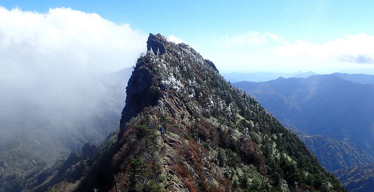
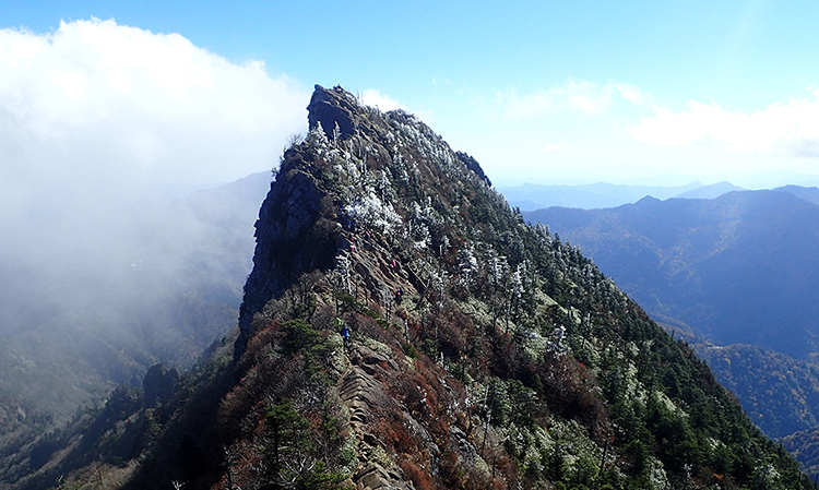
Mt. Ishizuchi summit
-
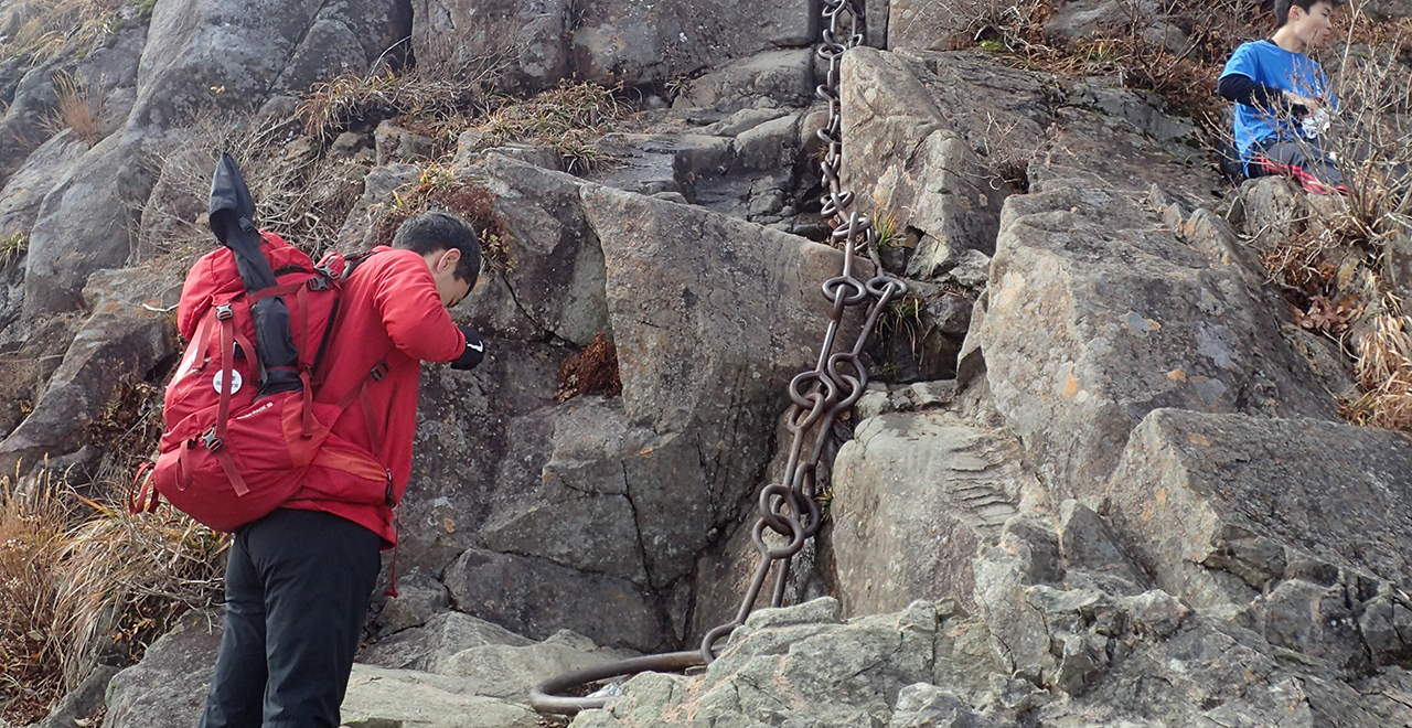
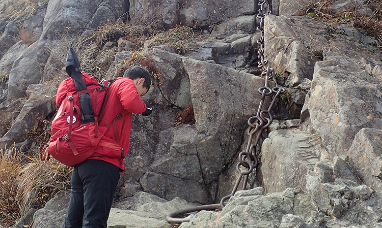
Third Chain
-
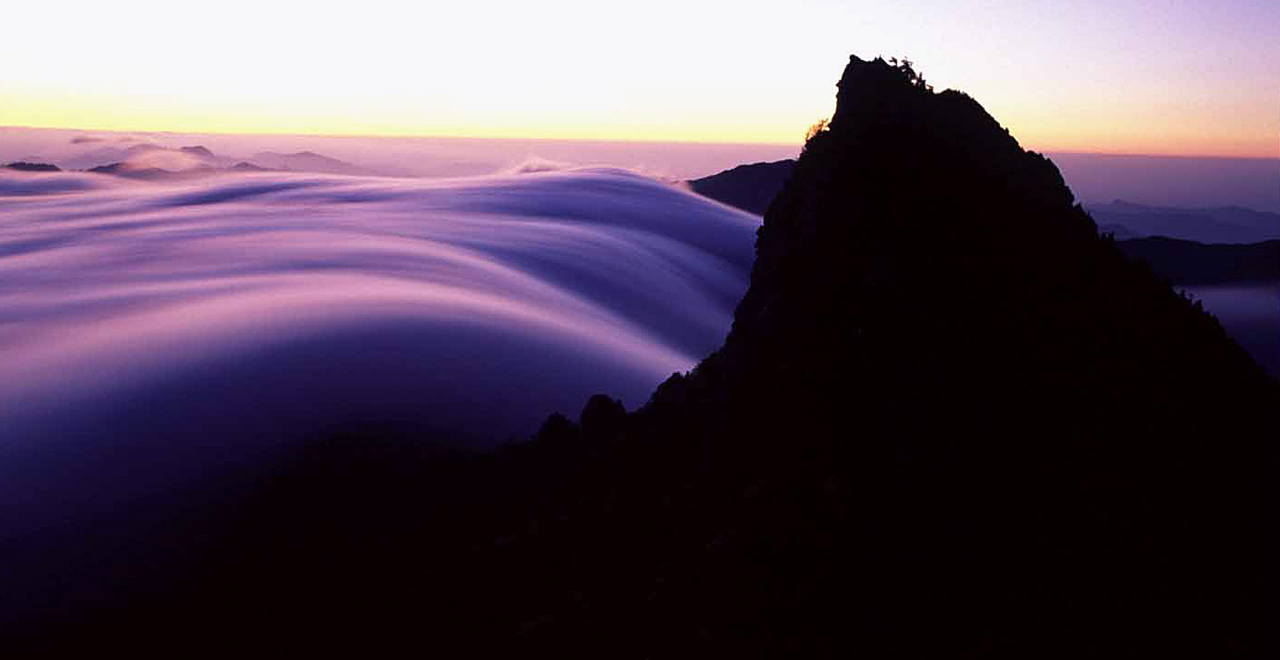
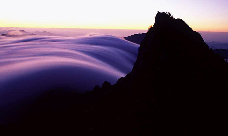
Morning glow on Mt. Ishizuchi
-
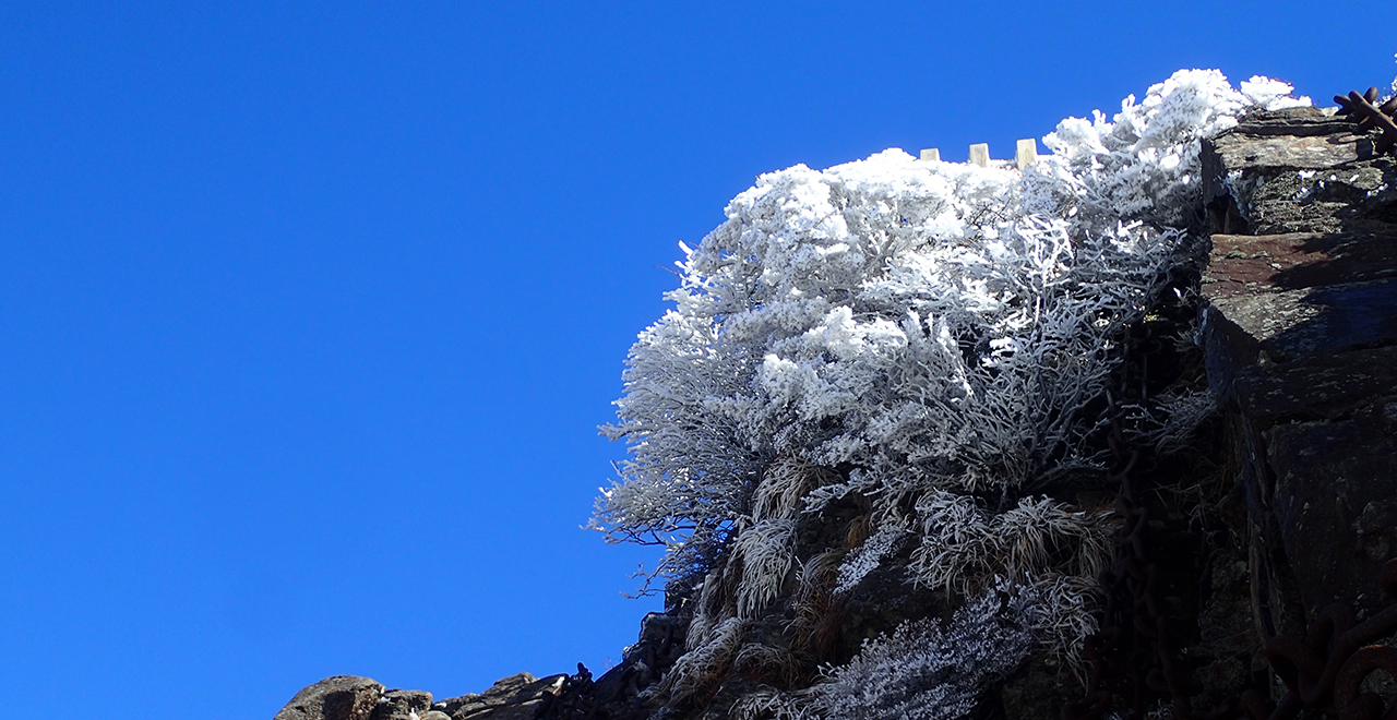
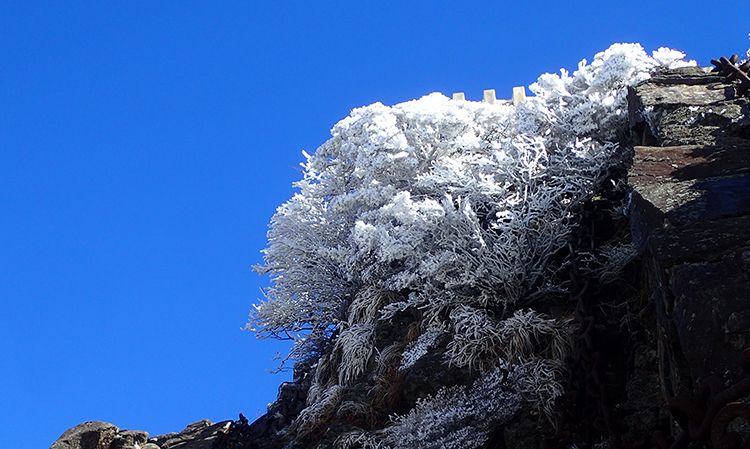
Frost-covered trees near the summit
-
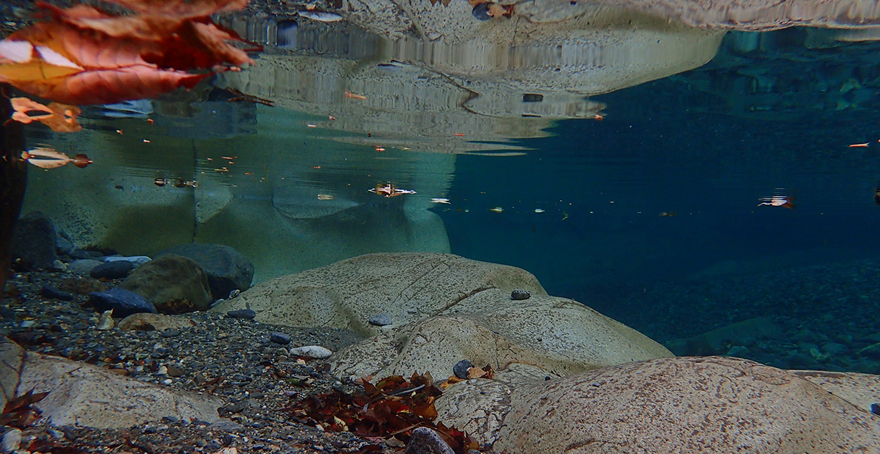
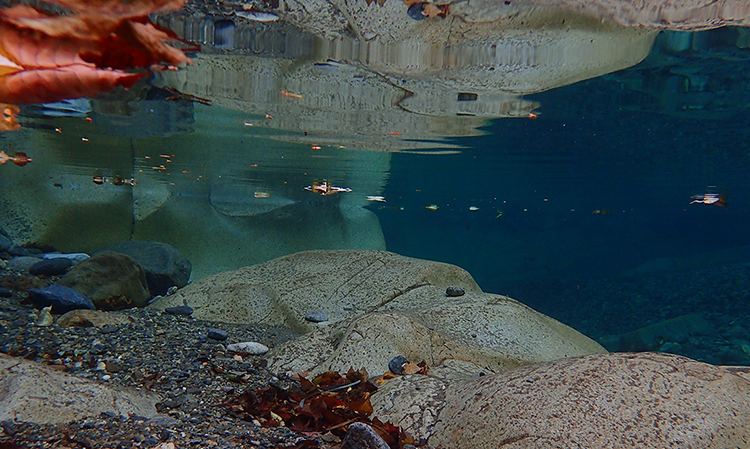
Omogo Gorge riverbed at the foot of the mountain
-
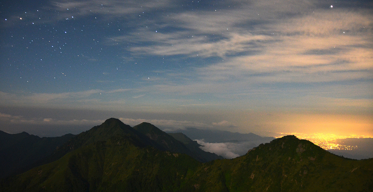
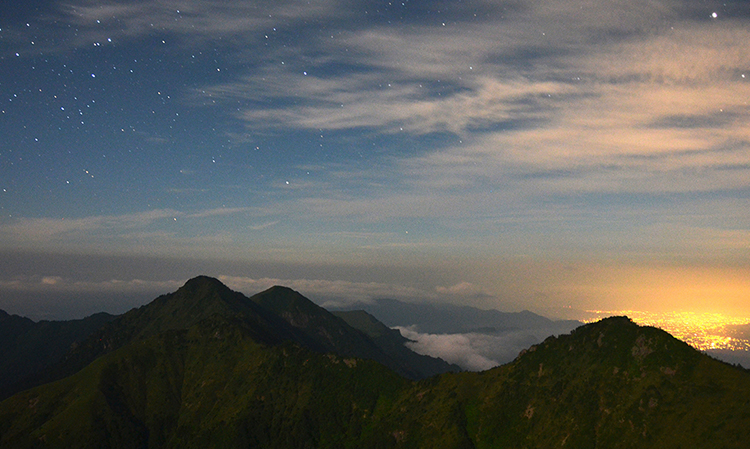
Moonlight view of the Ninomori Peak from Mt. Ishizuchi
-
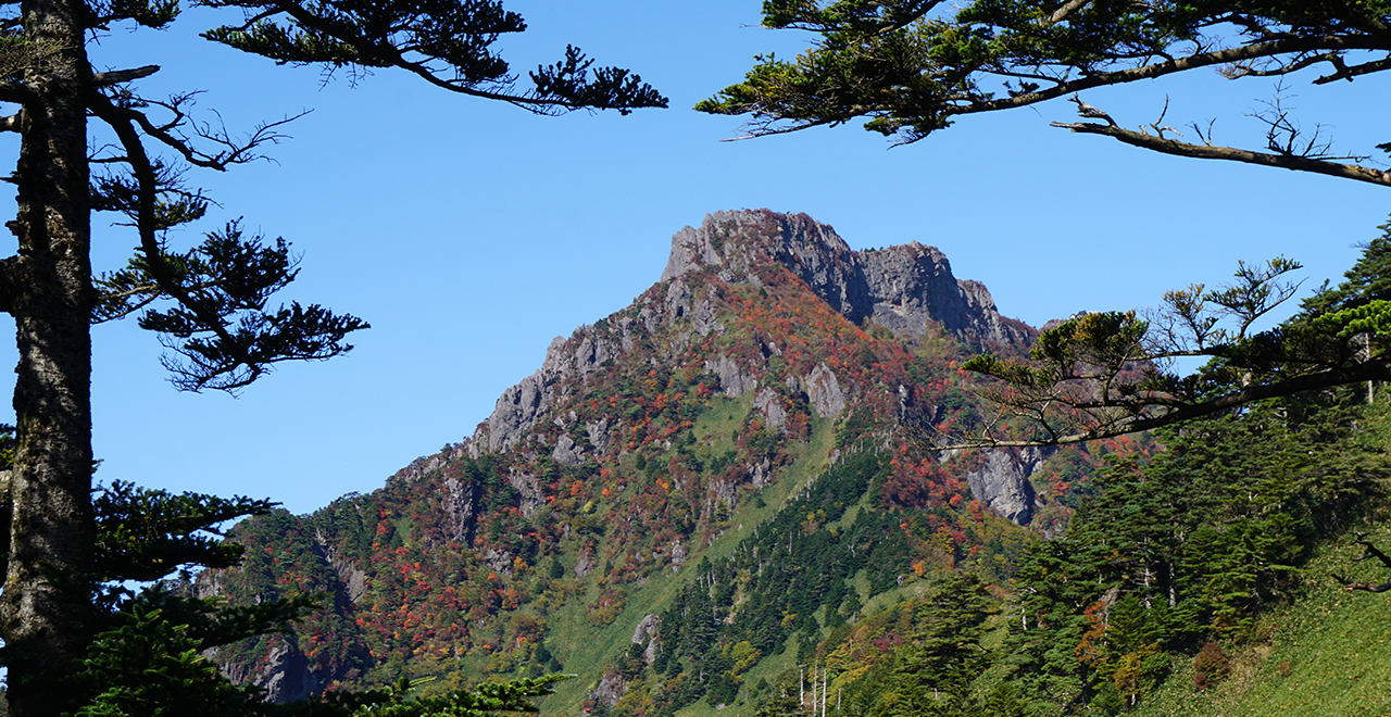
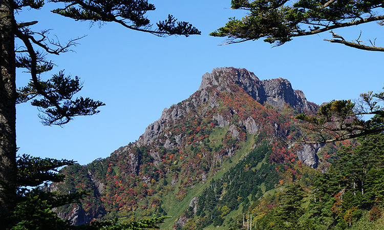
Distant view of Mt. Ishizuchi
Ishizuchi Recreation Forest
129.40ha
Elevation Lowest : 760m / Average : 760–1,600m / Highest : 1,600m (Mt. Ishizuchi summit [Tengudake Peak])
Sacred Mt. Ishizuchi ― the highest peak in western Japan
Sacred Mt. Ishizuchi ― the highest peak in western Japan
- Newest information
- Area
- Activities
- Overview
- Latest Information
- Usage Guide
- Facility
- Map
- Address
- Access
(Distances and times are
provided as a guide only) - Management office
contact details - Information on Other Local
Tourist Attractions - Official Tourist Information
- Recreation Forest
Management Committee - Supporters
- Other
- Newest information
- Gathering information in advance is important to safely enjoy forest recreation that brings you closer to nature.
・CHECK
・When you go out, please check local tourist and related information and gather information on road closures, weather conditions, etc.
- Area
- Shikoku
- Activities
- Flower-viewing (species: Akebono-tsutsuji (Rhododendron pentaphyllum var. shikokianum)) (Includes surrounding area) Autumn leaf viewing (Includes surrounding area) Waterfall viewing (Outside the forest) Birdwatching (Includes surrounding area) Picnics (lawn area/park) Mountain climbing Paddling / fishing (Outside the forest) (Payment required in some cases) River trekking (Outside the forest) (Payment required in some cases) Guided tours (Includes surrounding area) (Payment required) Hot Spring (Outside the forest) (Payment required for use of facilities and participation in activities) Ski area (no. of trails: 3) (Outside the forest) Ishizuki ski area mountain bike course (Outside the forest) (Payment required for use of facilities and participation in activities) Medium-long distance Trail (Includes surrounding area) Shrine / Temple visit (Includes surrounding area)
- Overview
-
- Geographical/topographical features
- The Ishizuchi Recreation Forest is located half way up the northern slope (the Setonaikai Sea side) of Mt. Ishizuchi, the highest peak in western Japan. The rocks belong to the Ishizuchi Group, and the andesites exposed around the summit of Mt. Ishizuchi tell us about the origin of the mountain's volcanic activity which began about 15 million years ago. The hiking route starts from the end of the ropeway, the Sancho-Joju Station (elevation: about 1,300 m). A relatively gently sloping footpath leads from the station to the Joju-sha Shrine of the Ishizuchi Shrine complex. Beyond the Joju-sha Shrine, the trail ascends through repeated ups and downs, and after passing the Trial Chain (74 m) in Zenjagamori, and reaching the Yoakashi-toge Pass, the dense forest opens up and an observation point awaits where you can command a view of Mt. Misen (Chojo-Sanso Lodge) to the Tengudake Peak (the highest peak of Mt. Ishizuchi). If you continue to ascend the trail, you will go through steep rocky areas from the First Chain (33m), the Second Chain (65m), and to the Third Chain (68m), and head to the Misen Peak where the Sancho-sha Shrine of the Ishizuchi Shrine complex stands. All of the chain areas have detours, so you can ascend safely. If you descend toward the east from the Yoakashi-toge Pass (elevation: about 1,650 m), you can follow the old path "Nishinokawa Route" that runs via the Tenchuseki Rock (Oto Ishi), where En no Gyoja (En the ascetic) and the holy priest Kukai are said to have conducted training, through the Oto Valley down to the Nishinokawa bus stop (elevation: about 430 m).
- Historical/cultural features
- In the middle of the forest, there is a worshiping hall called "Mikaeri Ryohaiden" of the Joju-sha Shrine of the Ishizuchi Shrine complex, where the statue of En no Ozunu, who opened a temple on sacred Mt. Ishizuchi about 1,300 years ago, is enshrined. At the Mountain-Opening Festival on July 1–10 every year, worshipers come to hike from all over Japan. In the festival, shell horns and bells resound through the entire mountain, and Shugen practitioners clad in white walk on the path leading to the shrine, showing the power of tradition in the mountain worship that lives on still today. Sacred Mt. Ishizuchi, which is the highest peak in western Japan, has been praised as "Iyo no Takane" (the high peak in the province of Iyo) from ancient times, and many poets including Ki no Tsurayuki have read about looking up to the mountain from the coast of the Setonaikai Sea in their poems. Legends that are directly linked with Mt. Ishizuchi and people's daily lives as well as the story of the Great Tengu (long-nosed goblin) have been passed down in extensive coastal areas of the Setonaikai Sea. In this way, Mt. Ishizuchi has inspired a wide range of culture as a mountain of worship, a mountain of literature, and a mountain of ethnology.
- Climate, flora and fauna
- The climate is generally temperate, but it is cool in summer, and it snows deep in winter. The vegetation along the mountain trail shifts from a warm-temperate zone with trees such as Sugi (Japanese cedar (Cryptomeria japonica)) to a mid-temperate zone with Momi (fir (Abies firma)) and Tsuga (Japanese hemlock (Tsuga sieboldii)), a cool-temperate zone with Buna (Japanese Beech (Fagus crenata Blume)) and Kohauchiwakaede (Acer sieboldianum Miq.), and to a subarctic zone with Nanakamado (Sorbus commixta Hedl.) in the higher part of the forest. You can have a splendid view of the bamboo grass field along the ridge and the subarctic forest represented by Shikokushirabe (Abies veitchii Lindl. var. reflexa Koidz.) from the summit, which is like a live vegetation picture book showing the vertical distribution of vegetation. Many plants bloom from spring to late autumn and add beauty to the mountain: Akebono-tsutsuji (Rhododendron pentaphyllum var. shikokianum) from late April; Ishizuchizakura (Cerasus shikokuensis (Moriya) H.Ohba) in May; Nangokuminekaede (Acer australe (Momot.) Ohwi et Momot.) in June; and Shikokuichige (Anemone sikokiana (Makino) Makino) and Miyamadaikonso (Geum calthifolium Menzies ex Sm. var. nipponicum (F.Bolle) Ohwi) in July. The higher part of the forest has been designated as part of the Ishizuchi Mountain Range Forest Ecosystem Reserve and efforts have been made to protect valuable flora and fauna, such as species endemic to the Shikoku region and endangered species.
- Attractions
- The abundant and precious vegetation and the unique scenery of this forest led to mountain worship in ancient times. Today, such features of the forest serve as the basis for a wide variety of nature experience programs for fully enjoying Ishizuchi's nature, such as hiking events, hiking and star-gazing tours, and mine remains tours. A ski area is also located adjacent to the forest, so you can engage in all kinds of nature activities throughout the year.
Various accommodations are available according to one's purpose, such as hot spring inns at the foot of the mountain, Japanese inns around the Joju-sha Shrine of the Ishizuchi Shrine complex, and a mountain hut at the summit. Above all, the easy access of only 8 minutes by a ropeway from the foot of the mountain to an elevation of 1,300 m has been well-received by visitors.
- Latest Information
-
- Regular events
- ・Akebono-tsutsuji Observation Hiking (late April through early May)
・Opening of Mt. Ishizuchi to hikers (July 1 to 10)
・Ishizuchi Autumn Leaves Festival (early October through November 3)
・Ishizuchi Snow Carnival (late December) - Warnings (Flora and fauna)
- There has been no definite information on the presence of Tsukinowaguma (Asian black bear (Ursus thibetanus) in the Ishizuki Mountains, but they have been identified in the Tsurugi Mountains.
Ticks: Please note that ticks are present in bamboo grass areas. Wearing long sleeves and long trousers is essential. - Warnings (Dangerous areas)
- The temperature differs considerably between the foot of the mountain and the summit, and the weather frequently changes, so sufficient trekking equipment is essential. In particular, equipment for winter mountains is needed during winter due to heavy snowfall and freezing.
- Warnings (Other)
- Information on Mt. Ishizuchi is available in English on the Saijo City website.
- Usage Guide
-
- Entrance fee
- None for the Recreation Forest itself, but fares are required for hiking the mountain by using the ropeway.
(Operation information: Ishizuchi Tozan Ropeway website (http://www.ishizuchi.com/rw)) - Opening seasons and hours
- Accessible 24 hours a day
- Staffed facilities such as administration buildings
- Ishizuchi Tozan Ropeway Sancho-Joju Station (only staffed during the ropeway operating hours)
- Accommodation options
- [Outside the forest : adjacent] Tamaya Ryokan, Shiraishi Ryokan Inn, Hinodeya Ryokan Inn
[Outside the forest] Chojo-Sanso Lodge, People's Lodge Ishizuki, Shiraishi Lodge, Kyoya Ryokan (main inn), Izumiya
- Facility
- Toilets (Includes surrounding area) : 6 locations (Payment required in some cases) Footpath (Includes surrounding area) Parking lot (Outside the forest) : 6 locations (Payment required) Observation platform (Includes surrounding area) Vending machine Shop (Includes surrounding area) Restaurant (Outside the forest) Campsite and/or cabins (Outside the forest) (Payment required for use of facilities and participation in activities) Accommodation facilities (Hotels/Japanese inns) (Outside the forest)
- Map
- Address
- Nishinokawatei, Saijo City, Ehime Prefecture
- Access
(Distances and times are provided as a guide only) -
- By public transport
-
<Access from nearest railway station / bus stop>
- [To the Ishizuchi Tozan Ropeway]
- JR Iyo-Saijo Station [Saijo Ekimae bus stop] → (Setouchi Bus: about 60 minutes) → Ropeway-mae bus stop → (on foot: 5 minutes) → Ishizuchi Tozan Ropeway Sanroku-Shimotani Station
- [To the Tsuchigoya (Ishizuchi Skyline)]
- * The Ishizuchi Skyline is closed during winter (December through March / may vary depending on snowfall).
- JR Matsuyama Station bus stop → (JR Shikoku Bus Kumakogen Line: about 60 minutes) → Kuma-eigyosho bus stop → (on foot: 1 minute) → Kuma-eigyosho bus stop (Iyotetsu Nanyo Bus: about 90 minutes) → Ishizuchi Tuchigoya bus stop, Tsuchigoya Shiraishi Lodge
- By car
-
<Access>
- [To the Ishizuchi Tozan Ropeway]
- Matsuyama Expressway Iyo-Komatsu IC → (public road: about 40 minutes (about 20 km)) → Ishizuchi Tozan Ropeway Sanroku-Shimotani Station
- [To the Tsuchigoya (Ishizuchi Skyline)]
- (From Matsuyama City, Ehime Prefecture) Matsuyama Expressway Matsuyama IC → (public road: about 120 minutes (about 80 km)) → Tsuchigoya
- (From Kochi City, Kochi Prefecture) Kochi Expressway Ino IC → (public road: about 120 minutes (about 80 km)) → Tsuchigoya
<Car parking capacity / parking charges>[Ishizuchi Tozan Ropeway]
Kyoya Inn: 500 vehicles / 700 yen, Izumiya: 15 vehicles / 500 yen
[To the Tsuchigoya (Ishizuchi Skyline)]
Ishizuchi Skyline Tsuchigoya Parking Lot: free parking for about 100 vehicles
* The Ishizuchi Skyline is closed during winter (December through March / may vary depending on snowfall). - Nearby tourist facilities
-
- Starting point: Ishizuchi trailhead / Mt. Ishizuchi (Ishizuchi Tozan Ropeway Sanroku-Shimotani Station)
- ・35 minutes by car to the Saijo City Local History Museum "Ichinokawa stibnite crystals listed as one of the world's important mineral specimens"
- ・60 minutes by car to "Maintopia-Besshi", a theme park using the ruins of Besshi Copper Mine facilities
- Management office contact details
-
Ehime District Forest OfficeTEL:089-924-0550
https://www.rinya.maff.go.jp/shikoku/ehime
- Information on Other Local Tourist Attractions
-
Saijo City [External link]Ishizuchi Tozan Ropeway [External link]Ishizuchi Kanko [External link]NPO School of Ishizuchimori [External link]NPO Saijyo Nature School [External link]
- Official Tourist Information
-
Ishizuchi Mountain Range [External link]
- Recreation Forest Management Committee
-
Ishizuchi Recreation Forest Protection and Management Committee
(in the Tourism Promotion Section, Saijo Municipal Office)TEL:0897-52-1446
FAX:0897-52-1386
- Supporters
- ー
- Other
- ー
PDF形式のファイルをご覧いただく場合には、Adobe Readerが必要です。
Adobe Readerをお持ちでない方は、バナーのリンク先からダウンロードしてください。
![]()