


-
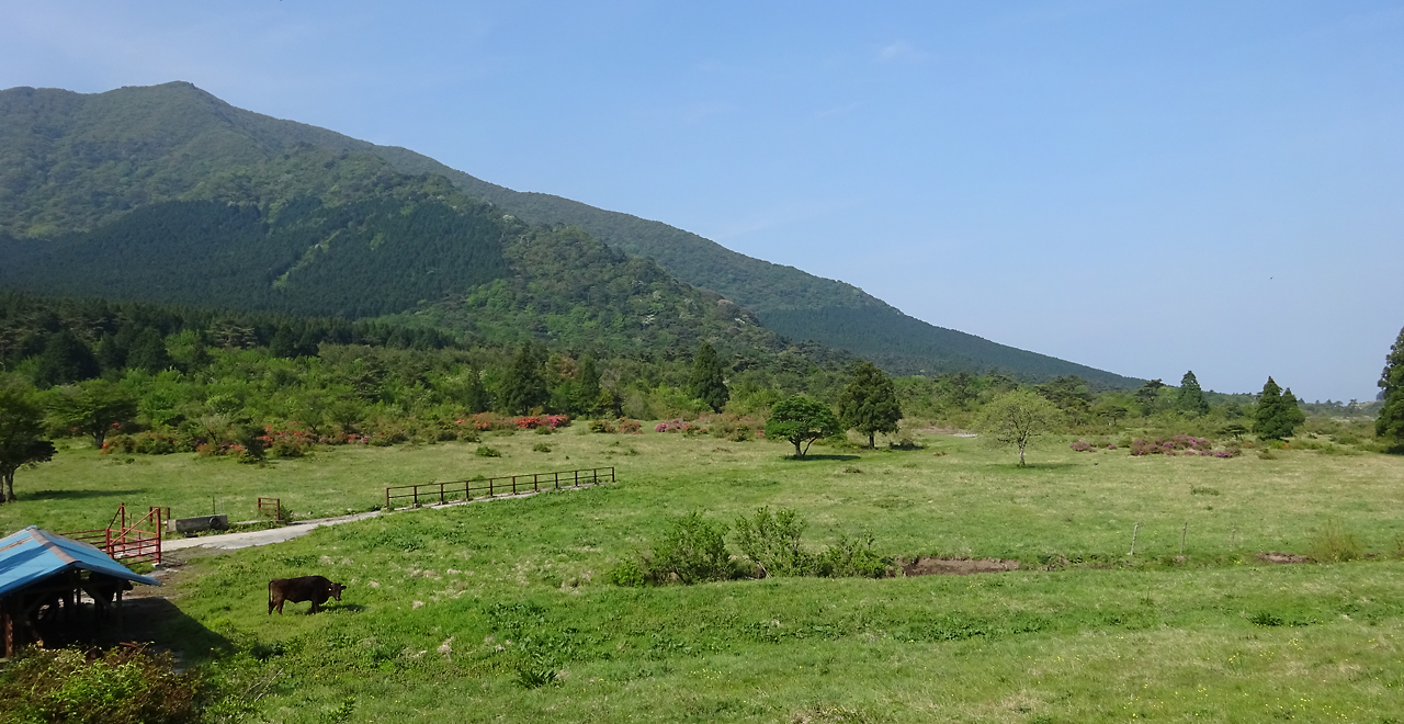
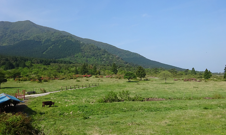
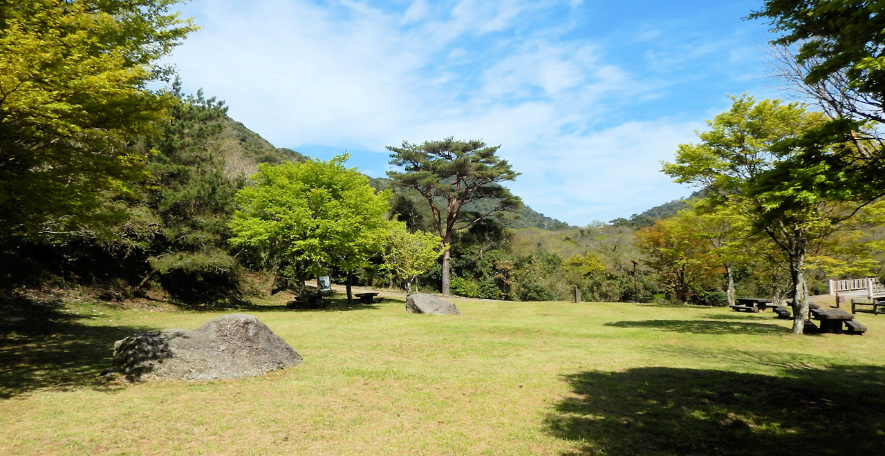
Tashirobaru grassland and Mt. Heisei-Shinzan
-
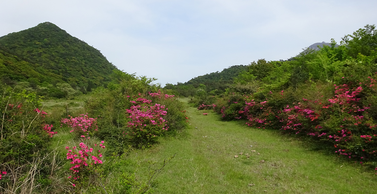
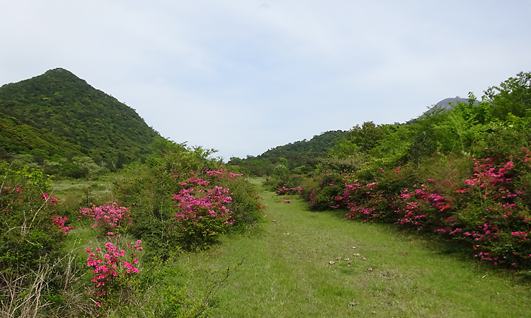
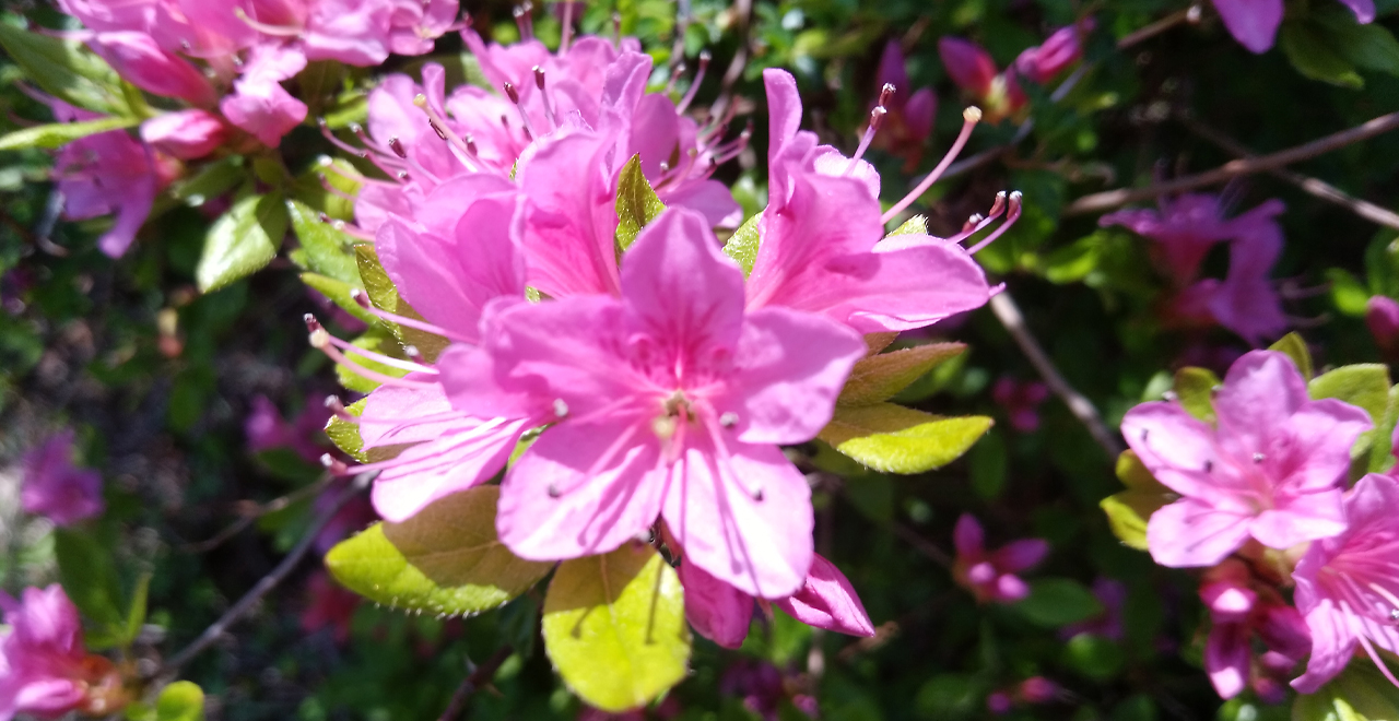
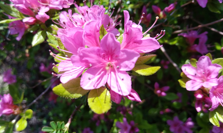
Tashirobaru marshland and Kyushu azalea in spring
-
Tashirobaru marshland in autumn
-
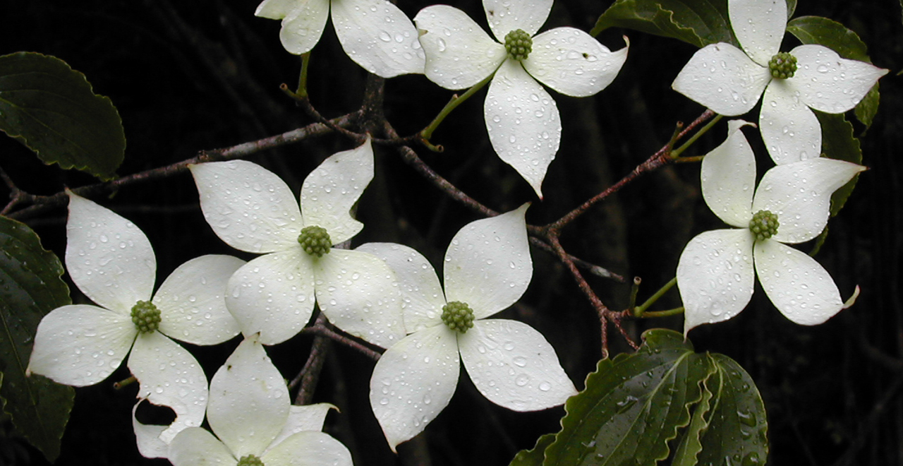
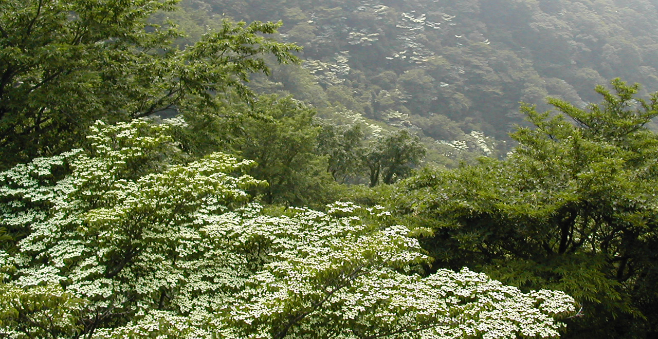
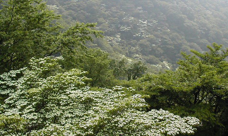
Japanese dogwood blooming in the rain
-
Campsite waiting for children
-
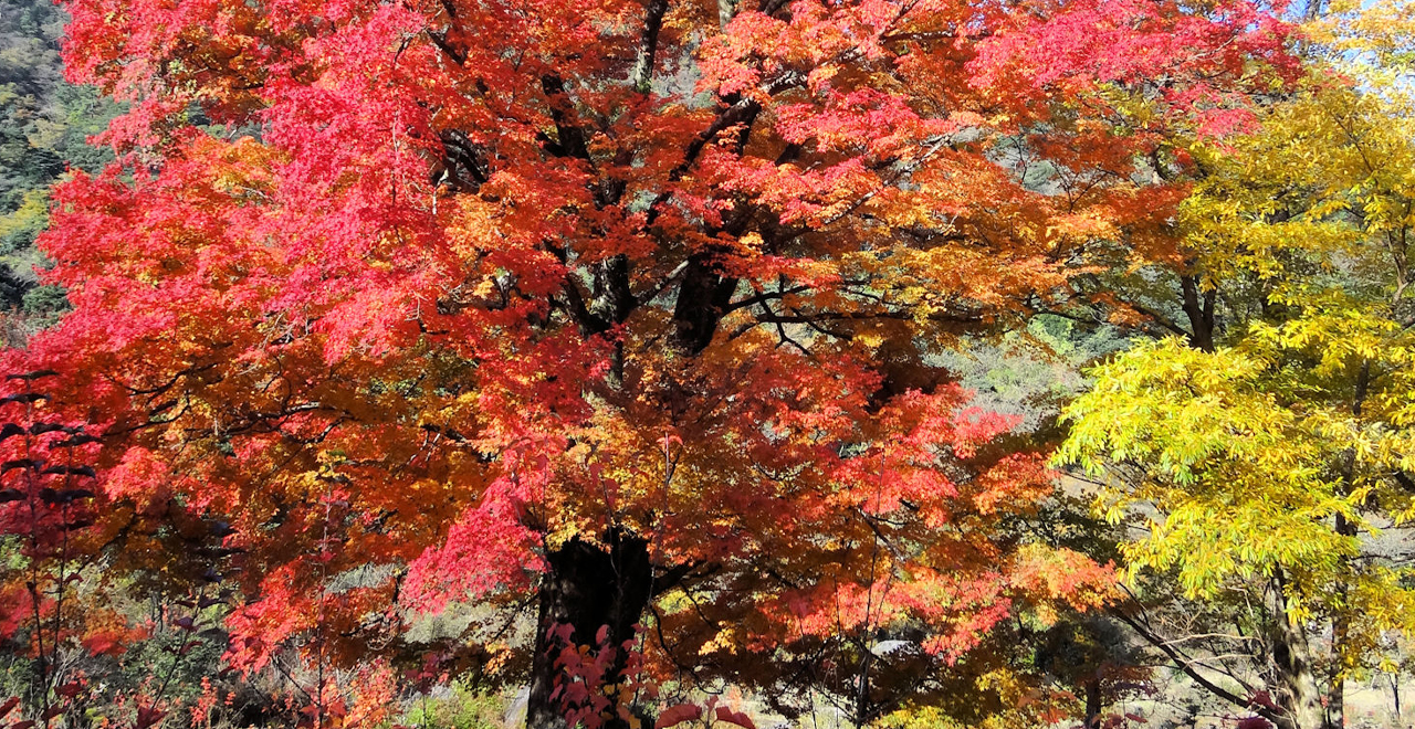
Giant tree with autumn foliage
-
Japanese dogwood blossoms coloring the mountain
-
Kyushu azalea flowering in the spring
-
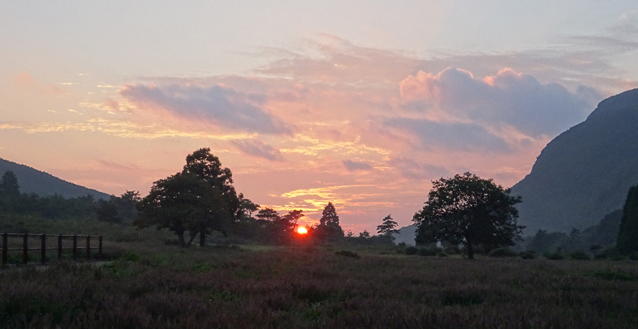
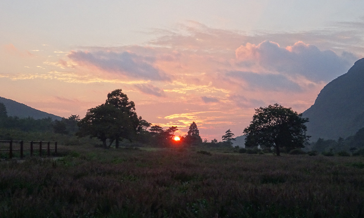
Tashirobaru at sunset
-
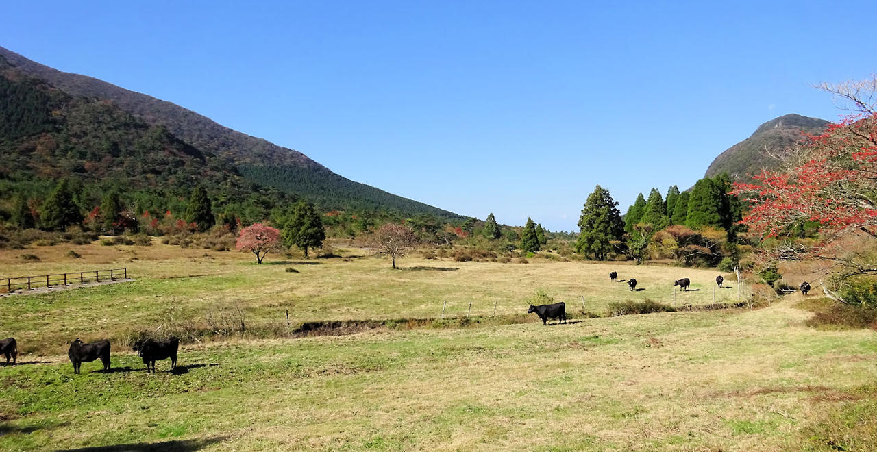
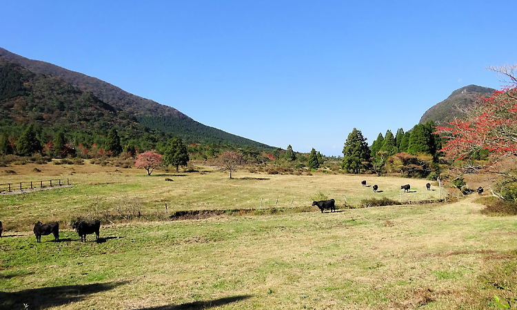
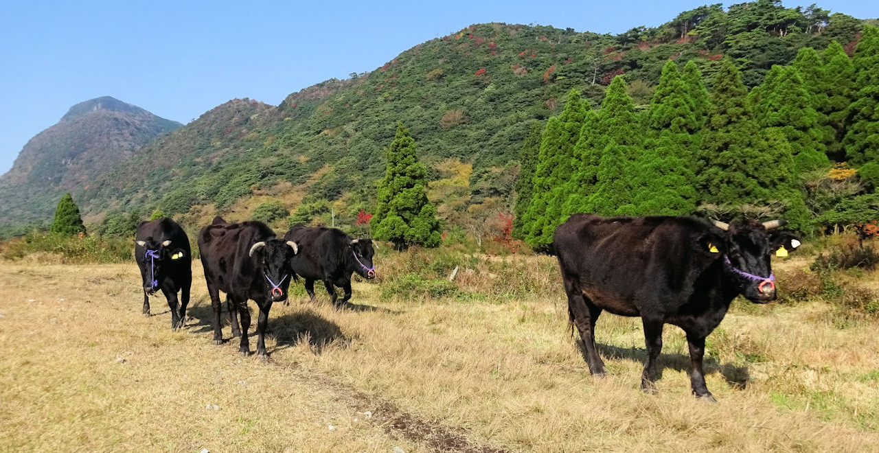
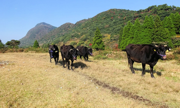
Tashirobaru grassland and range cattle
Tashirobaru Recreation Forest
61.73ha
Elevation Lowest: 610 m / Average: 610–640 m / Highest: 725 m (Mt. Kusenbu Summit: 1062 m)
Treasure chest of colorful natural splendor
―Walking the earth at Tashirobaru―
Treasure chest of colorful natural splendor
―Walking the earth at Tashirobaru―
- Newest information
- Area
- Activities
- Overview
- Latest Information
- Usage Guide
- Facility
- Map
- Location
- Access
(Distances and times are
provided as a guide only) - Management office
contact details - Information on Other Local
Tourist Attractions - Official Tourist Information
- Recreation Forest
Management Committee - Supporters
- Other
- Newest information
- CHECK
Please visit official tourism websites for the latest updates and information.
- Area
- Kyusyu
- Activities
- Flower-viewing (species: Kyushu azalea / Japanese dogwood)(Includes surrounding area) Autumn leaf viewing (Includes surrounding area) Birdwatching (Includes surrounding area) Picnics (lawn area/park) (Includes surrounding area) Paddling / fishing / boating (pond / lake / river) Guided tours (Outside the forest) (Payment required in some cases) Hands-on forestry / woodworking experience (Outside the forest) (Payment required in some cases) Shrine / Temple (Outside the forest)
- Overview
-
- Geographical/topographical features
- Tashirobaru Recreation Forest, located within the first national park designated in Japan, is also called Oku-Unzen. It is surrounded by mountains on three sides (Mt. Kusenbu, Mt. Azuma and Mt. Torikabuto) and range cattle graze in the central valley. It is a small highland area full of natural dynamism.
Certified as a UNESCO Global Geopark, it is a precious area where large-scale topographic changes can be seen with the naked eye. Shimabara Peninsula, once an island, became a peninsula when Unzen Volcano erupted about 500,000 years ago. Since then, it has experienced repeated topographic changes―becoming an island again and then a peninsula―due to three subsequent eruptions as well as the associated pyroclastic flows and volcanic earthquakes.
Today, it is known as a volcanic area where many volcanoes rise around one of the world's most active volcanoes, Mt. Unzen. The Tashirobaru Recreation Forest is located along the Chijiwa Fault, which was active 300,000 years ago. Even today, the entirety of Shimabara Peninsula inches southwards. - Historical/cultural features
- In the past, cattle were actively grazed on the mountains in the Unzen area. A type of azalea called Miyamakirishima (Kyushu azalea (Rhododendron kiusianum Makino))―a plant that cattle do not eat―began to proliferate in clusters that attracted a large number of tourists when in bloom (from late May through mid-June).
In recent years, however, the mountains have become overgrown with bushes and the Kyushu azalea have diminished as the amount of cattle grazing in the area has decreased. The only remaining grazing land is in the Tashirobaru Recreation Forest.
Today, efforts are being made, mainly by local people, to conserve Kyushu azalea through bush clearing and other manual work. Visitors can take in the precious natural beauty of these flowers, which are a product both of cattle grazing and diligent human conservation efforts.
There is also a path called "Tonosama Doro" (the path of lords) which is said to have been walked by Sakamoto Ryoma and Katsu Kaishu. By walking this path, you can see the same scenery and feel the same air as these great historical figures. - Climate, flora and fauna
- Cattle are grazed in the area from April through November.
Visitors can enjoy Kyushu azalea flowers in the spring, white Yamaboshi (Japanese dogwood (Cornus kousa Buerger ex Hance subsp. kousa)) flowers in the summer, colored leaves in the autumn and trees covered in frost in the winter.
As the elevation is high and the humidity is low, the area is also perfect for camping and for avoiding the heat in the summer. - Attractions
- In the surrounding area, Mt. Torikabuto (where the more than 1,300 year old Akaiwa Kannon is enshrined) rises in the east. Mt. Kusenbu rises in the south. Mt. Kusenbu is an important mountain for Shugendo (Japanese mountain ascetism) and the place where Gyoki Bosatsu is said to have trained before becoming involved in the construction of the Great Buddha of Nara. Mt. Azuma, where the Kodakara Kannon is enshrined, is in the northwest. Chijiwa Bay can be viewed in the distance toward the west, and in the center, there is a grazing pasture with an old path: the Tonosama Doro (path of lords), where Sakamoto Ryoma and Katsu Kaishu are said to have walked.
Major points of interest in the Tashirobaru Recreation Forest include captivating views along the road and chances to interact with nature. A drive from Sandoguchi on Pref. Route 210 in the direction of the central Shimabara Peninsula to the campsite is recommended as you can see pink Kyushu azalea flowers in the spring, fresh green leaves and white Japanese dogwood flowers in the summer, red- and yellow-colored leaves in the autumn, trees covered in pure-white frost in the winter and slowly grazing cattle during the grazing period.
In addition, the Kyushu Nature Trail, a campsite and a trail center for nature exploration are available, so visitors can easily enjoy trekking, camping, and nature observation. Visitors can have the inspirational experience of strolling along footpaths and interacting with nature during the day and watching millions of stars shining in the dark at night. - Other
- Historic sites, places of scenic beauty and natural monuments / National Park Class II special zone
- Latest Information
-
- Warnings (Dangerous areas)
- Caution is required as road surfaces freeze during the winter.
- Warnings (Flora and fauna)
- - Consideration should be given to cattle during the grazing period.
- Inoshishi (wild boar (Sus scrofa leucomystax)): If you see a boar, do not approach it. Be calm and move slowly away.
- Ticks: Please note that ticks. Wearing long sleeves and long trousers is recommended.
-Wasps: Beware of wasps, which are active from May through November.
- Usage Guide
-
- Entrance fee
- Free
- Operating hours and seasons
- Accessible 24 hours a day, 365 days a year.
- Staffed facilities such as administration buildings
- [Campsite]
8: 30 am - 5: 30 pm, May 1 through October 31 Closed on Thursdays - [Trail Center]
10: 00 am - 5: 00 pm, May 1 through November 30 Closed on Thursdays
* The center may close due to bad weather (e.g., a typhoon). Contact the Tourism and Products Division, Unzen Municipal Office. - Accommodation options
- [Inside the forest]
Tashirobaru Campsite (May through October / 15 tent sites)
[Outside the forest]
Unzen Onsen Resort (10 minutes by car), Obama Onsen Resort (25 minutes by car), private lodging (adjacent to the Recreation Forest), Yuugakunosato-kunimi (10 minutes by car)
- Facility
- Toilets and drinking fountains Walking trail : Kyushu Nature Trail (Includes surrounding area) Walking trail (accessible) Parking lot (Includes surrounding area) Observation platform (Includes surrounding area) Visitor center (staffed only)(Includes surrounding area) Shop (Outside the forest) Restaurant (Outside the forest) Campsite and/or cabins (Payment required for use of facilities and participation in activities) Resource center/Museum (Outside the forest)(Payment required for use of facilities and participation in activities) Cultural asset (nationally designated) (Includes surrounding area) Accommodation facilities (Hotels/Japanese inns) (Outside the forest) Hot Spring (Outside the forest) (Payment required for use of facilities and participation in activities)
- Map
- Location
- (Tashirobaru Camping Ground)
Chijiwachoko, Unzen City, Nagasaki Prefecture
- Access
(Distances and times are provided as a guide only) -
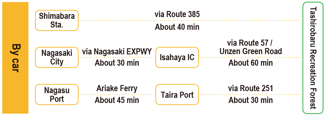
-
Parking lot capacity / parking charges- Free parking for 30 vehicles
- Nearby tourism facilities
- ・Unzen Onsen Resort (hot spring) (about 20 minutes by car)
- ・Obama Onsen Resort (about 50 minutes by car)
- ・Nita Pass (about 35 minutes by car)
- ・Shimabara Castle (about 45 minutes by car)
- Management office contact details
-
Staff in charge of Shinrin Fureai (forest interaction), Operations Group, Nagasaki Forest Administration OfficeTEL:0957-41-6911
- Information on Other Local Tourist Attractions
-
Unzen Tourist Association [External link]
- Official Tourist Information
-
Shimabara Tourism Board [External link]
- Recreation Forest Management Committee
-
Unzen Tashirobaru Recreation Forest Management CommitteeContact: Tourism and Products Division, Unzen Municipal Office
TEL:0957-38-3111
FAX:0957-38-3205
- Supporters
- ー
- Other
- ー
PDF形式のファイルをご覧いただく場合には、Adobe Readerが必要です。
Adobe Readerをお持ちでない方は、バナーのリンク先からダウンロードしてください。
![]()