


-
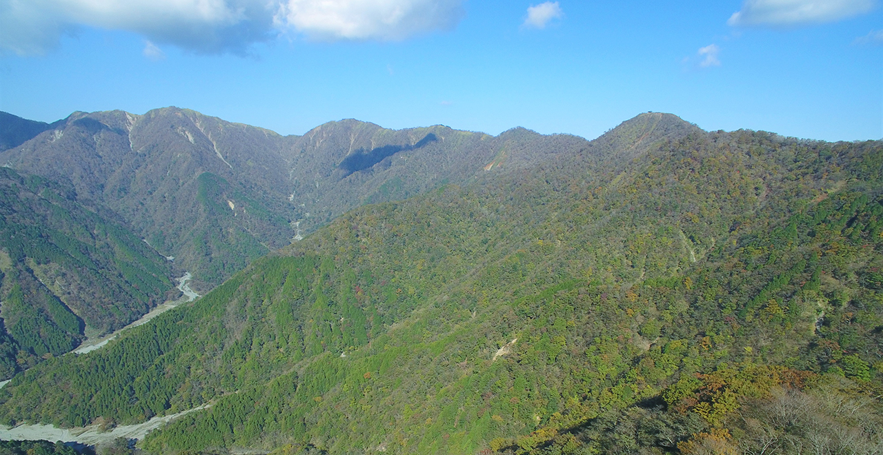
Mt. Hirugatake, Mt. Tanzawa, and Mt. Tonodake
-
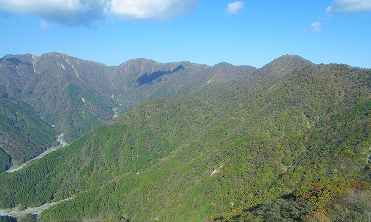
Mt. Tonodake and the ridgeline of Mt. Nabewari
-
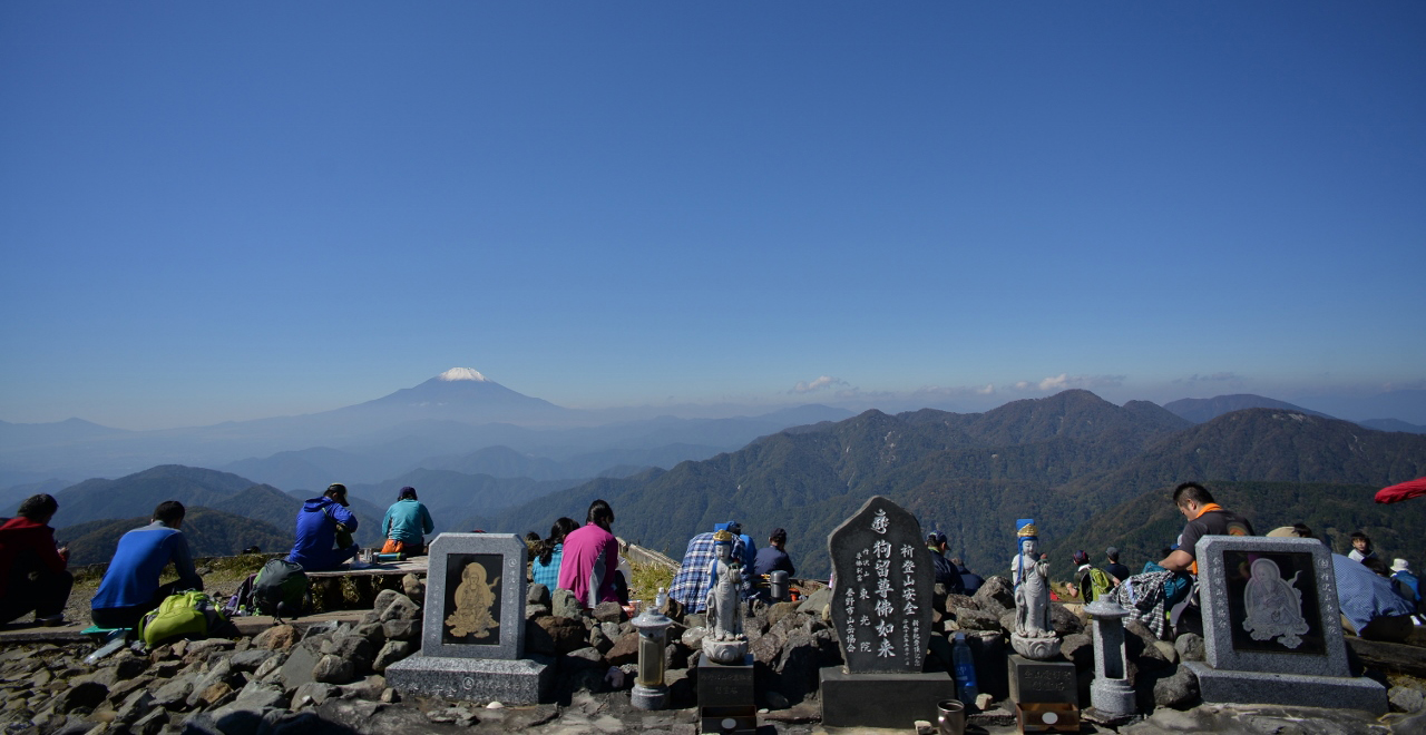
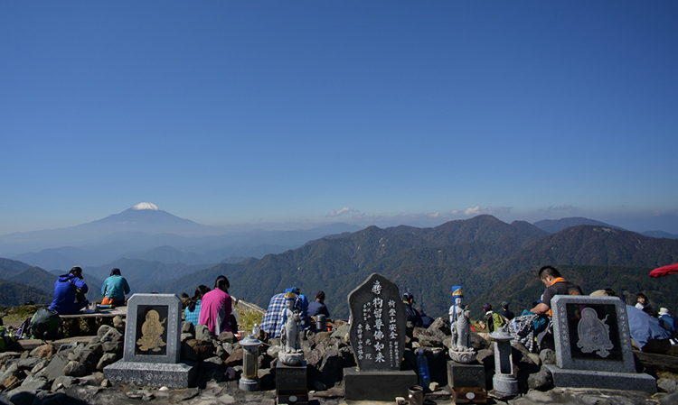
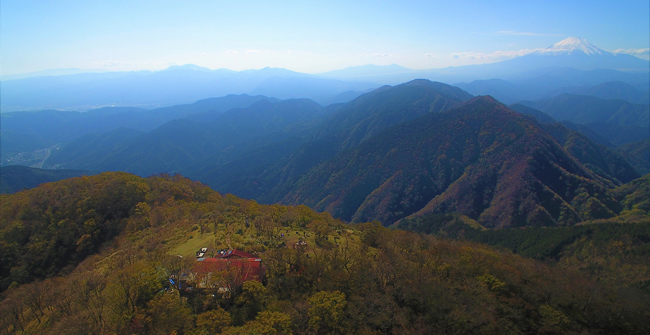
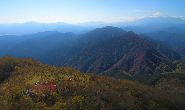
View of Mt. Fuji from the summit of Mt. Tonodake
-
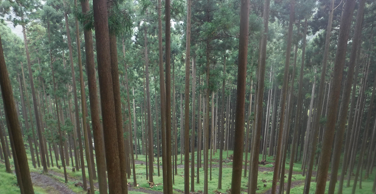
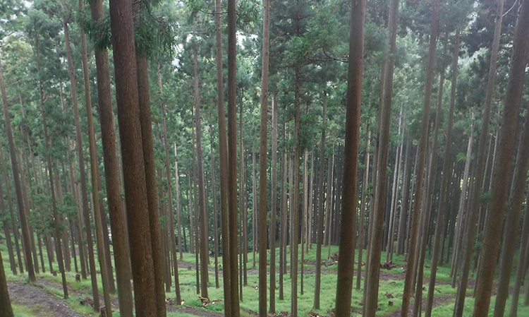
Planted Sugi (Japanese cedar (Cryptomeria japonica)) forest in the mist
-
Nabewari Sanso Lodge and Mt. Fuji
-
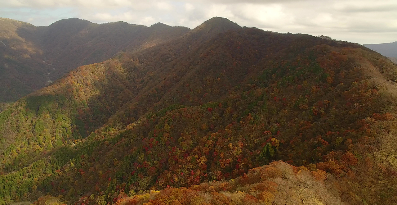
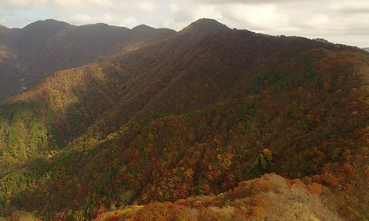
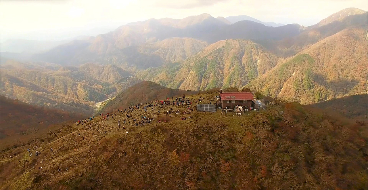
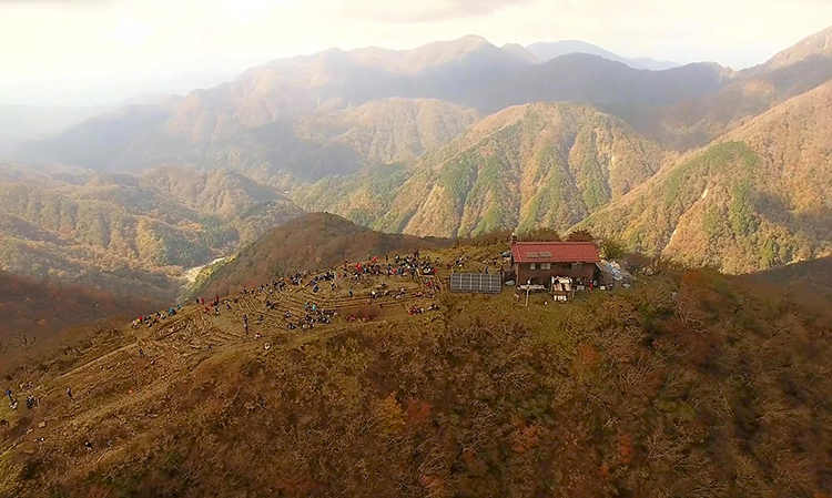
Nabewari Sanso Lodge and autumn colors
Tanzawa Recreation Forest
1,278.09ha
Elevation Lowest : 530m / Average : 700–1,200m / Highest : 1,490m
Tanzawa’s gentle natural beauty awaits,
with sunbeams streaming through the fresh green Buna tree leaves (Japanese beech (Fagus crenata Blume))
in early summer and the soft glow of multihued autumn leaves later in the year
Tanzawa’s gentle natural beauty awaits,
with sunbeams streaming through the fresh green Buna tree leaves (Japanese beech (Fagus crenata Blume))
in early summer and the soft glow of multihued autumn leaves later in the year
- Newest information
- Area
- Activities
- Overview
- Latest Information
- Usage Guide
- Facility
- Map
- Address
- Access
(Distances and times are
provided as a guide only) - Management office
contact details - Information on Other Local
Tourist Attractions - Official Tourist Information
- Recreation Forest
Management Committee - Supporters
- Other
- Newest information
- CHECK
Please visit official tourism websites for the latest updates and information.
- Area
- Kanto
- Activities
- Flower-viewing (cherry (Prunus)) (Outside the forest) Autumn leaf viewing (Includes surrounding area) Waterfall viewing (Outside the forest) Birdwatching (Includes surrounding area) Picnics (lawn area/park) (Outside the forest) Mountain climbing (Includes surrounding area) Paddling (river) (Includes surrounding area) Canyoning (River trekking) (Outside the forest) Bicycle rental (Outside the forest) Hands-on forestry / woodworking experience (Outside the forest) Forest therapy (therapy center) (Outside the forest) Hot Spring : Tsurumaki Onsen, Nakagawa Onsen (Outside the forest) Botanical garden (Outside the forest) Shrine / Temple visit (Outside the forest)
- Overview
-
- Geographical/topographical features
- This area is located in northwestern Kanagawa Prefecture. Although it is in the Tokyo suburbs, a virgin forest still remains. The rich forest, the eroded rocks distinctive of the Tanzawa Massif, steep valleys and numerous waterfalls are wonderfully harmonious and provide tourists with varied seasonal experiences.
- Historical/cultural features
- Roben Shonin, the first head priest of the Todaiji Temple in Nara, founded a temple in this area in the middle of 8th century. The Tanzawa massif has been a training ground for hermits and ascetics and a sacred place for mountain worship ever since. Worshippers actively made pilgrimages, particularly to Mt. Tonodake and Mt. Oyama, which were centers of mountain worship.
Because of this, many mountain names and place names in this area are related to religion, such as Mt. Gyoja, Mt. Sonbutsu, Yakushi, Bodai and Orondo. - Climate, flora and fauna
- This area is close to the Sagaminada Sea and has a maritime climate in which fog occurs very frequently. Fog sometimes forms in the morning even on sunny summer days. The average temperature is around 15°C at the foot of the mountains, 12–13°C midway up the slopes of the mountains, and a very low 7°C at their summits.
The area is home to temperate and warm temperate vegetation. Evergreen broad-leaved trees, such as live (evergreen) oak and Sudashii (Castanopsis sieboldii), and conifers such as Momi (fir (Abies firma)) and Tsuga (Japanese hemlock (Tsuga sieboldii)) grow in some low-elevation areas, while Buna (Japanese beech (Fagus crenata Blume)), Mizunara (Japanese oak mizu-nara (Quercus crispula Blume) and maple (Acer) grow in higher-elevation areas.
A variety of animals inhabit the area, including Nihonjika (shika deer (Cervus nippon)), Nihon Zaru (Japanese macaque (Macaca fuscata)), Nihon Kamoshika (Japanese serow (Capricornis crispus)) and Tsukinowaguma (Asian black bear (Ursus thibetanus)). While the number of shika deer has grown too large and there is a need to reduce their numbers, only around 30 Asian black bears live throughout the Tanzawa Mountains and they are in danger of extinction. - Attractions
- This area features a beautiful virgin forest with abundant tree species and magnificent views from the Tanzawa Mountains. The view of the vast Kanto Plain spreading to the east, the deep-blue Pacific Ocean to the south and sacred Mt. Fuji rising in the west is majestic and stunning.
A growing number of tourists have in recent years begun visiting this area not only to experience nature and for camping and hiking, but also for serious trekking. - Other
- The natural springs of the Hadano Basin at the foot of the mountains have been chosen as one of Japan's 100 Selected Water Spots. The Gomayashiki water spot, Kuzuha water spot and Ryujin spring are particularly famous, as is the Kobo spring near Hadano Station, which has a legendary association with famous Buddhist monk Kobo Daishi.
- Latest Information
-
- Regular events
- ・Hadano Tanzawa Festival (April)
・Tsurumaki Onsen Spring Festival (April)
・Tanzawa Yamamori Festival (August) - Warnings (Flora and fauna)
- Nihonyamabiru (land leech (Haemadipsa zeylanica japonica)): Please be careful to avoid land leeches from April through November, particularly on or after a rainy day.Wearing long sleeves and long trousers is essential.
Mushrooms: Some of the mushrooms that grow in the forest are poisonous. Do not attempt to select and eat wild mushrooms yourself under any circumstances. - Warnings (Dangerous areas)
- Some mountain trails can be treacherous in places, so please exercise caution while walking.
- Usage Guide
-
- Entrance fee
- Free of charge
- Opening seasons and hours
- Accessible 24 hours a day, 365 days a year
- Accommodation options
- [Inside the forest] Sonbutsu Sanso, Hanatate Sanso, Nabewari Sanso, and Kinomata Goya
[Outside the forest] Hirugatake Sanso, Miyama Sanso, Aogatake Sanso, and Tsurumaki Onsen (3 facilities)
- Facility
- Toilets and drinking fountains (Includes surrounding area) : Several mountain huts Toilet (accessible) (Outside the forest) Footpath / walking trail / nature trail (Includes surrounding area) : Several mountain trails Walking trail (accessible) (Outside the forest) Parking lot (Outside the forest) Observation platform (Outside the forest) Visitor center (staffed only) (Outside the forest) Vending machine (Outside the forest) Shop (Outside the forest) Restaurant (Outside the forest) Campsite and/or cabins (Outside the forest) Free public wireless LAN (Wi-Fi) (Outside the forest) Botanic garden (Outside the forest) Resource center (Outside the forest) World Heritage Site / Cultural asset (nationally designated) (Outside the forest) Accommodation facilities (Hotels/Japanese inns) (Outside the forest)
- Map
- Address
- Kurokura, Yamakita Town, Ashigarakami Country, Kanagawa Prefecture / Mikurube 2, Hadano City, Kanagawa Prefecture
- Access
(Distances and times are provided as a guide only) -
- By public transport
-
<Access from nearest railway station / bus stop>
- Okura bus stop (Kanagawa Chuo Kotsu) → about 110 minutes on foot (4.8 km)
<Access from major transport hubs to nearest railway station / bus stop>- Shinjuku Station → (Odakyu Odawara Line, 74 minutes by rapid express) → Shibusawa Station (15 minutes by Kanagawa Chuo Kotsu bus) → get off at the Okura bus stop
- By car
-
<Access>
- Tokyo Station → Tomei Expressway (Hadano Nakai IC) → (public road: 30 minutes) → a parking lot near the Okura bus stop
<Car parking capacity / parking charges>・Okura Parking Lot: Parking for 150 ordinary vehicles
・Mizunashigawa Parking Lot: Parking for 75 ordinary vehicles
・Suwamaru Parking Lot: 77 ordinary vehicles
* Free parking for the first 30 minutes in all of the above parking lots - Nearby tourist facilities
-
- ・Tsurumaki Onsen hot springs: 31 minutes by car from the Okura bus stop. Slightly alkaline chloride springs. The water of these hot springs is said to have the highest concentration of calcium ions in the world, comparable to cow milk.
- ・Yabitsu Pass: 37 minutes by car from the Okura bus stop. The pass is very popular with hikers on holidays because of the Kanagawa Chuo Kotsu bus route to Yabitsu Pass from Hadano Station on the Odakyu Odawara Line and mountain trails leading to Mt. Tonodake (Omote ridge) and Mt. Oyama from the pass.
- ・Mt. Oyama: 41 minutes by car from the Okura bus stop. Mt. Oyama has been regarded as a sacred mountain since ancient times, and Jomon pottery from the Mesolithic period believed to have been used for rituals has been excavated at its summit. Because clouds and fog often formed on the mountain and brought rain, Mt. Oyama was also referred to as "amefuri" (rainy) mountain, and people prayed to it for rain.
- Management office contact details
-
Tokyo/Kanagawa District Forest OfficeTEL:0463-32-2867
https://www.rinya.maff.go.jp/kanto/tokyo_kanagawa/index.html
- Information on Other Local Tourist Attractions
-
Yamakita Town Tourism Association [External link]
- Official Tourist Information
-
Hadano City Tourism Association [External link]
- Recreation Forest Management Committee
- ー
- Supporters
- ー
- Other
- ー
PDF形式のファイルをご覧いただく場合には、Adobe Readerが必要です。
Adobe Readerをお持ちでない方は、バナーのリンク先からダウンロードしてください。
![]()