


-
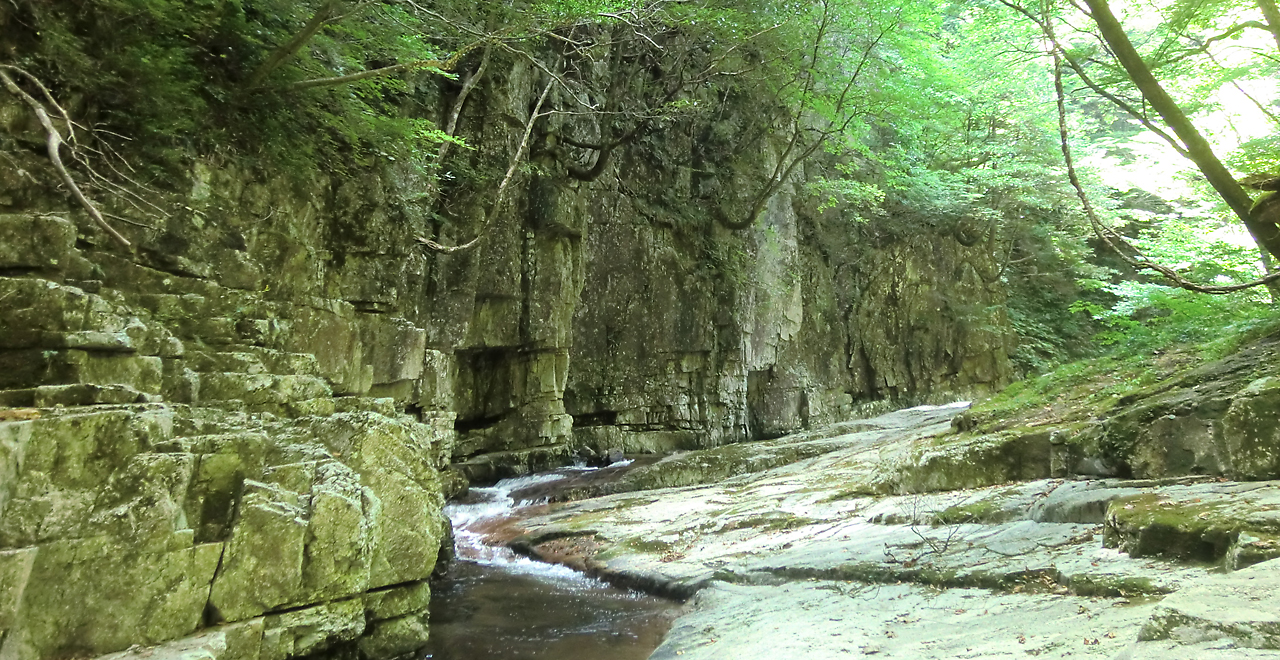
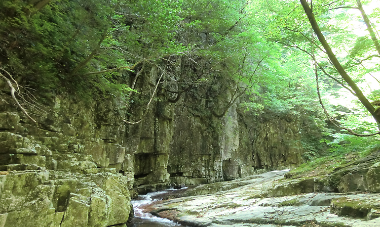
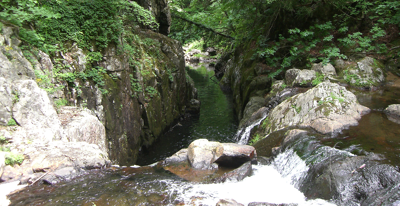
Breathtaking scenery of Sandankyo Gorge lined with unusually shaped rocks
-
Sandankyo Gorge
-
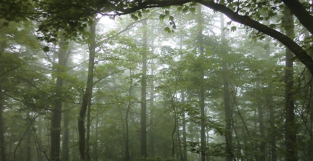
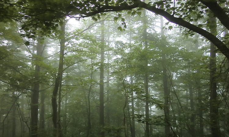
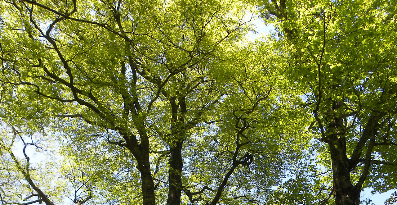
Misty forest
-
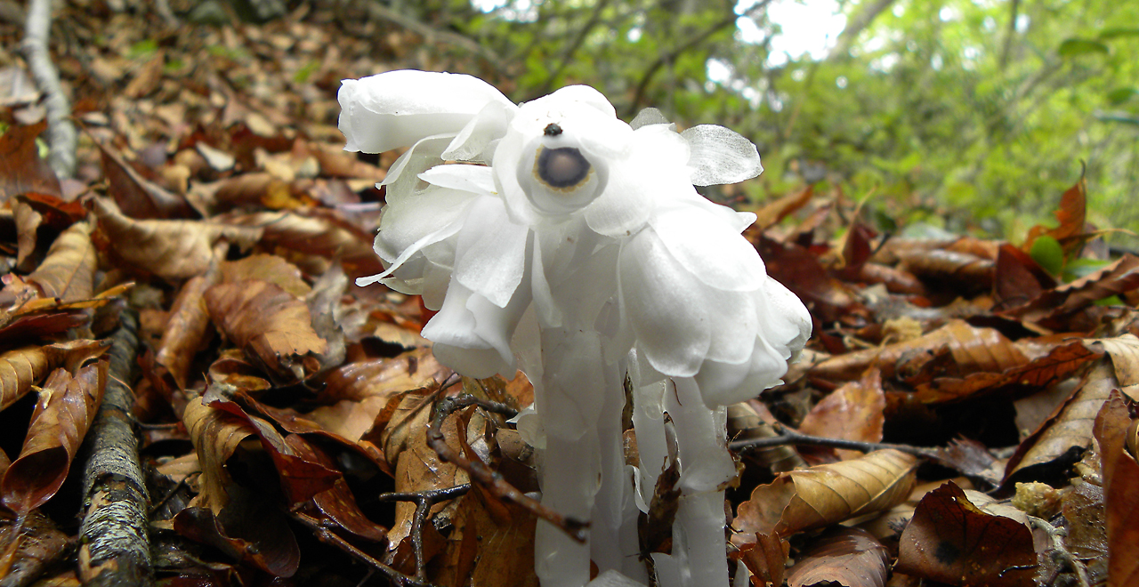
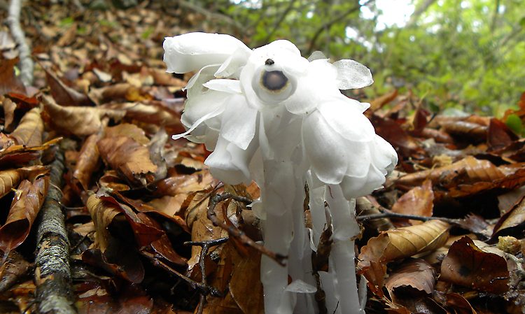
Fascinating flowers of Ginryoso
-
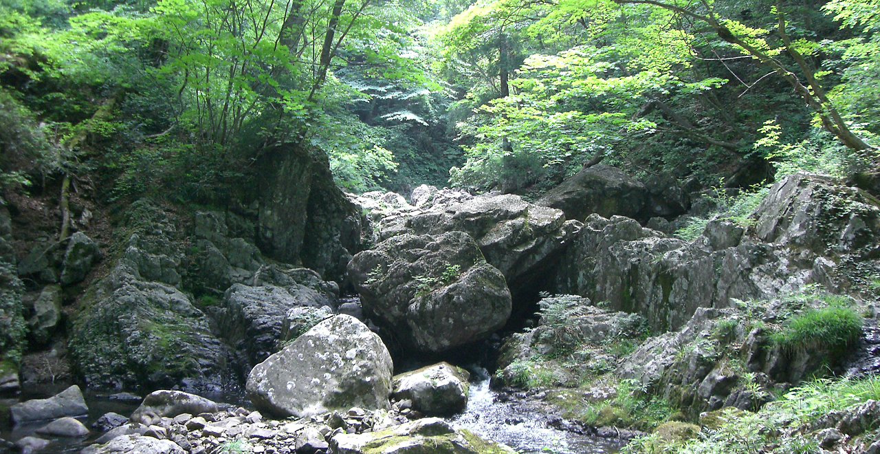
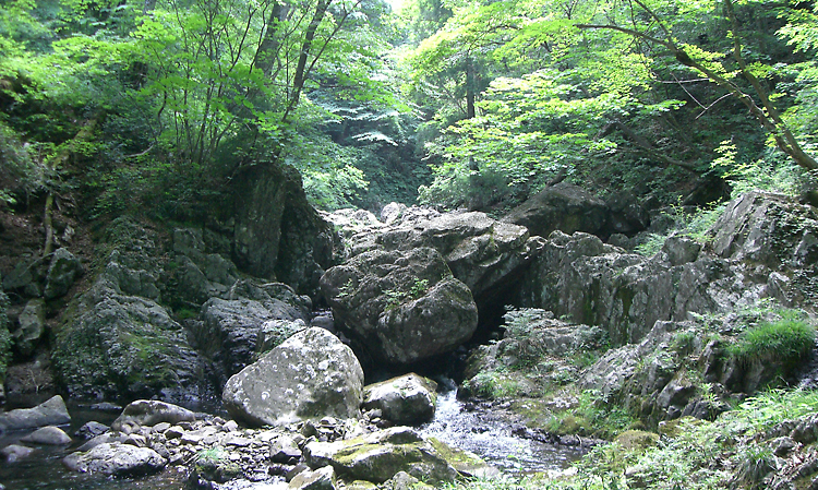
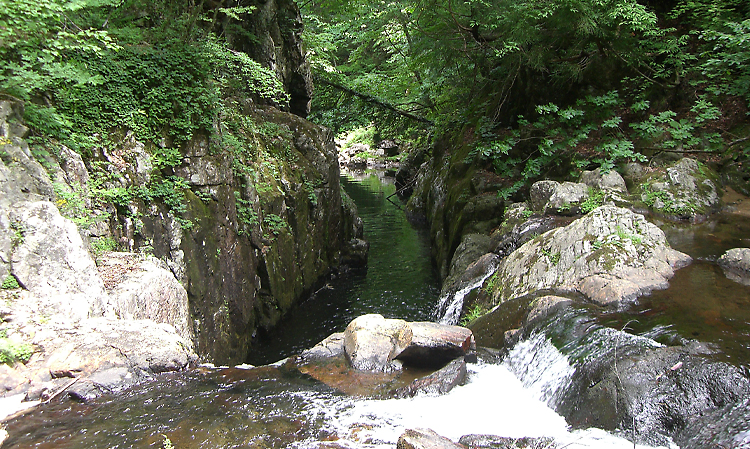
Sandankyo Gorge
-
Osorakan in early summer
-
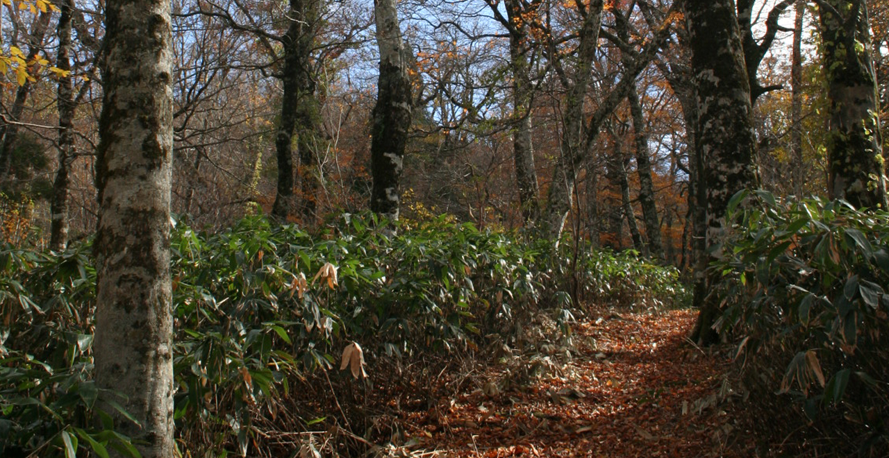
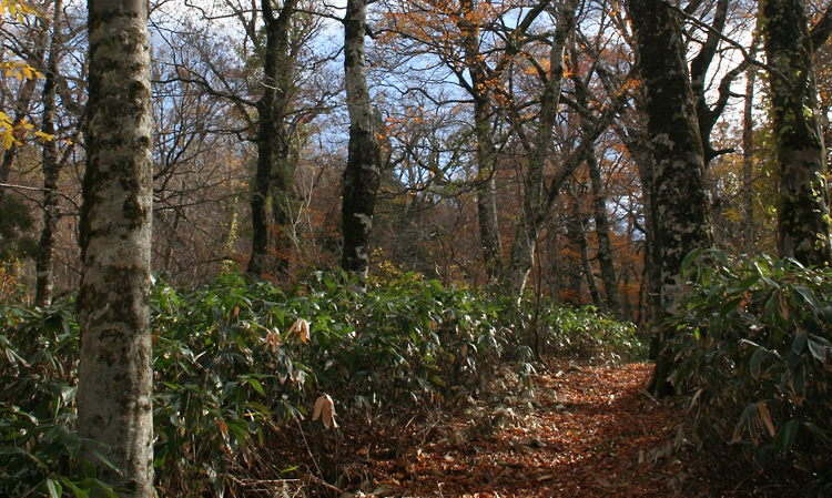
Osorakan in autumn
-
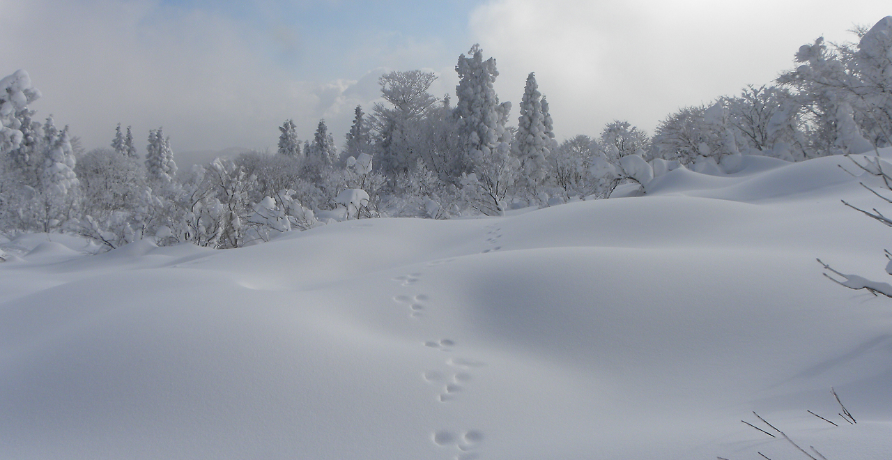
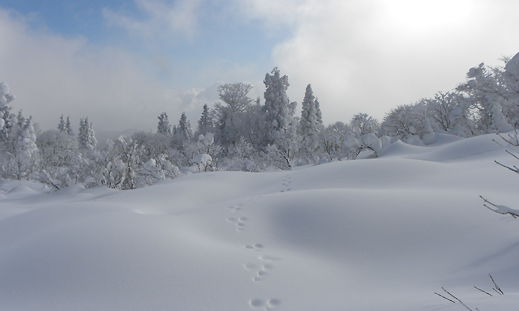
Snowscape
-
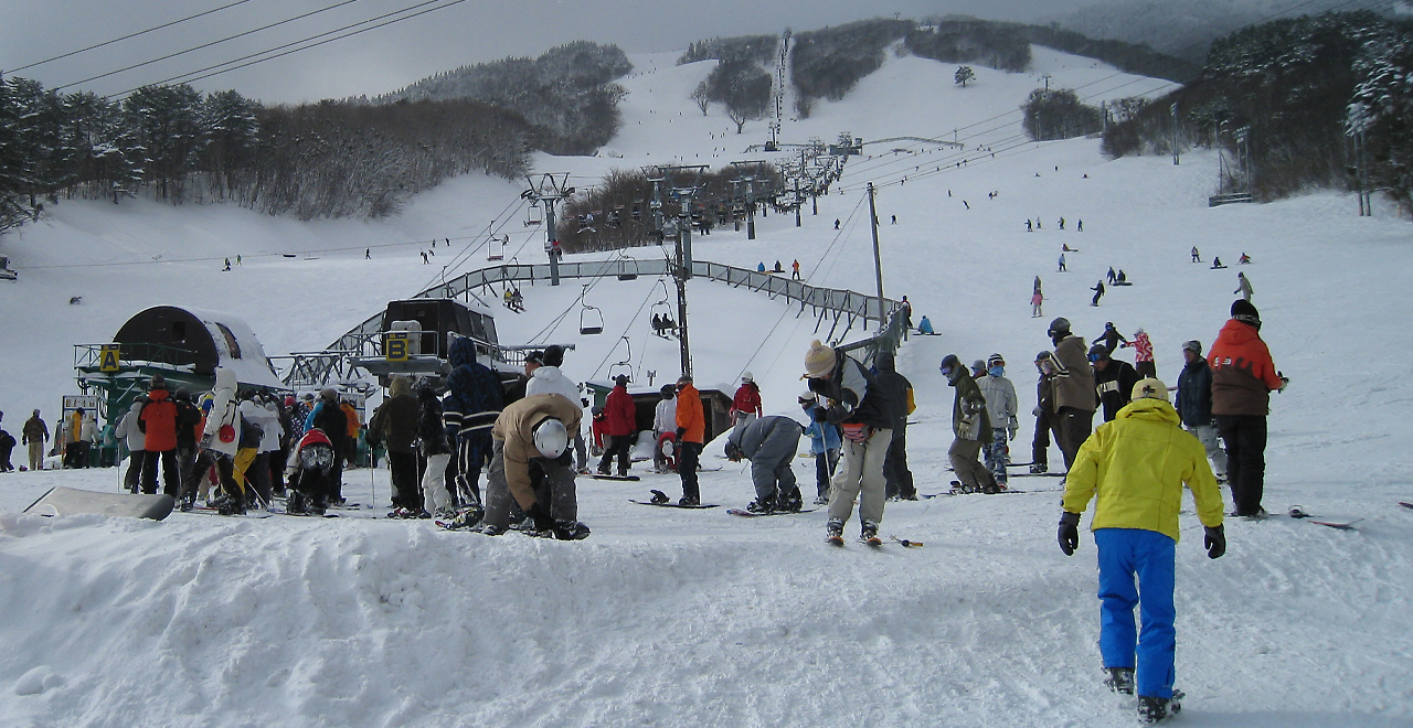
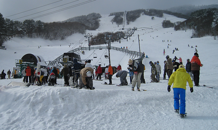
Osorakan Snow Park (Ski Area)
Osorakan-Hosomi-kyo Recreation Forest
1,373.15ha (Osorakan District: 442.30 ha, Hosomi-kyo District: 950.85 ha)
Elevation Lowest: 520 m / Average: 800–1,300 m / Highest: 1,346 m
Come to Osorakan for year-round mountain activities
Come to Osorakan for year-round mountain activities
- Newest information
- Area
- Activities
- Overview
- Latest Information
- Usage Guide
- Facility
- Map
- Location
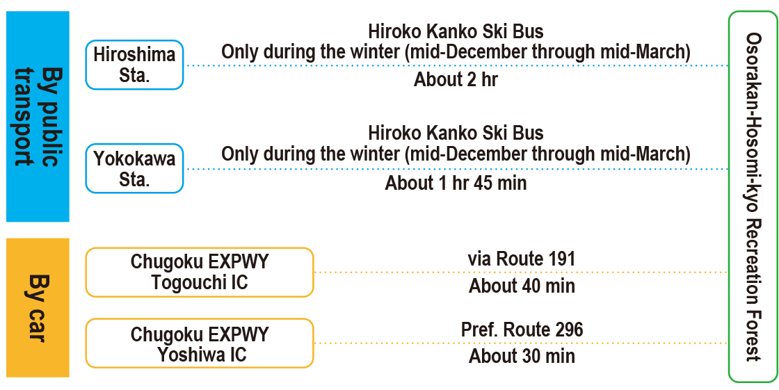
- Access
(Distances and times are
provided as a guide only) - Management office
contact details - Information on Other Local
Tourist Attractions - Official Tourist Information
- Recreation Forest
Management Committee - Supporters
- Other
- Newest information
- CHECK
Please visit official tourism websites for the latest updates and information.
- Area
- Kinki Chugoku
- Activities
- Flower-viewing(species: Sakura (cherry (Prunus)), Momo (peach (Prunus persica)) and Rengyo (Forsythia suspensa Vahl)) (Includes surrounding area) Autumn leaf viewing (Includes surrounding area) Waterfall viewing (Outside the forest) Birdwatching (Includes surrounding area) Picnics (lawn area/park) (Includes surrounding area) Paddling / fishing / boating (pond / lake / river) (Includes surrounding area) Canyoning (River trekking) (Outside the forest) Bicycle rental (Outside the forest) Hands-on forestry / woodworking experience (Outside the forest) Forest therapy (therapy center) (Outside the forest) Ski resort (no. of trails: 11) (Includes surrounding area) Hiroshima Osorakan Trail (Includes surrounding area)
- Overview
-
- Geographical/topographical features
- [Osorakan District]
The district is part of the Nishi-Chugoku Sanchi Quasi-National Park and encompasses Mt. Osorakan (1,346 m), which straddles the border between Hiroshima and Shimane Prefectures. Its summit is the highest peak in both prefectures.
[Hosomi-kyo District]
The district is part of the Nishi-Chugoku Sanchi Quasi-National Park. It also includes the Hosomi Valley to the west of Mt. Jippo (1,318 m), a high peak near the border between Hiroshima and Shimane Prefectures. It has so many gorges that it has been referred to as the place of "808 valleys." Despite the steep landscape, the area is a popular mountain stream fishing spot. - Historical/cultural features
- [Osorakan District]
The Osorakan District flourished as one of Japan's largest iron production areas until around the mid-1950s. The major iron production method used was Japan's traditional manual method called tatara iron making.
In this method, iron-sand and charcoal were placed in a clay furnace that was kept burning for three days and nights while a constant amount of wind was continuously fed into it.
This required a tremendous amount of charcoal and manpower. The sites where wood for the charcoal was logged can be seen today in the terraced fields and along the Osorakan Trail. - Climate, flora and fauna
- [Osorakan District]
The district is covered by a vast primeval forest of Buna (Japanese beech (Fagus crenata Blume)), Mizunara (Japanese oak mizu-nara (Quercus crispula Blume)) and Tochinoki (Japanese horse chestnut (Aesculus turbinata Blume)).
In May, 120,000 Suisen (daffodil (Narcissus sp.)) color the ski slopes of the Osorakan Snow Park, and Mt. Osorakan is opened to hikers.
[Hosomi-kyo District]
The district has a picturesque gorge where streams contrast with early-summer green or autumn red and yellow leaves of Japanese beech, Japanese oak mizu-nara, Mizume (Japanese cherry birch (Betura grossa)) and Katsura (katsura trees (Cercidiphyllum japonicum Siebold et Zucc. ex Hoffm. et Schult.).
The district is also the southernmost habitat for Tsukinowaguma (Asian black bear (Ursus thibetanus)) on the island of Honshu. - Attractions
- Akiota Town's "Forest Therapy Base" (Therapy Road) is found at the foot of Mt. Osorakan, the highest peak in both Hiroshima and Shimane Prefectures. The base offers various therapy programs, including snow-covered mountain forest therapy using snow (the ski area) in the winter.
The Osorakan Snow Park is a ski area with 100% natural snow. Visitors can enjoy skiing, snowboarding and various other thrilling snow activities.
The vast ski slopes, with an elevation difference of 420 m, have 8 chair lifts and 11 trails and offer a perfect snow experience for skiers and snowboarders of all levels.
The snow park also has a family zone where small children can have fun in the snow safely. In addition, mystic frost-covered trees can be seen on the higher ski slopes.
The Osorakan Ecology Campsite is the highest-elevation campsite in Hiroshima Prefecture.
It is fully equipped with cabins and an auto-camping site, making it easy to enjoy camping. The site also offers a variety of outdoor activities, such as zip-lining.
In Hosomi-kyo, visitors can stroll in the forest and explore nature as they camp, trek and hike in the cool air.
Meanwhile, Hosomi Gorge is known as a hidden spot perfect for mountain stream fishing for Yamame (masu salmon (Oncorhynchus masou masou)) and Iwana (Japanese char (Salvelinus leucomaenis subspp.)), attracting many fishing enthusiasts from local areas and also from outside the prefecture. - Other
- [Hosomi-kyo District]
The district has the Tateno Campsite, which is about 15 minutes by car from Yoshiwa IC on the Chugoku Expressway. Anyone can use the campsite free of charge, but an advance reservation is required. 30 tent sites, a field kitchen and public toilets are available. The district’s other facilities include an observatory and a trail shelter.
- Latest Information
-
- Information on temporarily unavailable facilities
- [Osorakan District]
Please check the website.
AKIOTAKARA [External link] - [Hosomi-kyo District]
Please check the website.
Hatsukaichi Tourism Association [External link] - Warnings (Dangerous areas)
- The Jippozan (Hosomidani) Forest Road is currently impassable.
- Usage Guide
-
- Entrance fee
- Free
- Operating hours and seasons
- Accessible 24 hours a day, 365 days a year.
- Staffed facilities such as administration buildings
- Please refer to the information at [External link]
- Accommodation options
- [Osorakan District]
5 pensions and Japanese inns (3 of which only operate during the winter), campsites (500 m at the nearest, 10 minutes) - [Hosomi-kyo District]
3 accommodation facilities at Yoshiwa, Hatsukaichi City
- Facility
- Toilets and drinking fountains (Includes surrounding area) Walking trail (Includes surrounding area) Bike trail (Outside the forest) Parking lot (Includes surrounding area) Vending machine (Includes surrounding area) Shop (Includes surrounding area) Restaurant (Includes surrounding area) Campsite and/or cabins (Includes surrounding area) Accommodation facilities (Hotels/Japanese inns) (Outside the forest)
- Map
- Location
- Akiota Town, Yamagata County, Hiroshima Prefecture (Osorakan District)
Yoshiwa, Hatsukaichi City, Hiroshima Prefecture (Hosomi-kyo District)
- Access
(Distances and times are provided as a guide only) -
-
Parking lot capacity / parking charges- [Osorakan District]
Free parking for 1,700 vehicles
- [Osorakan District]
- Nearby tourism facilities
- Sandankyo Gorge (a 16 km-long gorge nationally designated as a special place of scenic beauty with scenery representative of Nishi-Chugoku Sanchi Quasi-National Park): 15 minutes by bus from Chugoku Expressway Togouchi IC.
- Get off at the Sandankyo bus stop and walk 10 minutes.
- Management office contact details
-
Hiroshima District Forest OfficeTEL:082-247-2201
- Information on Other Local Tourist Attractions
- ー
- Official Tourist Information
-
[Osorakan District]
AKIOTA City Management Inc. [External link][Hosomi-kyo District]
Hatsukaichi Tourism Association Website[External link]
- Recreation Forest Management Committee
- ー
- Supporters
- ー
- Other
- ー
PDF形式のファイルをご覧いただく場合には、Adobe Readerが必要です。
Adobe Readerをお持ちでない方は、バナーのリンク先からダウンロードしてください。
![]()