


-
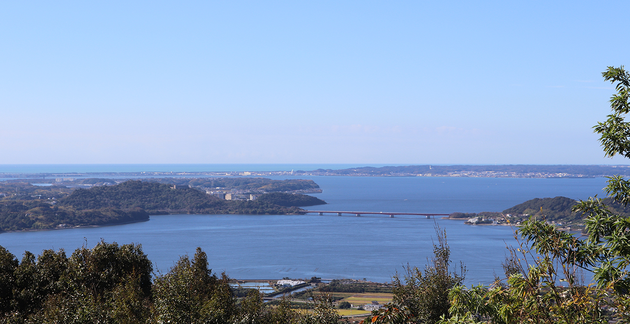
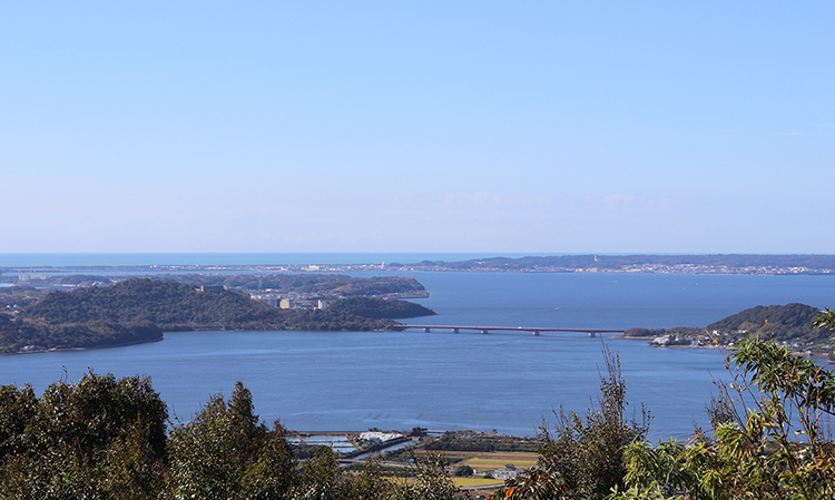
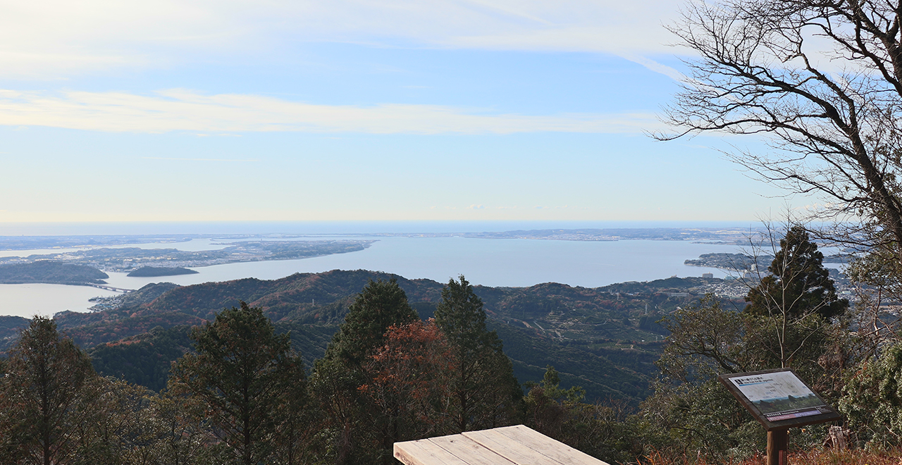
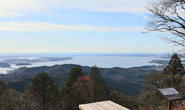
View of Lake Hamana and the Enshunada Sea from the Nisangatsu Pass observation platform
-
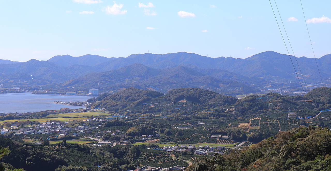
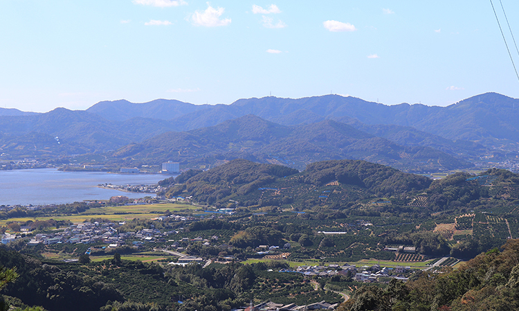
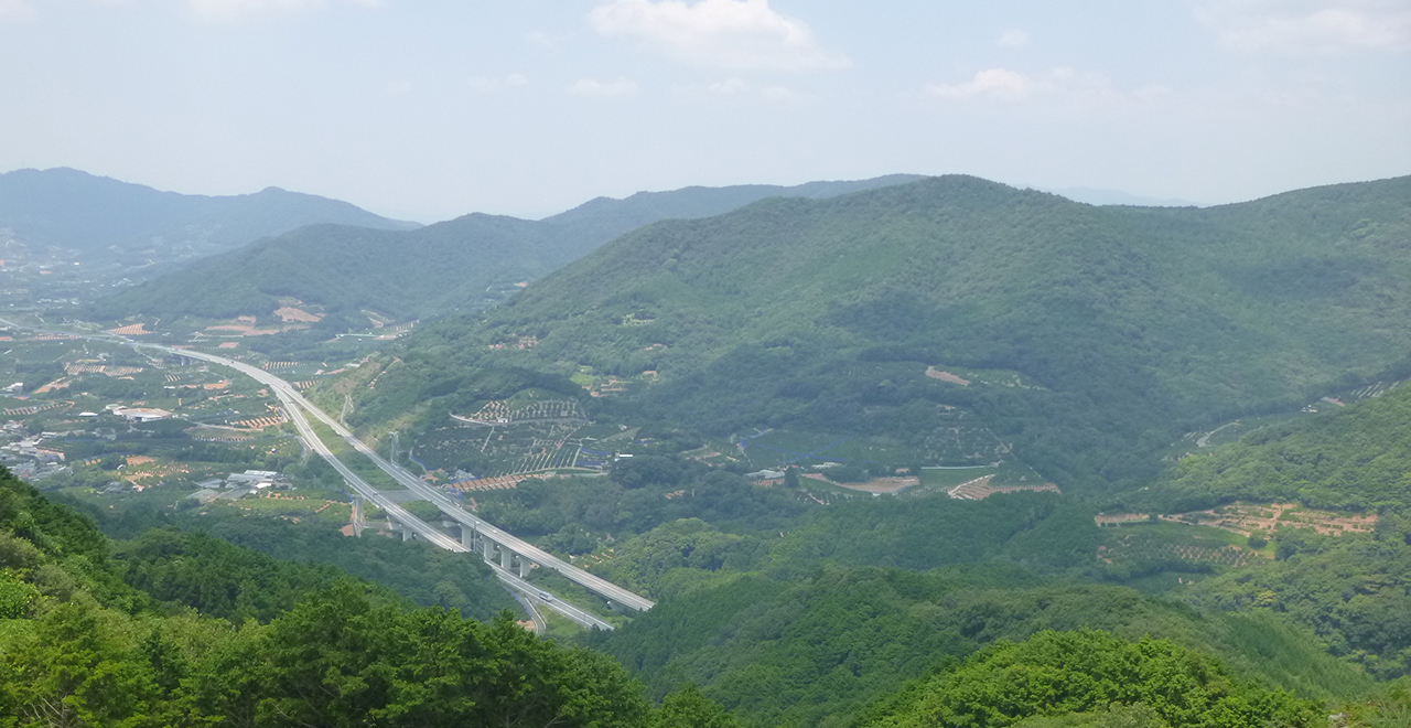
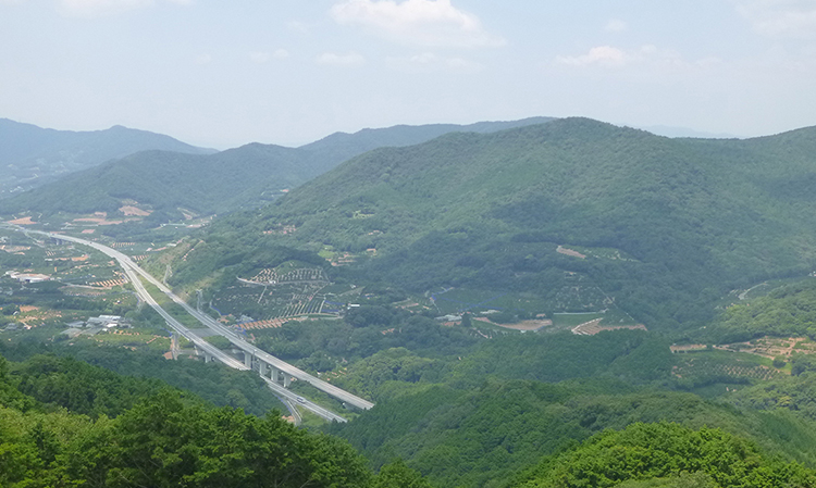
A commanding view of Mikkabi Town from the Sakume Course
-
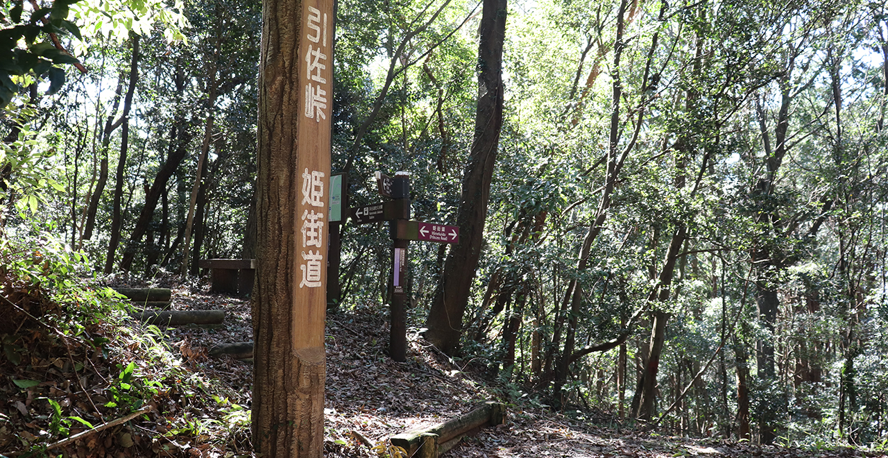
Inasa Pass
-
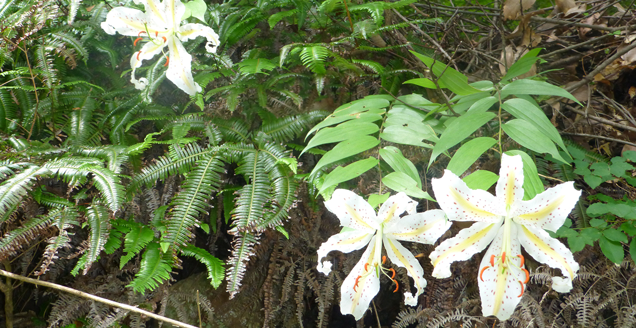
Yamayuri (golden-rayed lilies (Lilium auratum)) blooming on Mt. Tonmaku
-
Looking out over Lake Hamana from Mt. Jogamine
-
Distant view from the footpath of the Kazakoshi Pass
Okuhamana Recreation Forest
1,112ha
Elevation Lowest : 70m / Average : 70–563m / Highest : 563m (Mt. Tonmaku)
Enjoy a variety of mountain hiking courses and the mirror-like beauty of Lake Hamana
― Forest with a mild climate and among the most annual hours of sunlight in Japan ―
Enjoy a variety of mountain hiking courses and the mirror-like beauty of Lake Hamana
― Forest with a mild climate and among the most annual hours of sunlight in Japan ―
- Newest information
- Area
- Activities
- Overview
- Latest Information
- Usage Guide
- Facility
- Map
- Address
- Access
(Distances and times are
provided as a guide only) - Management office
contact details - Information on Other Local
Tourist Attractions - Official Tourist Information
- Recreation Forest
Management Committee - Supporters
- Other
- Newest information
- CHECK
Please visit official tourism websites for the latest updates and information.
- Area
- Kanto
- Activities
- Flower-viewing (Flower viewing (cherry (Prunus), Ume, Japanese apricot (Armeniaca mume (Siebold et Zucc.) de Vriese), etc.)) : Okuyama Highlands / Okuyama Park / cherry blossoms along the Miyakoda River dikes / Shiroyama Park, etc. (Outside the forest) Autumn leaf viewing (Includes surrounding area) : Okuyama Course, etc. Waterfall viewing : Sengan Falls, Fudo Falls (Outside the forest) Birdwatching (Includes surrounding area) : Sakume Course, Hosoe Course Picnics (lawn area/park) (Includes surrounding area) : Ruins of Bankyoji Temple, Okuhamanako Tenbo Park Mountain climbing (Includes surrounding area) Paddling / fishing / boating (lake / river) (Outside the forest) (Payment required for use of facilities and participation in activities) Cycling (cycle path) (Outside the forest) Bicycle rental : Kiga Station / Mikkabi Station / Kanasashi Station (Outside the forest) Guided tours (Includes surrounding area) : Tours hosted by Okuhamanako Tourism Association, etc. Hot Spring (Outside the forest) : Kanazanji Hot Spring / Mikkabi Hot Spring Botanical garden (Outside the forest) : Hamanako Garden Park (free), Hamamatsu Flower Park (paid entry), Hamamatsu Fruit Park Tokinosumika (paid entry) Shrine / Temple visit (Outside the forest) : Kohoku Gozan including Ryotanji Temple / Mitake Castle / Suzuki Residence / Hamana Sosha Shinmeigu Shrine / station buildings of the Tenhama Line, etc.
- Overview
-
- Geographical/topographical features
- The Okuhamana Recreation Forest is located north of Lake Hamana in western Shizuoka Prefecture. It is a gently sloping, hilly area with elevations ranging from 70 m to 563 m, and is part of the Akaishi Mountains. The hills run like folding screens behind Lake Hamana.
- Historical/cultural features
- The Okuhamanako area, which contains the Okuhamana Recreation Forest, has been referred to as a place of retreat for Enshu (an old province in western Shizuoka Prefecture). The base of the hills, which open up toward Lake Hamana with Mt. Mitake (468 m), Mt. Tonmaku (563 m) and the mountains of the Inasa, Hosoe, Mikkabi and Kosai areas rising behind, is full of historical and cultural resources, such as famous temples, parks and historical paths, that are sure to pique your historical and cultural curiosity. In addition, visitors can hike through all of the mountains’ various seasons because the area has a mild climate optimal for hiking and among the most annual hours of sunlight in Japan.
The Hime Kaido is a historical path that has attracted attention in recent years. It was a 60 km side route of the Tokaido Road, one of the five major routes in the Edo period, which connected the traveler stations Mitsuke-juku (Iwata City) and Goyu-shuku (Toyokawa City) by detouring around the northern shore of Lake Hamana and using the Honsaka Pass. Many historical sites remain along the path, including the Kiga Sekisho (Kiga Barrier) and milestones.
The Inasa Pass, at an elevation of 200 m, is particularly rich in historical features. For example, a stone-paved path that intersects with the Okuhamana Nature Trail recalls bygone days. There is also a slope called "Zonakizaka" (elephant roaring slope). It is said that in 1729, when an elephant brought from Annam (currently Vietnam) to be presented to then-shogun Yoshimune walked the Hime Kaido on its way from Dejima in Nagasaki to Edo, it had difficulty walking on this extremely steep slope and roared in protest.
Furthermore, you can find many historical sites related to Ii Notora (the head of the Ii clan) where the shooting of NHK Taiga Drama "Onna Joshu Naotora" (Naotora: The Lady Warlord) took place. Among them, the "Kohoku Gozan" (Five Temples North of the Lake) hold nationally designated important cultural properties. One of the five is Ryotanji Temple, Ii Naotora's family temple. These old temples vividly convey the ancient culture of the Okuhamanako area from the Heian Era (794 to 1185 CE) and the Edo Era (1693 to 1868 CE) to the present day. - Climate, flora and fauna
- The area has a mild climate distinctive to the Pacific side off Japan. In the winter, a dry, cold, strong north-westerly wind blows, commonly called the "Enshu Karakkaze" (dry wind of Enshu).
About 90% of the total area of the Recreation Forest is a planted forest consisting of Sugi (Japanese cedar (Cryptomeria japonica)) and Hinoki (Japanese cypress (Chamaecyparis obtuse)). However, the Recreation Forest has abundant vegetation, including conifers such as Akamatsu (Japanese red pine (Pinus densiflora)) and Kuromatsu (Japanese Black Pine (Pinus thunbergii)), evergreen broad-leaved trees such as Shiinoki (chinquapin trees (Castanopsis)), live (evergreen) oak and Tsubaki (Theaceae), and deciduous broad-leaved trees such as Konara (Quercus serrata), Kuri (chestnut (Castanea crenata)) and Hikosanhimeshara (sawtooth stewartia (Stewartia serrata Maxim.)).
Colorful flowers can be seen on Mt. Tonmaku (563 m), including Sasayuri (Lilium japonicum Houtt.), Matsumushiso (Scabiosa japonica Miq.) and Rindo (Gentiana scabra Bunge var. buergeri (Miq.) Maxim. ex Franch. et Sav.). - Attractions
- Almost the entire area of the forest has been designated as the Hamanako Prefectural Natural Park. The Okuhamana Nature Trail in the park offers four courses where you can enjoy beautiful views of Lake Hamana, the city of Hamamatsu, mandarin orchards and rustic scenery. Another reason for the popularity of this trail is that each course is easily accessible by public transport (Tenryu Hamanako Railroad / Enshu Railway).
[Sakume Course] (5.7 km from Hamanako-Sakume Station on the Tenryu Hamanako Railroad to the summit of Mt. Jogamine); Bird-watching course <Attractions: Zonakizaka at Inasa Pass / Shishiotoshi> This is a course that leads from Hamanako-Sakume Station on the Tenryu Hamanako Railroad and crosses the Ina Pass to the summit of Mt. Jogamine. It intersects with Hime Kaido on the way and passes the "Shishiotoshi" (boar falling slope) near the end, a steep slope where a wild boar is said to have fallen. If you climb the steep, rocky area by holding onto the rope, you can reach the summit of Mt. Jogamine, where cute wild boar statues await.
[Hosoe Course] (1.6 km from Kiga Station on the Tenryu Hamanako Railroad to Hosoe Park (trailhead); 5 km from the trailhead to the summit of Mt. Jogamine and 10.8 km to the summit of Mt. Tonmaku) Panoramic course with splendid landscape views <Attractions: People's Lodge Okuhamanako, Omokaru Daishi, Nisangatsu Pass> The course starts with a sudden, steep slope, and soon you will find an "Omokaru Daishi" (heavy or light Kobo Daishi) enshrined along the trail. Please try lifting the statue. The Omokaru Daishi is a stone statue which is believed to become light if your wish will come true, and heavy if it will not come true. The Nisangatsu Pass observation platform is further ahead. The view overlooking the center of Hamamatsu City will ease your fatigue from the ascent. This area is also popular with aerial sports enthusiasts, and there is a paraglider take-off area with a superb view next to the course. After passing Mt. Jogamine, you cross the Kazakoshi Pass, and finally reach Mt. Tonmaku.
[Okuyama Course] (4.7 km from the Okuyama bus stop on the Entetsu Bus to Mt. Tonmaku) Culture course <Attractions: Okuyama Park, Okuyama Highlands, Houkouji Temple (Kohoku Gozan)> The ascent takes about 60 minutes, and the descent about 45 minutes. The trail is relatively easy to walk, and you can see many flowers on the way.
[Tadaki Course] (4.2 km from the Tadaki Village Center to the summit of Mt. Tonmaku) Therapeutic walk course <Attractions: remains of Bankyoji Temple (city-designated buried cultural property)> A park containing the ruins of Banyoji Temple is located at the halfway point of the Tadaki Course. There is a resting place at the center of the park with a nice shelter and a Kusunoki tree (camphor tree (Cinnamomum camphora (L.) J.Presl)). You can also find a signboard explaining the ruins and a monument. - Other
- The wooden station buildings of Kiga Station and Mikkabi Station on the Tenryu Hamanako Railroad from which the courses can be accessed have been recognized by the national government as Registered Tangible Cultural Properties (structures).
- Latest Information
-
- Regular events
- "Himesama Dochu" (Princess Road Procession) (around the Kiga Barrier and the banks of the Miyakoda River; 1st Saturday and Sunday in April), hiking, Shoryu Shidare Plum Festival (end of February to end of March), fruit picking, regular festivals and tea ceremonies at temples and shrines, etc.
- Warnings (Flora and fauna)
- Please be careful of the dangerous animals that inhabit the area, such as Inoshishi (wild boar (Sus scrofa leucomystax)), Suzumebachi (hornets (Vespidae)), and Mamushi (Japanese pit viper (Gloydius blomhoffii)).
- Warnings (Dangerous areas)
- Some parts of the nature trail can be slippery, so please exercise caution.
The "Shishiotoshi" slope on the Sakume Course is very steep, so visitors are recommended to use the detour.
- Usage Guide
-
- Entrance fee
- Free of charge
- Accommodation options
- [Outside the forest] People's Lodge Okuhamanako, Kanpo No Yado Hamanako Mikkabi, and other hotels and guest houses
- Facility
- Toilets (6 locations) and drinking fountains (1 location) (Includes surrounding area) Toilet (accessible) (Includes surrounding area) Okuhamana Nature Trail (4 courses) (Includes surrounding area) Bike trail (Outside the forest) Parking lot (2 locations) (Includes surrounding area) Observation platform (4 locations) (Includes surrounding area) Vending machine (Outside the forest) : People's Lodge / Okuyama Highlands Shop (Outside the forest) : People's Lodge Restaurant (Outside the forest) : People's Lodge Campsite and/or cabins (Outside the forest) (Payment required for use of facilities) Free public wireless LAN (Wi-Fi) (Outside the forest) Botanic garden (Outside the forest) : Hamanako Garden Park (free), Hamamatsu Flower Park (paid entry), Hamamatsu Fruit Park Tokinosumika (paid entry) Resource center (Outside the forest) : Hamamatsu City Himekaido and Dotaku Historical Tradition Museum Museum (Outside the forest) : Hamamatsu City Local Heritage Center Cultural asset (nationally designated) : Kohoku Gozan including Ryotanji Temple / Mitake Castle / Suzuki Residence / Hamana Sosha Shinmeigu Shrine / station buildings of the Tenhama Line, etc. (Payment required for use of facilities) Accommodation facilities (Hotels/Japanese inns) (Outside the forest)
- Map
- Address
- Hosoe Town, Inasa Town, and Mikkabi Town, Kita Ward, Hamamatsu City, Shizuoka Prefecture
- Access
(Distances and times are provided as a guide only) -
- By public transport
-
<Access from nearest railway station / bus stop>
- [Sakume Course] Hamanako-Sakume Station (Tenryu Hamanako Railroad) → (1 minute on foot)
- [Hosoe Course] Kiga Station (Tenryu Hamanako Railroad) → (20 minutes on foot (about 1.6 km)) → Hosoe Park
- [Okuyama Course] Kanasashi Station (Tenryu Hamanako Railroad) → (Entetsu Bus: about 20 minutes) → Okuyama bust stop
- [Tadaki Course] Mikkabi Station (Tenryu Hamanako Railroad) → (about 60 minutes on foot (about 4.1 km)) → Tadaki Village Center
<Access from major transport hubs to nearest railway station / bus stop>- ・From Tokyo: Go from JR Tokyo Station to JR Hamamatsu Station, then take a train on the Enshu Railway from the adjacent Shin Hamamatsu Station for 35 minutes, and change to a train bound for Shinjyohara Station on the Tenryu Hamanako Railroad at Nishikajima Station.
- ・From Nagoya: Go from JR Nagoya Station to JR Shinjyohara Station. There, change to a train bound for Nishikajima Station on the Tenryu Hamanako Railroad.
- By car
-
<Access>
- [Hosoe Course] Tomei Expressway "Mikkabi IC" → (public road: about 15 minutes) → Hosoe Park
- [Okuyama Course] Shin-Tomei Expressway "Hamamatsu Inasa IC" → (public road: about 10 minutes) → Okuyama bust stop
<Car parking capacity / parking charges>Free parking for 65 vehicles available at the Okuyama Parking Lot
* Bus accessible, toilet available - Nearby tourist facilities
-
- Ryotanji Temple, Daifukuji Temple, Hokoji Temple, Kiga Barrier, Ryugashi Cavern, Lake Hamana, Hime Kaido
- Management office contact details
-
Tenryu District Forest OfficeTEL:053-588-5591
https://www.rinya.maff.go.jp/kanto/tenryu/index.html
- Information on Other Local Tourist Attractions
-
Okuhamanako Tourism Association [External link]
- Official Tourist Information
-
Hamamatsu and Lake Hamana Tourism Bureau [External link]
- Recreation Forest Management Committee
-
Okuhamana Recreation Forest Management Committee
Kita Ward office, Hamamatsu CityTEL:053-523-1114
- Supporters
- ー
- Other
- ー
PDF形式のファイルをご覧いただく場合には、Adobe Readerが必要です。
Adobe Readerをお持ちでない方は、バナーのリンク先からダウンロードしてください。
![]()