


-
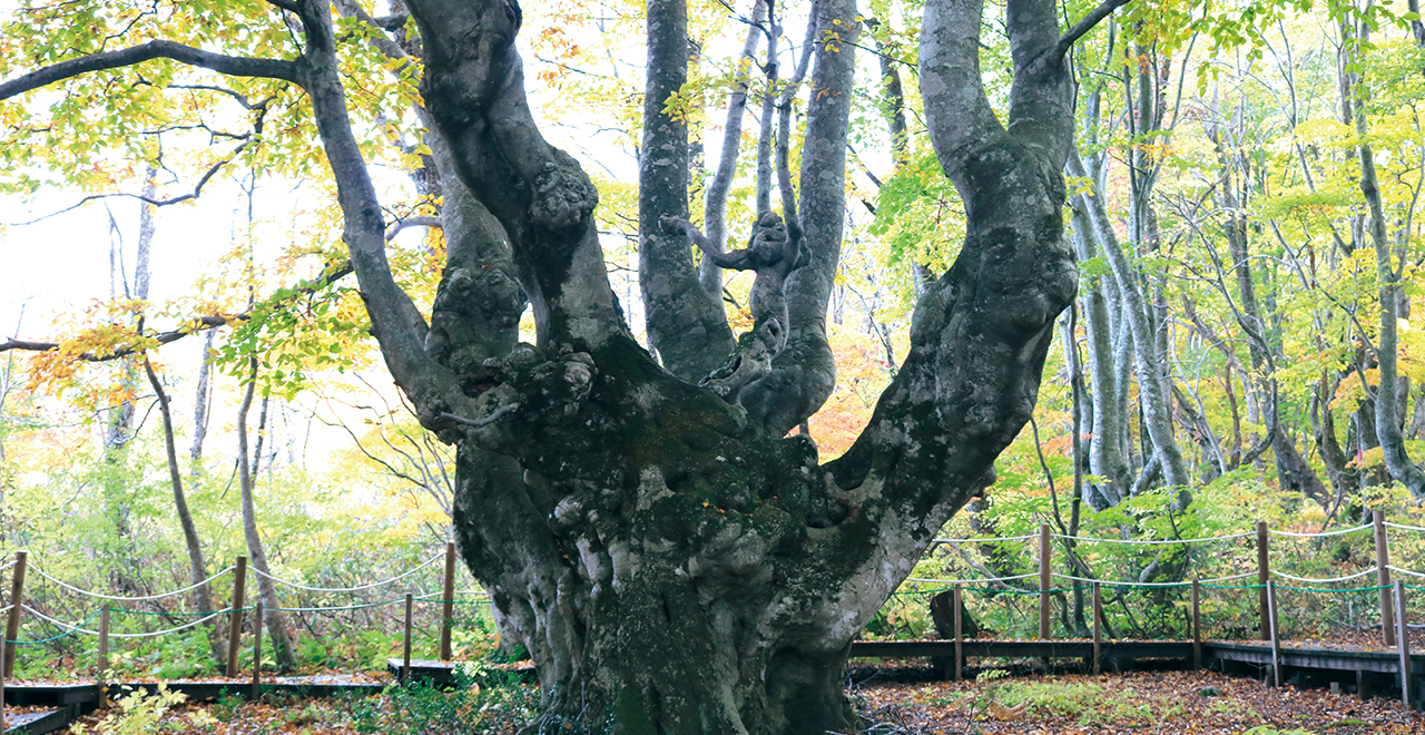
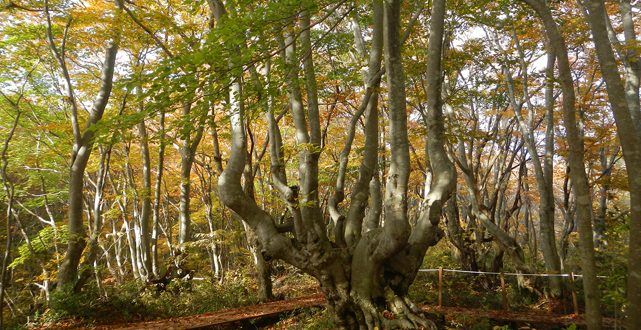
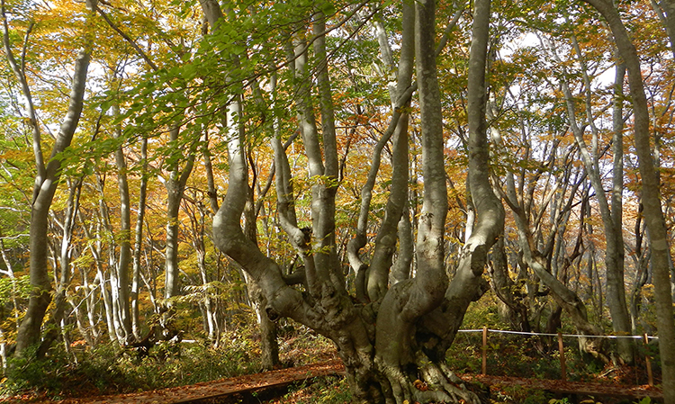
Oddly shaped Buna tree (Japanese beech (Fagus crenata Blume)) " Agariko Daio"
-
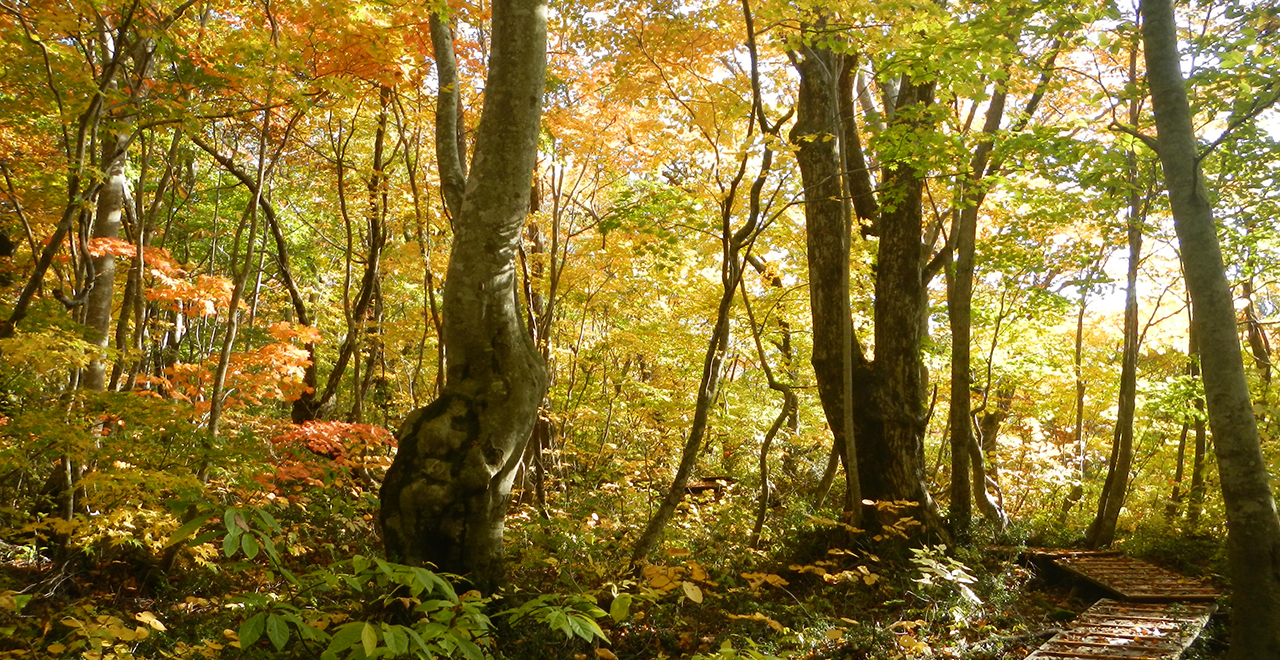
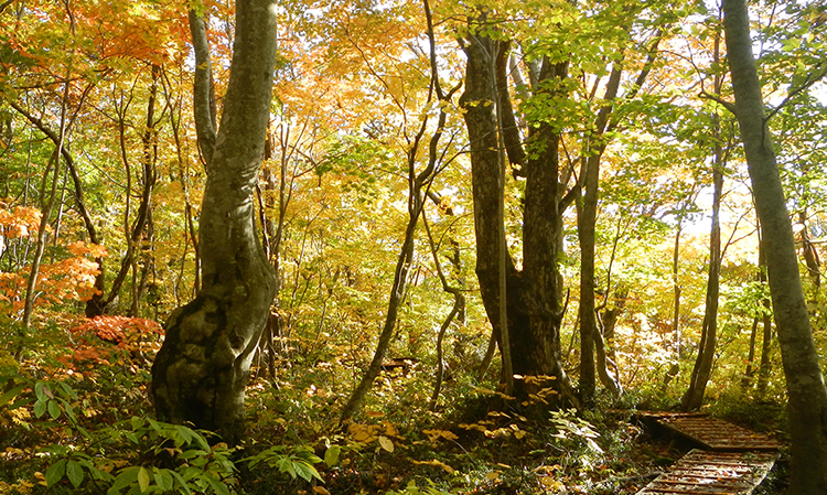
Strolling along a footpath through autumn foliage
-
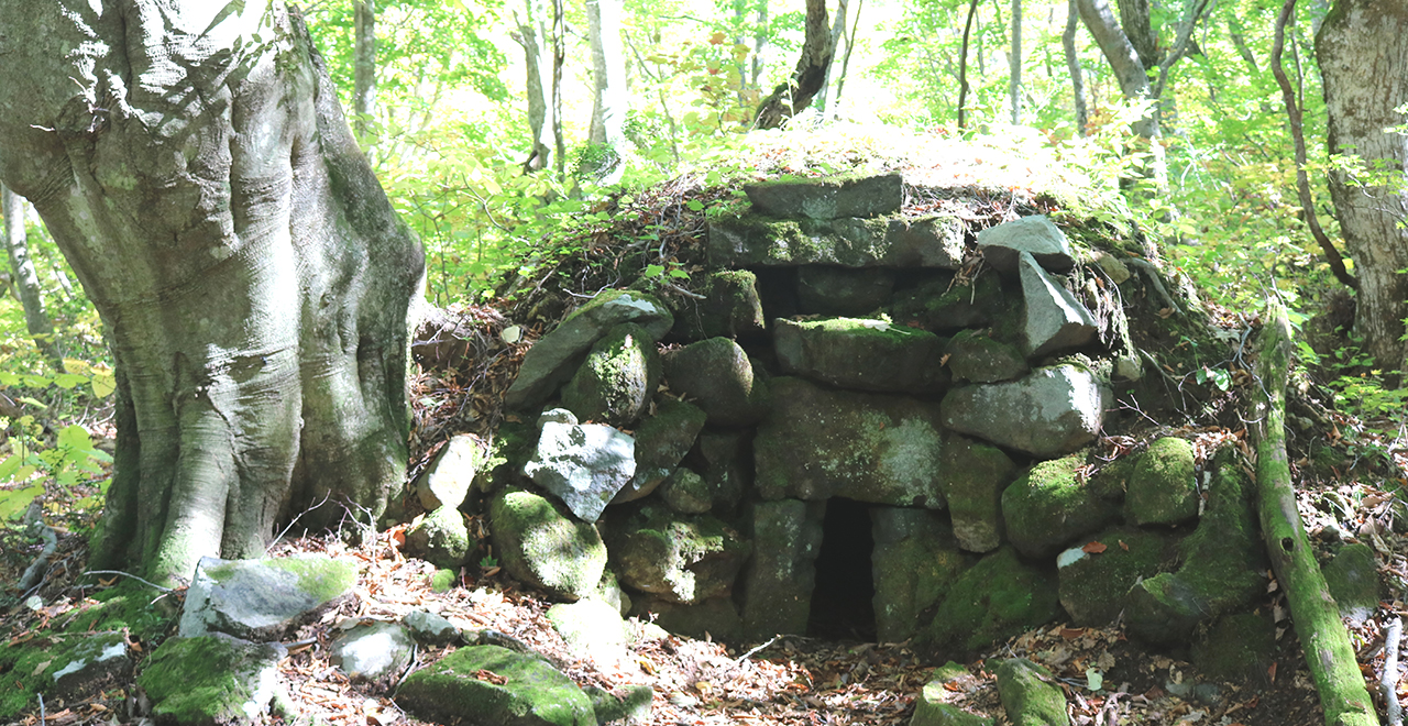
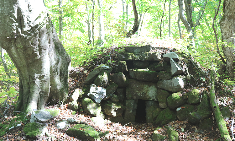
Charcoal kiln remains
-
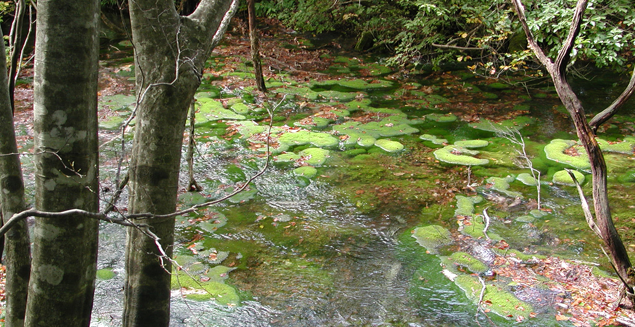
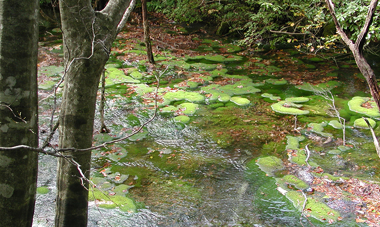
"Chokai marimo" moss balls
-
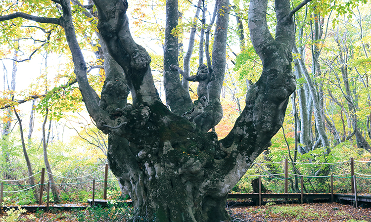
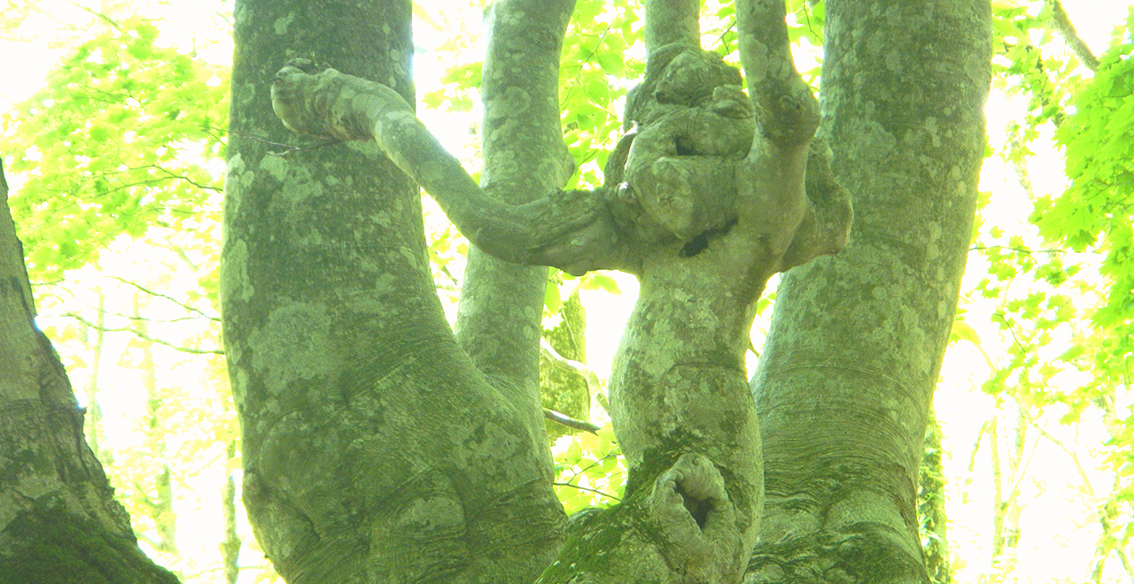
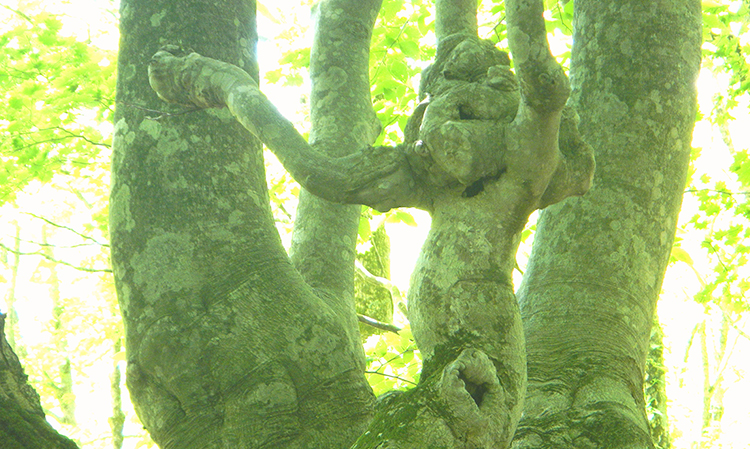
Agariko Daio branch resembling a monkey
-
Oddly shaped Japanese beech tree "Agariko Joo"
Chokai Recreation Forest (Nakajimadai District)
942.18ha
Elevation Lowest : 450m / Average : 460–550m / Highest : 830m
Let oddly shaped Japanese beech trees lure you to a mystical forest
Let oddly shaped Japanese beech trees lure you to a mystical forest
- Newest information
- Area
- Activities
- Overview
- Latest Information
- Usage Guide
- Facility
- Map
- Address
- Access
(Distances and times are
provided as a guide only) - Management office
contact details - Information on Other Local
Tourist Attractions - Official Tourist Information
- Recreation Forest
Management Committee - Supporters
- Other
- Newest information
- CHECK
Please visit official tourism websites for the latest updates and information.
- Area
- Tohoku
- Activities
- Autumn leaf viewing (Includes surrounding area) Waterfall viewing : Mototaki Fukuryusui Underflow, White Falls of Naso (Outside the forest) Fishing (river) (Outside the forest) Guided tours (Includes surrounding area) : Nikaho City Tourist Guide Association (Payment required) (Foreign language support not available) Hot Spring (Outside the forest) Shrine / Temple visit (Outside the forest)
- Overview
-
- Geographical/topographical features
- The Chokai Recreation Forest lies at the foot of Mt. Chokai, over the boundary between Akita Prefecture and Yamagata Prefecture. Mt. Chokai, the second highest mountain in the Tohoku region, has gained its present appearance after repeated eruptions beginning approximately 550,000 years ago. The melted snow of Mt. Chokai soaks into gaps of lava layers, and wells up as spring water after taking a very long time. The abundant spring water and multiple marshlands distributed from the middle to the foot of the mountain are distinctive features of the mountain. Nakajimadai is located half way up Mt. Chokai. It is a flat area formed by mud flow deposits with a vast forest of mainly Buna (Japanese beech (Fagus crenata Blume)).
- Historical/cultural features
- The Japanese beech forest that extends over Mt. Chokai has been repeatedly logged above fallen snow since more than 100 years ago. These beech trees are oddly shaped as the stub surfaces becomes gnarled after healing and the trunks become clumped.
The adjacent Shishigabana Marshland, which is designated as a Natural Monument, has an extremely severe environment with low temperature of about 7°C and acidity of ph 4.4–4.6. This marshland is home to some globally rare species of bryophytes such as Hira Uroko Goke (Nardia compressa (Hook.) A. Gray), Handeru Soroi Goke (Jungermannia handelii (Schiffn.) Amak.), and Yamato Yahazu Goke (Moerckia japonica Inoue). - Climate, flora and fauna
- In the area around the foot of Mt. Chokai, the heavy snow and springs give birth to abundant water, developing a rich ecosystem in which Tsukinowaguma (Asian black bear (Ursus thibetanus)) and other wildlife live in a broad-leaved forest of mainly Japanese beech.
- Attractions
- There is a walking trail of about 5 km that makes a circuit around a forest of oddly shaped Japanese beech trees such as those called “Agariko Daio” and “Agariko Joo” and a mystical forest where you can see communities of bryophytes including "Chokai marimo" moss balls, which are bryophytes that have grown into a hemispherical shape due to the abundant spring water. It is a perfect trail for enjoying a relaxing stroll.
- Latest Information
-
- Regular events
- A Recreation Forest opening event is held in late May.
- Warnings (Flora and fauna)
- Asian black bear: Tsukinowaguma (Asian black bear (Ursus thibetanus)) may be present during the period from May to November. When entering the forest, please carry a bear bell and stay in a group. Check for local information on bear sightings and warnings and follow instructions.
Torikabuto (monkshood (Aconitum L.)) (deadly poisonous): Keep away from this plant, which grows in clusters along the walking trail near the administration building. - Warnings (Dangerous areas)
- Some parts of the walking trail on the mountain side of Shishigabana Marshland are rocky, so take care while walking.
- Usage Guide
-
- Entrance fee
- Free of charge
- Staffed facilities such as administration buildings
- There is an administration building at the walking trail entrance, and staff are stationed from May through November. There is a toilet facility beside the parking lot.
- Accommodation options
- There are hot spring accommodation facilities 9–13 km downstream.
- Facility
- Toilets (1 location) Walking trail (3 main courses) (Includes surrounding area) Parking lot (3 locations) Restaurant (Outside the forest) Cultural asset (nationally designated) (Outside the forest) Accommodation facilities (Hotels/Japanese inns) (Outside the forest)
- Map
- Address
- Nakajimadai, Yokooka, Kisakata Town, Nikaho City, Akita Prefecture
- Access
(Distances and times are provided as a guide only) -
- By public transport
-
<Access from nearest railway station / bus stop>
- Kisakata Station → (taxi or rental car: 30 minutes (13 km)) → Nakajimadai
<Access from major transport hubs to nearest railway station / bus stop>- ・Akita Station → (Limited Express Inaho: about 60 minutes) → Kisakata Station
- ・ANiigata Station → (Limited Express Inaho: about 170 minutes) → Kisakata Station
- ・AAkita Airport → (AKITA Airportliner (a pre-booked shared taxi)) → Ugo-Honjo Station → (JR Uetsu Main Line) → Kisakata Station (about 90 minutes)
- By car
-
<Access>
- Kisakata Station → (public road: 30 minutes, 13 km) → Nakajimadai
<Car parking capacity / parking charges>Free parking for approximately 20 buses and 50 ordinary vehicles
- Nearby tourist facilities
-
- Mt. Chokai Haraigawa Trailhead: 40 minutes by car from Nakajimadai (15 km)
- Management office contact details
-
Yuri District Forest OfficeTEL:0184-22-1076
https://www.rinya.maff.go.jp/tohoku/syo/yuri/
- Information on Other Local Tourist Attractions
-
ー
- Official Tourist Information
-
Tourism Division, Commerce and Tourism Department, Nikaho Municipal Office / Nikaho City Tourist Association [External link]
- Recreation Forest Management Committee
- ー
- Supporters
- ー
- Other
- ー
PDF形式のファイルをご覧いただく場合には、Adobe Readerが必要です。
Adobe Readerをお持ちでない方は、バナーのリンク先からダウンロードしてください。
![]()